A day trip to Lac du Ballon

Enjoy a relaxing break at Lac du Ballon before setting off again along the Route des Crêtes.
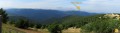
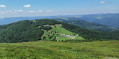
The route for this second day, starting from the Grand Ballon, includes a short detour to Lac du Ballon, so you can take in the scenery and the tranquillity of this little paradise. The walk continues along the Route des Crêtes to Markstein, with views of the Grand Ballon and the Thur Valley, and, if you wish, you can enjoy the leisure and outdoor activities on offer at the Markstein resort.

This walk is part of a multi-day hike: The Grand Ballon circuit in 5 days

Details

n°46111831
Creation:
Last update:
Last review:
  • Walking
    Activity: Walking
  • ↔
    Distance: 8.50 mi
  • ◔
    Average duration: 5h 10 
  • ▲
    Difficulty: Moderate

  • ⚐
    Back to start: No
  • ↗
    Ascent: + 1,467 ft
  • ↘
    Descent: - 2,031 ft

  • ▲
    Highest point: 4,633 ft
  • ▼
    Lowest point: 3,196 ft

Description of the walk

(S) Starting from the Grand Ballon chalet-hotel, follow part of the Grand Ballon panoramic route by heading left up the track via the Blue Ring marked trail. Ignore a junction until you reach the Monument des Diables Bleus.

(1) Then follow the trail marked ‘Red Ring’ to the left, then turn right onto the trail marked ‘Red Rectangle’ to reach the Haag farmhouse inn.

(2) Take the Route des Crêtes to the right, then, at the next hairpin bend, leave the road and take the path on the left marked with a Red Rectangle crossed by a white bar, towards Roedelen – Lac du Ballon. At the Fork in the road, turn right to reach a second Fork in the road about a hundred metres further on.

(3) Keep left onto the path that descends gently, signposted with a Red Rectangle crossed out in white, towards Gustiberg. Shortly afterwards, you’ll emerge onto the stubble fields of Roedelen (magnificent view of the Petit Ballon range and the hamlets of Remspach). Pass by the Roedelen farm on your left and arrive at a Fork in the road.

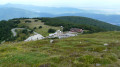
(4) Ignore the path that takes a hairpin bend to the right and carry on straight ahead, towards Gustiberg. The track enters the forest and begins a steep, stony descent, before emerging onto the Gustiberg pastures (altitude 978 m, farmhouse inn).

(5) Pass between the farm and inn buildings and follow the track, marked with a Blue Cross, which leads to the dam at Lac du Ballon (altitude 992 m, benches, tables, car park, ‘Pays d’Art et d’Histoire’ sign).

(6) Cross the embankment, climb a few steps to reach the end of the forest track coming up from the valley. Walk round the lake to the right, following the track marked with a Red Rectangle crossed by a White Rectangle. Just before reaching the end of the lake, leave the track and take a small path on the right – still marked with the Red Rectangle crossed by a White Rectangle – which winds upwards in several hairpin bends to join theGR® 532, crossing a track marked with a Yellow Rectangle.

(7) Follow thisGR® 535 to the right towards the Markstein and ignore the path heading in the opposite direction towards the Col du Haag. Cross a track and, as you approach the Moorfeld hilltop, take the path that climbs to the left, then head straight on along the track that passes not far from the Riedisheim Ski Club chalet, before joining the Route des Crêtes. Follow it downhill for a few metres, then rejoin theGR® 532 route, which runs parallel to the road, skirting the Moorfeld hilltop.

(8) At the Col du Moorfeld, join a path marked with a Yellow Rectangle coming from the Col du Haag via the northern slope of the Storckenkopf. Take this path towards Markstein, continuing to follow theGR®5markings (Red Rectangles), which share the route with the Yellow Rectangles for the first 700 metres. Cross a track and then reach the Hundsruecken Pass.

(9) Continue to follow theGR®5, marked with a Red Rectangle, which leads to one of the car parks at the Markstein ski resort (E).

Waypoints

  1. S : mi 0 - alt. 4,432 ft - Col du Grand Ballon (1341m)
  2. 1 : mi 0.31 - alt. 4,633 ft - Monument des diables bleus
  3. 2 : mi 1.09 - alt. 4,042 ft - Le Haag
  4. 3 : mi 2.21 - alt. 4,072 ft - Fork in the road
  5. 4 : mi 2.67 - alt. 3,753 ft - Virage
  6. 5 : mi 3.28 - alt. 3,202 ft - Auberge du Gustiberg
  7. 6 : mi 4.32 - alt. 3,255 ft - Lac du Grand Ballon
  8. 7 : mi 5.4 - alt. 3,891 ft - GR
  9. 8 : mi 6.4 - alt. 3,917 ft - Moorfeld
  10. 9 : mi 7.38 - alt. 3,858 ft - Col du Hundsrucken (1177m)
  11. E : mi 8.5 - alt. 3,858 ft - Markstein (le)

Notes

Between (8) and (9), after crossing a track and just before the Col du Hundsruecken, you can reach the Chalet Edelweiss run by the Saint-Amarin Ski Club, open at weekends (signposted).

- Ferme Auberge du Güstiberg - 03 89 74 05 01
Alpine herder’s meal and hikers’ menu ranging from €12 to €20.
Picnics available with produce from the farm.
Open daily, closed from 15 November to 15 January.

- Where to eat and stay at Markstein?
Hôtel-Restaurant Wolf - 03 89 82 64 36 (booking recommended).
Half-board rates (meals, accommodation and breakfast) between €64 and €83 per person.
Hiker’s picnic: €10 per person.
Restaurant – 03 89 39 65 56
Open for lunch and on Friday, Saturday and Monday evenings.

- Le Tremplin Restaurant - 03 89 38 25 92
À la carte meals between €6 and €17. Open for lunch all year round and in the evenings in July and August.

- Auberge le Steinlebach - 03 89 82 61 87 (booking recommended).
Half-board rates for a private room or dormitory between €39 and €48 per person.
Picnic (cold meal) for €7.50.

- Refuge des Amis de la Nature du Treh - 03 89 82 65 06 (booking recommended).
Prices for rooms and dormitories range from €6 to €11.50; a fully equipped kitchen is available.

- Ferme-auberge du Treh - 03 89 39 16 79.
Farmers’ menu and à la carte meals from €11 to €20.
Farm produce and bread on sale.

- Ferme Auberge du Markstein - 03 89 82 61 84
Set menus and à la carte meals, prices ranging from €7 to €19 (closed on Mondays).

- Refuge Saint Antoine - 03 89 38 96 35
Room and dormitory rates between €15 and €18, including breakfast. Fully equipped kitchen available. Open at weekends.

Worth a visit

Always be cautious and plan ahead when you're outdoors. Visorando and the author of this route cannot be held responsible for any accidents occurring on this route.

The GR® and PR® markings are the intellectual property of the Fédération Française de Randonnée Pédestre.

Reviews and comments

User 27866448

The route takes a closed path. To be changed! The current path starts 15 metres downstream.

Machine-translated

Other walks in the area

For more walks, use our search engine .

The GPS track and description are the property of this route's author. Please do not copy them without permission.