3-day tour of the Grand Ballon: from Guebwiller to the Grand Ballon

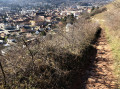
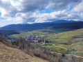
First day of the 3-day Grand Ballon circuit. Starting from Guebwiller, the first day of this multi-day hike will take you to the Grand Ballon, the highest peak in the Vosges mountains, which rises to an altitude of 1,424 metres. The ascent is quite challenging and requires a good level of fitness. Along the way, you can enjoy the varied landscapes and the flora and fauna of the Vosges, and on arrival, the exceptional panoramic views across the whole of the Alsace plain, the Black Forest and, on a clear day, even the Bernese Alps.

This walk is part of a multi-day hike: Tour du Grand Ballon en 3 jours

Details

n°44180349
Creation:
Last update:
Last review:
  • Walking
    Activity: Walking
  • ↔
    Distance: 8.23 mi
  • ◔
    Average duration: 6h 55 
  • ▲
    Difficulty: Difficult

  • ⚐
    Back to start: No
  • ↗
    Ascent: + 3,622 ft
  • ↘
    Descent: - 174 ft

  • ▲
    Highest point: 4,426 ft
  • ▼
    Lowest point: 945 ft

Description of the walk

(S) On leaving the Guebwiller Tourist Office, walk round the back of Notre-Dame Church and continue up Rue des Chanoines to its end, at the junction with Rue du Maréchal Joffre. Turn left towards the fire station. At the first roundabout (fire station – Crédit Mutuel), carry on straight ahead into Rue du Vieil Armand, towards the secondary school – military cemetery – Auberge du Vallon. At the second roundabout, carry on straight up the hill for 100 metres until you reach a junction.

(1) The gravel road splits. Head left towards the small wooden footbridge spanning a stream. This is the entrance to the Promenade Paul Déroulède (with numerous benches, tables and remarkable trees). Continue straight on along this promenade (marked with oak leaf signs). On the left, you’ll see the graves of the military cemetery and, on the right, the dog training ground.

(2) At the end of the Promenade Paul Déroulède, take the small road on the right called Chemin du Vallon (do not take the forest track marked with a Yellow Disc, which leads to the Maison Forestière de l’Ax). Walk past the inn (on your right: a warm welcome and good traditional cuisine). At the Fontaine de l’Ax, the path curves to the right and leads to the Sandgrube car park (start of the fitness trail).

(3) Take the wide forest track marked with a Yellow Disc towards the Col du Bildstoeckle.

(4) A few metres before the pass, turn right onto the forest track marked with a Blue Triangle, heading towards the Rehbrunnenkopf. Keep to the left straight away. Continue to the first junction with the Red Triangle path.

(5) Leave the forest track and take the path leading uphill, still marked with a Blue Triangle. After a hairpin bend and a short climb, the path emerges at the summit of the Rehbrunnenkopf (altitude: 632 metres. There is a bench and a viewpoint overlooking the entrance to the Florival Valley and the mission cross). The descent begins on the Simbert Krenger trail (named after the former president of the Guebwiller Club Vosgien). Steep at first, it levels out and leads to the Col de Péternit (altitude: 566 metres. Benches and a table).

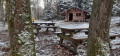
(6) Follow the signs for Rimbach, opposite, for a few metres, then turn left and immediately right onto the small path marked with a Red Rectangle crossed by a White Rectangle, which branches off to the right towards the Col du Munsteraeckerle. This narrow track, which in places becomes a footpath, leads gently up to the pass via the southern slope of the Geisskopf (altitude: 655 metres; a charming little open wooden shelter, with tables and benches). At the pass, turn right then head straight ahead along a gently ascending forest track marked with a Red Rectangle crossed by a white bar, towards the Judenhut. Further on, this track takes a sharp left-hand bend and passes two cave entrances.

(7) Shortly afterwards, leave the track and take a small path on the left, marked with a Blue Triangle, towards the Rocher Saint-Pirmin and the Judenhut. The path winds its way up the northern slope of the Ebeneck in a series of hairpin bends. After a final, very steep hairpin bend, the slope levels out, giving you a chance to catch your breath. 150 metres further on, leave the signposted path to the left, enter the pastures via a cleared path and head left, climbing gently (follow the visible track in the grass) to the summit of the Ebeneck (altitude: 859 metres. Bench. Magnificent views over the Alsace plain, the Black Forest, the hills above Guebwiller, the Hartmannswillerkopf and the Grand Ballon).

(8) Retrace your steps to the crossroads in the forest and continue uphill along the signposted path. Shortly afterwards, this leads to the rocky ridge of the Rocher Saint-Pirmin (altitude: 908 metres.

(9) Viewpoint over the Murbach valley)''. The path crosses the rocky outcrop and joins another path coming in from the left, marked with a Red Rectangle crossed out in white.

(10) Follow this lovely path, which leads, over a few small hills, to the Col de Judenhut (altitude: 979 metres. Large clearing with numerous benches, tables and the unmanned Judenhut shelter. Drinking water available at the Schlumberger Fountain). There is now about an hour’s steady climb to the Grand Ballon.

(11) Take the track that starts in front of the Schlumberger Fountain, following the forest path marked with a Blue Cross. A few metres further on, leave this path and take the narrower one that climbs to the right, marked with a Red Rectangle crossed out in white. As you climb, it narrows and turns into a footpath.
It leads onto another forest track; follow this to the left for about a hundred metres, then turn right. Cross a track. Shortly afterwards, walk alongside the drinking water catchment areas for the town of Soultz, then cut across the path marked with a ‘Red Diamond’, cross an old ski run twice and, after a final hairpin bend, finally emerge from the forest at the foot of the buildings of the Self de la Vue des Alpes.

(12) Cross the Route des Crêtes. The Chalet-Hôtel du Grand Ballon is directly opposite (altitude: 1,343 metres) (E).

Waypoints

  1. S : mi 0 - alt. 948 ft - Tourist Information Centre
  2. 1 : mi 0.64 - alt. 1,030 ft - Junction
  3. 2 : mi 0.9 - alt. 1,165 ft - Cimetière militaire de Guebwiller
  4. 3 : mi 1.19 - alt. 1,204 ft - La Sandgrube
  5. 4 : mi 1.71 - alt. 1,486 ft - Bildstoeckle
  6. 5 : mi 2.32 - alt. 1,772 ft - Red Triangle Trail
  7. 6 : mi 3.23 - alt. 1,841 ft - Col de Peternit
  8. 7 : mi 4.9 - alt. 2,448 ft - Path after the caves
  9. 8 : mi 5.5 - alt. 2,815 ft - Vue sur plaine Alsace et Forêt Noire
  10. 9 : mi 5.8 - alt. 2,917 ft - Rocher St-Pirmin
  11. 10 : mi 5.99 - alt. 2,949 ft - Junction
  12. 11 : mi 6.66 - alt. 3,189 ft - judenhut
  13. 12 : mi 8.16 - alt. 4,396 ft - Grand Ballon car park
  14. E : mi 8.23 - alt. 4,426 ft - Grand Ballon Chalet Hotel - Grand Ballon

Worth a visit

Where to stay and eat at the Grand Ballon and in the surrounding area?
- Chalet Hôtel-Restaurant du Grand Ballon 03 89 48 77 99 CLOSED – REOPENING PLANNED FOR 2025
- Guebwiller Ski Club Mountain Hut at Roedelen/Grand Ballon 03 89 74 34 12 or 06 50 04 24 24 email: simontrottberg@neuf.fr Price per night in a dormitory: €11 per adult. Fully equipped kitchen available. Open only on Saturday evenings.
- Moorfeld Chalet – Riedisheim Ski Club – 06 50 04 24 24 Weekend accommodation available by booking – please enquire by telephone regarding opening periods.
- La Vue des Alpes snack restaurant – Grand Ballon 03 89 76 14 40 Self-service, salads, meat dishes and tartes flambées.
- Maison de l’abeille et du pain d’épices – Grand Ballon – 03 89 62 94 59 Crêpes, ice cream, sandwiches… Drinking water point for filling water bottles. Full breakfast from 7.30 am.
- Hôtel - Restaurant à l’Aigle d’Or, Rimbach 03 89 76 89 9. 15 mins from Munsteraeckerlé. Daily set menu (3 courses) – Packed lunches. Restaurant closed on Mondays. Rooms from €58.
- Ferme Auberge du Haag 03 89 48 95 85 Set menus or à la carte. Open all year round except from mid-November to mid-December and two weeks before Easter. Closed on Wednesdays.
- Ferme Auberge du Grand Ballon 03 89 76 95 79 ‘Macaire’ meals and à la carte dishes. Open from Easter to November every day except Monday evenings and all day on Tuesdays.
- Ferme Auberge du Güstiberg 03 89 74 05 01 Macaire meals and hikers’ set menus. Picnics available with farm produce. Closed from 15 November to 15 January. Open only at weekends from January to Easter.

Reviews and comments

4 / 5
Based on 2 reviews

Reliability of the description
4 / 5
Ease of following the route
3.5 / 5
Route interest
4.5 / 5
User 30378086

Overall rating : 4.3 / 5

Date of your route : Aug 08, 2026
Reliability of the description : ★★★★★ Very good
Ease of following the route : ★★★★☆ Good
Route interest : ★★★★☆ Good
Very busy route : No

My wife and I set off on this hike with the aim of taking it easy over three days, spending two nights in a tent.

The first day was meant to take us from Guebwiller to the Grand Ballon, with an uphill stretch for almost the whole day. As we couldn’t camp in that area – it’s a nature reserve – we decided to carry on towards the Markstein.

After a short break to find some water – as our flasks were starting to run low – we climbed to the summit near the civil aviation radome to be treated to an exceptional view! We then set off again towards the Col du Haag, passing the Diables Bleus monument. The paths were steeper, but that’s what we love, and in the end our day was to finish after a 22-km walk (instead of 13), just before the Markstein, where we could enjoy a lovely view once we’d set up camp.

The second day was meant to take us to the Col du Petit Ballon, initially planned as a 22-km walk, but as we’d gone the extra mile the day before, we ended up with a 14–15-km hike. After a restless night following a visit from a few curious cows to our camp, we set off again, initially in search of water as we’d run out, and we were able to top up our supplies at the Markstein (phew). We continued on our way at a leisurely pace towards the Steinlebach farmhouse inn for a quick coffee break, then set off again for the Petit Ballon, arriving at 1 pm! And now we’re asking ourselves, “What shall we do? Either we stay round here for the afternoon or we carry on!” Personally, I wanted to carry on, and my partner’s reply was, “We’re not going to stop at this time of day!” So we set off again after a short break…
The descent from the Col du Petit Ballon is interesting as far as the Auberge du Strohbert, then we come to a wide white track leading downhill (just like the first climb from Guebwiller) until we rejoin a narrow path through the woodland leading to the Col du Bannstein. From there, we gradually make our way back to civilisation towards Buhl, crossing orchards, skirting fishing ponds before reaching the final challenge (or nearly so) as we cross the vineyard plots and enjoy a lovely view of Buhl and the Florival valley, before descending a little towards the shooting range, then heading back into the forest and rejoining the vineyards to make our way down to Guebwiller and reach the end of our journey! The second day ended up being 35 km long!

Machine-translated

Guebwiller Tourisme
Guebwiller Tourisme

Hello and thank you for your comment

We are delighted that you enjoyed the hike!

We will look into clarifying the description, particularly regarding the descent to the Bannstein Pass.

Regarding the estimated walking times, it is true that it is possible to cover the stages much more quickly. The times indicated are intended to allow hikers who are unfamiliar with the area to take the time to enjoy the scenery, stop for photos and visit the farm inns along the route.

Thank you again for your feedback and see you soon in the Guebwiller region!

Kind regards,

The team at the Guebwiller Region Tourist Office.

Machine-translated

User 26855792

Overall rating : 3.7 / 5

Date of your route : Aug 04, 2025
Reliability of the description : ★★★☆☆ Average
Ease of following the route : ★★★☆☆ Average
Route interest : ★★★★★ Very good
Very busy route : No

The hike is magnificent and very well designed in every respect. There are numerous splendid views of the valleys. This hike is quite accessible, even without extensive training.

The description is often good, but on several occasions, particularly for the Bannstein destination, it contains too little information and is too vague. We found the right destination because I am fairly familiar with the area. But still, well done for suggesting this hike. With the maps provided, you should be able to find your way around without any problems!

One comment about the times given. They seem unrealistic to me. I am 60 years old, weigh 80 kg, do little or no hiking (nothing for a year), and I did the 3-day hike in one long day (12 hours of walking). For example, on the first day, from Guebwiller to the Châlet du Grand Ballon, it took me 3 hours. Your description says 6 hours 55 minutes, and Google Maps says about 4 hours 30 minutes. I think you should knock at least a quarter off the times given.

A general comment about your website: it's comprehensive and very well done, so well done for that.

Machine-translated

Other walks in the area

For more walks, use our search engine .

The GPS track and description are the property of this route's author. Please do not copy them without permission.