Country:

 City:


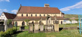
(S) From the town hall square, take Rue des Boulangers opposite, which climbs towards the beautiful Romanesque church of Soultzmatt. Turn left towards the church and walk to the right of the building up a steep slope. Turn left, then right again to reach the1st R.E.C. junction
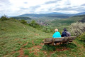
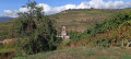
(1) Turn right. This street leads to the village school buildings. From there, follow a track marked with a Red Diamond towards Val du Pâtre. At the junction with the next track, not far from a wayside shrine, take a small path, signposted ‘Blue Triangle’, which winds upwards to the right to reach the Rocher du Grossfels viewpoint (magnificent view of the village of Soultzmatt, the limestone hills of the Zinnkoëpfle and the Strangenberg, and the entrance to the ‘Vallée Noble’. Bench. Commemorative plaque in honour of Thiébaut Walter, renowned historian and former president of the Club Vosgien de Rouffach).
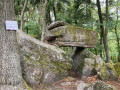
(2) At the junction, the climb continues to the top of the rock, then the path turns left. After a short descent via steps carved into the rock, the path levels out. It crosses a track, passes by the Langenstein menhir and reaches the starting point of the Pfingstberg fitness trail (car park, tables and benches) at Gauchmatt.
(3) Take the track, which branches off to the left, running alongside the football pitches in the village of Soultzmatt, and joins the Val du Pâtre Way of the Cross, marked with a red diamond. Follow it to the right as far as the Val du Pâtre Chapel (altitude: 380 metres. Benches, fountain).
(4) Take the small forest road, keeping well to the right towards Gauchmatt.
(5) When you reach the Romanian military cemetery (on the right), turn left onto the forest track marked with a Blue Triangle, heading towards Col du Bannstein. This straight track passes by a large hunting shelter. Continue straight on three times. Shortly afterwards, the path curves to the left and becomes a narrow track (Staad Trail), climbing in two hairpin bends to join another forest track; follow this to the right as far as the Col de Bannstein (altitude: 483 metres. Benches and tables. Car park).
(6) Turn left for a few metres and take the track, marked with a Blue Disc and a Red Ring, which branches off to the right and descends towards Buhl – Saint-Gangolphe. After about 700 metres, the forest gives way to a landscape of orchards and scattered houses. Carry on straight ahead at the first houses. The route passes by the Saint-Gangolphe pilgrimage site (chapel, inn): keep going straight on. The path runs alongside fishing ponds and eventually joins the cycle path coming from the right, from the centre of the village of Schweighouse. Carry on straight ahead along the cycle path towards Buhl, following the ‘Blue Disc’ markings. Continue until you pass a pink sandstone quarry (small car park, benches and tables) and the houses in Buhl.
(7) At the junction of Rue de la Carrière and Rue du Réservoir (large information board on the Buhl quarries route). Follow the path uphill, marked with a Red Ring. After the last houses, it crosses through vineyards and passes by Buhl’s drinking water reservoir (information board on the village’s past industry. Beautiful view of Buhl and the summit of the Grand Ballon). Ignore a path on the right and, after two hairpin bends, join another forest track.
(8) Take the path marked with a Red Ring on the left. This path initially offers lovely views over the Florival valley before entering the forest and joining a new track, coming from the left-hand side of the Col du Dreibannstein and marked with a Red Disc.
(9) Head downhill, passing the former national police shooting range (on the left), then the start of the Guebwiller Quarry Trail (also on the left), before continuing straight on to reach a junction.
(10) Leave the path marked ‘Red Disc’, which descends to the right towards Guebwiller (Heissenstein). Continue leftwards uphill along an unmarked track. 100 metres further on, the track levels out and splits into two. Take the right-hand fork. Shortly afterwards, it emerges from the forest, offering magnificent views over Guebwiller and the Florival valley. Keep to the right on this magnificent balcony path until you reach the Col de l’Unterlinger. On your left, you’ll find the Yellow Disc-marked trail coming from the Oberlinger (benches).
(11) Follow this path to the right as far as the Roche du Coucou. Continue downhill to the right. At the junction, go straight on twice, then enter a wood. On emerging from the wood, ignore the path leading down to the right for now and continue along the path which leads in a few minutes to the Croix de la Mission viewpoint (altitude: 360 metres). Rest area with benches and a table. 50 metres away, in the woods, there is an open shelter run by the Lion’s Club). Exceptional panoramic views over the Alsace plain, the Kaiserstuhl, the Black Forest range, the Swiss Jura, the Bernese Alps on a clear day, the entire Florival valley, the Hartmannswillerkopf, the Grand Ballon and the Petit Ballon.
(12) Retrace your steps and turn left twice to begin the descent towards Guebwiller through the vineyards (marked with a Yellow Disc) and along the Kitterlé tarmac path. At each junction, always continue along the wide, descending path. At the junction marked by traffic lights, cross Rue du Général de Gaulle and the bridge over the River Lauch.
(13) Take Rue de la Gare, which passes, amongst other things, in front of the Hôtel de l’Ange. After about 150 metres, it joins Rue de la République, opposite Place Jeanne d’Arc, where you’ll find Notre-Dame Church, the tourist office and the Théodore Deck Museum (E).
 Visorando Member
 Easy
 Difficult