Country:
 City:
City:


The route starts opposite Rouffach station. There is a car park on the other side of the tracks.
No signposting
(S/E) With your back to the station, take the path straight ahead to the roundabout. Go round the roundabout on the left, following the cycle path. Pass under the four-lane road. Enter Rouffach and pass the cemetery on your right. Continue along the road until the second junction. Turn left towards the Tourist Office and head for Notre-Dame Church.
(1) At the car park at the foot of the building, turn right. Then carry on straight ahead until you can go no further at Rue Bellevue.
(2) First turn right then left. Ignore a track on the left to reach a crossroads.
Discovery trail
Turn left, then right. Stay on the first track on the right; at its end, carry on almost straight ahead until you reach a Fork in the road.
Unmarked
Keep going straight on. Keep to the right of the road until you reach the orientation table.
Red Cross signposting
(3) Follow the road down to the first track on the left.
No signposting
Carry on to the left until you reach a building.
Green Ring markings
Carry on along the track until you reach the next path.
No signposting
Take the path going uphill, then go straight on. Immediately ignore a track on the right and take the second one. Keep to the right at the end of this path to reach a tarmac road.
(4) Keep to the left. Continue along the tarmac path that extends from it. Pass another path coming from the left, then at the next junction, keep to the left. Continue to the end of the path.
Nature trail
Turn right, then follow the path downhill. You’ll reach the houses in Pfaffenheim. Take the first street on the left. Keep to the right at the end of the street to reach the town hall. Turn left onto the street running past the town hall, heading due north to reach Saint-Martin’s Church.
(5) Continue to the bend. Turn left onto the uphill street (Rue du Vignoble) and follow it to the edge of the village.
No signposting
Keep to the right at the cross. Ignore a path leading downhill to the right (Rue du Tokay) and continue along the track. Ignore one Fork in the road and you’ll come to a second fork amongst the vineyards.
(6) Keep going straight on. Take a left-hand bend, then a right-hand bend. Carry on straight ahead until you reach the road. Follow it to the right as far as the Osperling Fountain.
(7) Continue straight on towards Guebershwihr. Just past a house, take the path leading down to the right, then, shortly afterwards, a track to the left. Stay on this side until you rejoin the road. Head uphill until you reach one of Guebershwihr’s main streets (Rue Basse). Follow it to the right until it ends. Turn left to see Saint-Pantaléon Church.
Yellow Cross signposting
(8) Return to the previous junction and turn left. At the cemetery, go round it on the right. Then continue straight ahead along a track. Pass the first path leading downhill to reach a second one.
No signposting
(9) Follow this track, leaving it at the first track on the left. Keep to the right at a tree, then continue straight ahead three times. You’ll reach a fourth junction.
(10) Head up to the left until you reach the end of the track. First turn left then right to join another track. This track leads to a viewpoint with an orientation board.
Discovery Trail
(11) Keep left until you reach the junction before a cross.
Unmarked
Turn right. Keep to the right until you reach Obermorscwihr. Cross the road and turn right towards the Church of Saints Philip and James.
(12) Carry on and go down the steps towards the town hall. At the town hall and a fountain, turn left. Ignore a road on the left to reach a cross.
Nature trail
Turn left, then right onto a track. Follow it to the end.
(13) First turn right then left. Continue to the end of the path and its junction.
Yellow Ring markings
(14) Head downhill, then turn left. Continue to the Langgraben stream.
(15) Keep going straight on. Ignore six paths.
No signposting
Immediately after the seventh path, turn right towards Éguisheim. Head towards the village houses. On reaching the village, turn right to reach a street.
Blue Ring signposting
First turn left then right to reach the main street in Éguisheim.
No signposting
Keep left twice to reach a striking, very narrow house.
(16) Walk past it. At the junction, turn right towards the church.
(17) Continue to the main street. Turn left and keep going until you reach the cross. Head up to the farm track on the right.
Blue Cross signposting
Take this track. Then keep left and then right to reach a path.
No signposting
(18) Cross over. Then carry on straight on until you reach the next road. Go straight ahead twice and reach the end of the path at Wettolsheim.
(19) Head almost straight ahead and leave the village through the vineyards. Continue to the end.
Green Ring signposting
Turn left, then start climbing to the right. First turn right then left to reach some Roman ruins.
(20) Continue uphill. Keep left twice, then turn right onto the steep track. Continue uphill along a narrow path on the left which leads to a pass. You can visit the Chapelle des Bois on the left.
Blue Cross signposting
(21) Head down the road opposite. At the bend, take the path on the left which descends into the forest. Cut across a track and follow a few hairpin bends. Continue straight ahead, then follow the road until you reach the third track on the left.
Red Triangle signpost
(22) Carry on to the left. Do the same at the next junction, then turn right and continue to the start of the tarmac road.
No signposting
Turn right, then right again at the end of the track until you reach the chapel.
(23) Turn left, then at the bend, cross the bridge. Turn left straight away along the road, then take the first track on the right. Keep left at the road. You’ll reach a junction.
(24) Go straight ahead. Keep to the left all the way until you reach the cycle path. Follow it, crossing a river. At the end, turn left to reach Turckheim station (E).

 ).
).


 Association / Club / Walk leader
 Easy
Easy  Visorando Member
 Moderate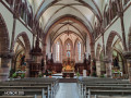
 Very difficult