


Refine your search for walks in Moisdon-la-Rivière
Moisdon-la-Rivière walks


 A lovely walk in Moisdon-la-Rivière
 Visorando Member
 6.12 mi
 +217 ft
 -217 ft
 3h 00
3h 00
 Easy
Easy
 Departure from Moisdon-la-Rivière (Loire-Atlantique)
Moisdon-la-Rivière is a small village situated a few kilometres from Châteaubriant, on the D178. About 2 km from the village liesthe Étang de la Forge, a former site of industrial forges. There is a museum, a café, and a beautiful pond surrounded by schist rocks. The route around this site is very pleasant and open to all from April to September (check the exact dates each year). The pond is fed by the River Don. The route runs between the pond and the river, making for a very pleasant walk.
Passing by the old lime kilns at Erbray
 6.47 mi
+144 ft
-144 ft
3h 05
Easy
Departure from Erbray (Loire-Atlantique)
6.47 mi
+144 ft
-144 ft
3h 05
Easy
Departure from Erbray (Loire-Atlantique)
A pleasant walk in the countryside that takes us past old lime kilns.
Discovering Châteaubriant
 9.75 mi
+302 ft
-302 ft
4h 45
9.75 mi
+302 ft
-302 ft
4h 45
 Moderate
Departure from Châteaubriant (Loire-Atlantique)
Moderate
Departure from Châteaubriant (Loire-Atlantique)
What better way to explore a town than on foot? That’s what I’m suggesting here: discover, in my own way, the small but charming town of Châteaubriant. So, follow me...
Walk around Châteaubriant
7.81 mi
+144 ft
-128 ft
3h 45
Moderate
Departure from Châteaubriant (Loire-Atlantique)
A pleasant route in Châteaubriant, passing by places for relaxation and leisure, ponds, the château... This small town of 12,000 inhabitants has many charming and enjoyable aspects to discover.
Étang de la Provostière and Rigole des Ajeaux starting from Riaillé
 8.10 mi
+131 ft
-102 ft
3h 50
Easy
Departure from Riaillé (Loire-Atlantique)
8.10 mi
+131 ft
-102 ft
3h 50
Easy
Departure from Riaillé (Loire-Atlantique)
A very shady route with little road (approximately 1 km) that takes you around the entire Étang de la Provostière, classified as a sensitive natural area, and follows the Rigole des Ajeaux, which feeds the Étang de Vioreau a few kilometres to the west.Note: avoid venturing around the lake during periods of high water. The path may be difficult to navigate.
Tour of Lake Vioreau
 6.58 mi
+33 ft
-33 ft
3h 05
Moderate
Departure from Joué-sur-Erdre (Loire-Atlantique)
6.58 mi
+33 ft
-33 ft
3h 05
Moderate
Departure from Joué-sur-Erdre (Loire-Atlantique)
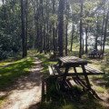
This small 2 km² lake between Nantes and Châteaubriant will delight you with the beauty of the site and all the activities on offer: hiking, horse riding, mountain biking, fishing, swimming, sailing, etc. The walking tour takes you along some very pleasant paths.
The ‘Orée des Bois’ route in Riaillé
 5.70 mi
+66 ft
-66 ft
2h 40
Easy
Departure from Riaillé (Loire-Atlantique)
5.70 mi
+66 ft
-66 ft
2h 40
Easy
Departure from Riaillé (Loire-Atlantique)
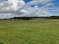
A fairly easy walk taking you through a variety of landscapes, ranging from vast pastures and cultivated fields to a stretch through a beautiful forest. Lots of lovely paths, just a tiny bit of road – perfect for stretching your legs.
Ponds and wayside crosses in Saint-Aubin-des-Châteaux
 9.88 mi
+338 ft
-335 ft
4h 50
Moderate
Departure from Saint-Aubin-des-Châteaux (Loire-Atlantique)
9.88 mi
+338 ft
-335 ft
4h 50
Moderate
Departure from Saint-Aubin-des-Châteaux (Loire-Atlantique)
This walk will allow you to discover beautiful countryside, a few mysterious woods, magical ponds and a fine collection of crosses. Most of the walk takes place along shaded paths lined with majestic trees. The sections on the road, however long or short, are quickly forgotten!
The Erdre footpaths from Bonnœuvre
 6.89 mi
+236 ft
-246 ft
3h 20
Moderate
Departure from Bonnœuvre (Loire-Atlantique)
6.89 mi
+236 ft
-246 ft
3h 20
Moderate
Departure from Bonnœuvre (Loire-Atlantique)
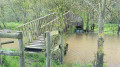
This is a pleasant, varied route with numerous sections through the forest, along farm tracks and finally alongside the beautiful River Erdre, which we follow at the end of the route.
This route follows two sections of marked routes, in yellow but in a very random manner; one on the Layons route and the other on the Erdre route.
Several sections are on authorised private land. Please respect these areas.
Terril and Abbartz Pond
 3.77 mi
+207 ft
-213 ft
1h 55
Moderate
Departure from Abbaretz (Loire-Atlantique)
3.77 mi
+207 ft
-213 ft
1h 55
Moderate
Departure from Abbaretz (Loire-Atlantique)
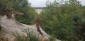
A beautiful short walk in a pleasant and surprising setting. Great view from the top of the slag heap.- 2019: No real changes to the route, but a fence has been put up to protect the entire inner area after checkpoint 2. Follow this route.
The Donneau Trail via the Moulin de la Garenne, starting from Pannecé
 7.14 mi
+56 ft
-56 ft
3h 20
Moderate
Departure from Pannecé (Loire-Atlantique)
7.14 mi
+56 ft
-56 ft
3h 20
Moderate
Departure from Pannecé (Loire-Atlantique)
A lovely countryside route in the commune of Pannecé. It comprises two main sections:
- the greenway, a former railway line now dedicated to walkers and cyclists,
- the Donneau stream, which you’ll follow at the end of the route, on private land open to the public.
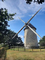
Be sure to take a short detour to admire the very pretty Moulin de la Garenne.
From one pond to another between Pannecé and Teillé
 6.78 mi
+98 ft
-98 ft
3h 10
Moderate
Departure from Pannecé (Loire-Atlantique)
6.78 mi
+98 ft
-98 ft
3h 10
Moderate
Departure from Pannecé (Loire-Atlantique)
This route connects the ponds in the neighbouring communes of Teillé and Pannecé.
To this route, which is part of the Departmental Programme of Walking and Hiking Routes (PDIPR) and marked in yellow accordingly, I have added the complete walk around the lovely Étang de Teillé, which is well worth a detour.
You’ll walk along the old railway line, which has been converted into a greenway, for about a third of the route. It will provide welcome shade on hot days.
Route de Rougé
7.42 mi
+279 ft
-269 ft
3h 40
Moderate
Departure from Rougé (Loire-Atlantique)
Rougé takes its name from the colour of the soil. Set off to explore the iron route, which partly follows the old railway line through the Brutz valley, crossing landscapes of moorland and hedgerows. You will see the site of the old iron mines, which were worked by the Celts and Gallo-Romans. You will notice the red colour of some of the paths, a sign of the presence of iron ore in the region. The same is true, in places, of the water in the streams.
The Grée route in Fercé
 7.17 mi
+167 ft
-164 ft
3h 25
Moderate
Departure from Fercé (Loire-Atlantique)
7.17 mi
+167 ft
-164 ft
3h 25
Moderate
Departure from Fercé (Loire-Atlantique)
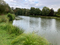
A lovely walk, almost entirely along beautiful, shaded paths. Starting from a pond, you’ll make your way to the highest point in the Loire-Atlantique department. You’ll cross vast agricultural landscapes bordered by beautiful hedgerows and enjoy the bountiful natural surroundings.
Route of the three ponds in Pouancé
 5.59 mi
+233 ft
-243 ft
2h 45
Easy
Departure from Pouancé (Maine-et-Loire)
5.59 mi
+233 ft
-243 ft
2h 45
Easy
Departure from Pouancé (Maine-et-Loire)
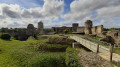
A pleasant route that takes you along paths to discover the pretty countryside of Pouancé, its ponds, its castle and the charming village with its narrow streets and beautiful bourgeois houses. A superb family walk with lovely views.
La Chauminette route
 4.98 mi
+112 ft
-69 ft
2h 25
Easy
Departure from Les Touches (Loire-Atlantique)
4.98 mi
+112 ft
-69 ft
2h 25
Easy
Departure from Les Touches (Loire-Atlantique)
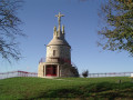
Set off to explore the Touchois bocage and its small sunken lanes. As soon as you set off, enjoy the 360° panorama from the Mont Juillet site. Its orientation table will help you to interpret the landscape around you.
Then set off to explore the surrounding countryside.
As you wander along the paths, you may come across an old building, a manor house, a calvary, a well or even a bread oven, each of which bears witness to a bygone era...
Gentle walk in Nort-sur-Erdre
4.75 mi
+46 ft
-46 ft
2h 15
Easy
Departure from Nort-sur-Erdre (Loire-Atlantique)
This walk is flat and allows you to follow the Erdre river before climbing back up from L'Isle along the Ruisseau de Montagné. This route is very natural, except for the section through the town centre (where we pass over a milestone on the Way of St James).
Blanche Noë Marshes Route
 10.96 mi
+26 ft
-26 ft
5h 05
Moderate
Departure from Nort-sur-Erdre (Loire-Atlantique)
10.96 mi
+26 ft
-26 ft
5h 05
Moderate
Departure from Nort-sur-Erdre (Loire-Atlantique)
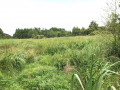
Set off to explore the Blanche Noë Marshes and the Nantes-Brest Canal.
The Erdre River, described by FrançoisI as "the most beautiful river in France", boasts a rich and diverse ecosystem. As you explore the marshes, you may spot one of the 140 species of birds listed in the vicinity of this river, which is classified as a Natura 2000 site.
Languin Mines route
 2.94 mi
+138 ft
-131 ft
1h 30
Easy
Departure from Nort-sur-Erdre (Loire-Atlantique)
2.94 mi
+138 ft
-131 ft
1h 30
Easy
Departure from Nort-sur-Erdre (Loire-Atlantique)
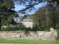
The village of Languin still bears traces of the old coal mines, which remained in operation until the early 20th century.
The route will take you along the banks of the "Rigole Alimentaire" (food canal), past the mine director's residence and its 300-year-old Lebanese cedar tree. From the village, you will enjoy a remarkable view of the surrounding countryside, which rises to an altitude of 55 metres.
The Greenway at Teillay
7.73 mi
+98 ft
-102 ft
3h 40
Moderate
Departure from Teillay (Ille-et-Vilaine)
This route, which is partly unmarked, will allow you to explore part of the ‘Voie Verte’ cycle path, built on a former railway line, running from Teillay to Guipry-Messac. You’ll walk alongside the Teillay Forest, passing the Saint-Eustache Chapel and some ponds.
Pas d'Héric lock circuit
 4.99 mi
+92 ft
-92 ft
2h 20
Easy
Departure from Nort-sur-Erdre (Loire-Atlantique)
4.99 mi
+92 ft
-92 ft
2h 20
Easy
Departure from Nort-sur-Erdre (Loire-Atlantique)
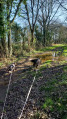
Set off to explore the Stream-Brest Canal, its "Rigole Alimentaire" and the surrounding countryside.
The Landes d’Ercé
7.35 mi
+30 ft
-30 ft
3h 25
Moderate
Departure from Ercé-en-Lamée (Ille-et-Vilaine)
This route largely follows the Circuits des Pierres Grises and the Circuits des Asphodèles (Bretagne Porte de Loire Communauté). Partly signposted, it will allow you to explore the Landes d’Ercé, de la Fleuriais and du Fayel. For your information: 1.25 km of tarmac-surfaced local roads; the rest consists of farm tracks and footpaths.