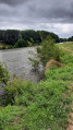
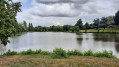
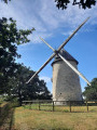
From one pond to another between Pannecé and Teillé

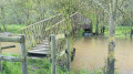
This route connects the ponds in the neighbouring communes of Teillé and Pannecé.
To this route, which is part of the Departmental Programme of Walking and Hiking Routes (PDIPR) and marked in yellow accordingly, I have added the complete walk around the lovely Étang de Teillé, which is well worth a detour.
You’ll walk along the old railway line, which has been converted into a greenway, for about a third of the route. It will provide welcome shade on hot days.

Details

36429978
Creation:
Last update:
Last review:
  • Walking
    Activity: Walking
  • ↔
    Distance: 6.78 mi
  • ◔
    Average duration: 3h 10 
  • ▲
    Difficulty: Moderate

  • ⚐
    Back to start: Yes
  • ↗
    Ascent: + 98 ft
  • ↘
    Descent: - 98 ft

  • ▲
    Highest point: 141 ft
  • ▼
    Lowest point: 69 ft
  • ⚐ Country: France
  • ⚐ City: Pannecé (44440)
  • ⚑
    Start/End: N 47.482921° / W 1.250223°
  • ❏
    IGN map(s): Ref. 1322SB
  • Hour-by-hour weather

Photos

Description of the walk

Park in the car park at the Étang de la Gravelle in Pannecé. You can also start from the car park at the Étang de Teillé.

:/A: Head north along the road, pass between the two ponds, then turn left immediately to walk alongside the Étang des Troches for its entire length. At the far end of the pond, take the small footbridge and continue along the stony path. When you reach the small road, turn right and you’ll arrive at the greenway.

(1) Turn left onto this route, section 38, heading south-west, and cross two minor roads followed by the D14. Continue to the hamlet of Rochettes. The route along the greenway ends at the start of greenway section no. 34.

(2) Turn left towards a small lake. Head towards Teillé church, which you can see ahead. Go round the community centre on the left.

(3) Opposite the church, turn left onto Rue du Centre and, a little further on, turn left again onto Chemin des Romains, which runs alongside the cemetery. After about a hundred metres (house no. 105), turn right and go down the steps. Then cross the D216 at the pedestrian crossing and carry on straight ahead for about 50 metres.

(4) Turn right at the pedestrian crossing and head towards the motorhome site.

(5) Cross the site before walking anti-clockwise round the Étang de Teillé.

(5) Return to the previous junction.

(4) Then follow the lane on your right, cross the departmental road and, 30 metres further on, take the small road furthest to the left, which becomes a track after the hamlet of La Butte. You will arrive at the hamlet of Le Tertre.

(6) Cross the small road and carry on to the next one, at the hamlet of La Lambière.

(7) Turn left onto the road heading towards the D9.

(8) A few metres before you reach it, turn right onto the path running parallel to this road. At the end of the lane, follow the small road for 50 metres.

(9) Turn left onto an old track, closed to motorised traffic, then carry on straight ahead along the road. At the ‘Give Way’ sign, rejoin the lane running alongside the D9 until it ends.

(10) Cross the departmental road with care to take the path opposite. Then cross a second road and enter the grounds adjoining the Étang de la Gravelle, which will be on your right. Follow it along the sandy path which will lead you to the finish point (S/E).

Waypoints

  1. S/E : mi 0 - alt. 105 ft - Car park at Étang de la Gravelle in Pannecé.
  2. 1 : mi 0.74 - alt. 121 ft - Entrance to the greenway, on the left
  3. 2 : mi 2.31 - alt. 115 ft - End of the route on the greenway
  4. 3 : mi 2.56 - alt. 141 ft - Opposite the church
  5. 4 : mi 2.8 - alt. 82 ft - T-junction (A/R) towards the pond
  6. 5 : mi 3.83 - alt. 72 ft - Circular loop around the pond
  7. 6 : mi 4.53 - alt. 98 ft - A place known as Le Tertre
  8. 7 : mi 4.92 - alt. 128 ft - La Lambetdière
  9. 8 : mi 5.22 - alt. 85 ft - Junction, path running parallel to the D9
  10. 9 : mi 5.74 - alt. 92 ft - Junction
  11. 10 : mi 6.42 - alt. 98 ft - D9
  12. S/E : mi 6.78 - alt. 108 ft - Étang de la Gravelle car park in Pannecé

Reviews and comments

3.7 / 5
Based on 4 reviews

Reliability of the description
3.8 / 5
Ease of following the route
4.3 / 5
Route interest
3 / 5
JBEAU
JBEAU

Overall rating : 4 / 5

Date of your route : Jul 05, 2026
Reliability of the description : ★★★★☆ Good
Ease of following the route : ★★★★★ Very good
Route interest : ★★★☆☆ Average
Very busy route : No

A lovely walk on a sunny day. Well signposted with yellow markings.
A bit of a tarmac stretch. A slightly long, straight path, but in the shade.

Machine-translated

Stephantlegars
Stephantlegars

Overall rating : 4.3 / 5

Date of your route : Nov 25, 2025
Reliability of the description : ★★★★☆ Good
Ease of following the route : ★★★★★ Very good
Route interest : ★★★★☆ Good
Very busy route : No

A pleasant hike in this autumn weather with a stop halfway at Lake Pannecé, as we started the route in Teillé from the motorhome car park.

Machine-translated

Max 3007
Max 3007

Overall rating : 3.7 / 5

Date of your route : Jul 30, 2023
Reliability of the description : ★★★★☆ Good
Ease of following the route : ★★★★☆ Good
Route interest : ★★★☆☆ Average
Very busy route : No

An enjoyable walk on the whole, with few tarmac sections and well signposted. It’s a good idea to include the walk around Teillé Pond, which adds a touch of ‘nature’ to this route. A greenway with lovely tree cover, but a little too monotonous.
Once you’ve walked round the pond, return to Point 4 by crossing the motorhome site again and then following the path on your right. At Point 8, don’t be put off by the ‘private road’ sign; carry on regardless.
In my opinion, this route doesn’t offer enough of a connection with nature; it’s not very scenic.

Machine-translated

JPBellocq
JPBellocq

Overall rating : 2.7 / 5

Date of your route : Jul 30, 2023
Reliability of the description : ★★★☆☆ Average
Ease of following the route : ★★★☆☆ Average
Route interest : ★★☆☆☆ Disappointing
Very busy route : No

The greenway is well-lined with trees but rather monotonous. Wide gravel paths or roads rated 4 to 8 and 9 to 10, which are rather uninteresting. The two ponds are pleasant but a little too manicured for our taste.
Please note: After the 8, you’ll come out onto a path about thirty metres further on. This is the one you must take, despite the ‘private property / no entry’ sign. Otherwise, you’ll end up on the road, which you must avoid at all costs. This information is not included in the guidebook nor indicated by the yellow markings, which are curiously absent at this one spot only!

Machine-translated

Other walks in the area

For more walks, use our search engine .

The GPS track and description are the property of this route's author. Please do not copy them without permission.