Country:
 City:
City:


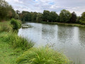
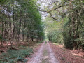
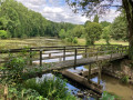
Car park near the Étang du Bois Péant.
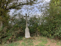
(S/E) With your back to the pond, head left (following the ‘La Grée’ markings). The road climbs. Pass a crossroads marked with a cross. Ignore a turn-off on the right to reach a path on the left, signposted ‘La Lipanière’.
(1) Turn onto this track and continue until you reach a Fork in the road.
(2) Take the right-hand fork. Ignore any paths branching off to the left or right. Continue until you reach a path coming from the left.
(3) Turn left onto this path to reach a crossroads.
(4) Head straight ahead to reach the highest point in the Loire-Atlantique department.
(5) Retrace your steps back to the previous junction.
(4) Turn left and continue until you reach a path entrance on the right.
(6) Follow this path until you reach a junction at a bend in the road.
(7) Take the path that branches off immediately to the right, running alongside a field. Continue until you reach a road at the entrance to La Renaudelière. Turn right and continue to the crossroads marked by a well-hidden cross.
(8) Turn left onto the path; when you reach a Fork in the road, take the right-hand branch. Carry on until you come to a wide path.
(9) Turn right onto this track, ignore two turnings on the right and cross the road carefully. Carry on straight ahead for 500 m until you reach a crossroads.
(10) Turn left onto the path, which first turns right then left, then carry on until you reach a path entrance on your right.
End of yellow signposting
(11) Follow this path to the right until you reach La Haute Picoisnière at a road.
(12) Turn left onto this road to join the D41.
Yellow markings resume
(13) Turn right onto this road and, taking great care, make your way to Fercé, where you will see the church. Tip: walk on the left-hand side, facing any potential danger.
Pass Rue des Lilas and head right onto Rue de l’Étang.
(14) Turn right onto this road and head towards Étang Péan (S/E).

 Visorando Member

 Easy
Easy