Country:
 City:
City:


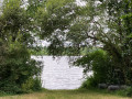
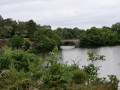
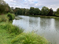
The walk starts at the Étang du Bas du Tertre.
(S/E) At the information boards at the start of the pond, take the path that runs along the left-hand bank. The path begins to climb. When you reach a Fork in the road, take the right-hand branch (signposted ‘Chemin des Étangs et des Calvaires’). Follow this path until you reach a small road. Cross carefully and take the path opposite. Continue until you reach another small road, which you should cross carefully. Take the path opposite again, turn right at the first junction and you’ll reach the D34.
(1) Cross the D34 carefully and, slightly to the left, take a path that branches off to the right. This path bends to the right and leads to the D40. Cross it carefully, then carry on until you reach the D69. Cross this carefully and continue towards Frény. Walk through the Bois de la Roche. At the next junction, turn left onto a path that runs alongside the River Chère. Continue until you reach a footbridge on your right.
(2) Cross the footbridge. At the other end, turn left, then immediately right. Cross the Grippais until you reach a road coming from the right (the junction is marked with a cross).
(3) Turn left, cross the Butte and you’ll reach a junction marked with a cross (signposted ‘L’Arche’).
(4) Turn right. The path takes a sharp left-hand bend. When you reach a Fork in the road, turn immediately right, towards La Goudais. You’ll come to a road joining from the right (the junction is marked with a cross).
(5) Follow the path that opens up immediately to your left. Cross the Chère. Continue straight ahead until you reach a crossroads marked with a cross.
(6) Retrace your steps and take the path on the left which runs alongside the Étang de la Hunaudière on your right. You’ll arrive at the Chapelle Saint-Éloi.
(7) Carry on until you reach a crossroads. Turn right onto the road. Walk along the edge of the lake and then turn right again. Carry on until you reach a crossroads. Turn right, ignore a path leading off to the right and carry on until you find a path on your left.
(8) Turn left onto this path. Carry on straight ahead until you reach the D34.
(9) Cross carefully, walk a few metres to the right and follow the road to the left; 100 metres further on, take the path opposite. Continue straight ahead until you reach the Étang de Chahin.
(10) After the pond, take the road on the right towards La Gautronnais. On leaving the village, turn left. Then turn right onto the first path you come to, then right again a little further on. You’ll come to a small road.
(11) Cross it and carry on until you reach a cross.
(12) Carry on along the track until you reach another cross at the entrance to La Gaudinais, on the edge of the D40.
(13) Cross the road carefully and turn left onto the road leading towards Mauny and then the Château du Plessis.
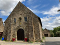
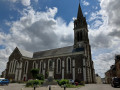
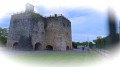
(14) Turn right onto a path just before the château. Walk alongside the woodland until you reach the D34. Turn left, then right towards Place Jeanne d’Arc. Turn right to go round the church, passing in front of its porch, then left to see the Templars’ Chapel (follow the signposts).
(15) Walk alongside the chapel, keeping it on your left. Take the path leading downhill, turn left at the first junction and reach the road via a few steps. Head off to the right. The Étang du Bas du Tertre is a little further on to the left, on the other side of the road. Cross the road carefully. A footbridge will take you to the (S/E) .


 Visorando Member

 Easy
Easy