


Refine your search for walks in Mognéville
Mognéville walks


 In the footsteps of the Tacot
 Visorando Member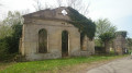
 9.69 mi
 +233 ft
 -115 ft
 1.5 hrs
 Easy
Easy
 Departure from Mognéville (Meuse)
A lovely walk, best done by bike, along the route of the old railway lines in the Saulx Valley, including the line known as the ‘Tacot’ or the ‘Meusien’, which was in service from 1883 to 1971.
It is not a circular route, but the return journey is easy as there is little incline.
The route is often shaded.
 From Robert-Espagne to Trois Fontaines
 13.59 mi
+466 ft
-440 ft
6h 40
13.59 mi
+466 ft
-440 ft
6h 40
 Difficult
Departure from Robert-Espagne (Meuse)
Difficult
Departure from Robert-Espagne (Meuse)
A hike through the Trois Fontaines Forest will allow you to discover the karstic relief of the area with its numerous chasms, sinkholes and resurgences, and offer a historical glimpse of the region with its Trois Fontaines Abbey and the monument to those shot on 29 August 1944 in Robert-Espagne.
Val d’Ornain – Fains-les-Sources circular route
 8.92 mi
+456 ft
-453 ft
4h 30
8.92 mi
+456 ft
-453 ft
4h 30
 Moderate
Departure from Val-d'Ornain (Meuse)
Moderate
Departure from Val-d'Ornain (Meuse)
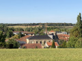
This circular route, which passes through the villages of Bussy-la-Côte, Varney, Fains-les-Sources and Mussey, is very easy and allows you to explore the churches of Saint-André (19th century) in Bussy, Sainte-Catherine (15th and 16th centuries) in Fains and Saint-Nicolas (12th–16th centuries) in Mussey.
Circular Golf course loop from Véel
 7.66 mi
+440 ft
-456 ft
3h 55
Moderate
Departure from Fains-Véel (Meuse)
7.66 mi
+440 ft
-456 ft
3h 55
Moderate
Departure from Fains-Véel (Meuse)
This route, starting from Véel, passes through Fains-les-Sources before reaching the 18-hole golf course at Combles-en-Barrois. It will take you past the churches of Saint-Martin (15th century) in Véel, Sainte-Catherine (15th and 16th centuries) in Fains-les-Sources, and the Saint-Joseph Chapel (19th century) between Fains and Combles.
It is an easy walk with little shade. There is a shaded picnic area (4 tables) in front of the Saint-Joseph Chapel.
Villers-aux-Vents circular
7.81 mi
+285 ft
-305 ft
3h 50
Moderate
Departure from Villers-aux-Vents (Meuse)
A walk through the Meuse countryside, taking in woods, meadows and ponds.
Route des Gouffres (Caves Route) in Trois-Fontaines-l'Abbaye
 7.42 mi
+430 ft
-407 ft
3h 45
Moderate
Departure from Trois-Fontaines-l'Abbaye (Marne)
7.42 mi
+430 ft
-407 ft
3h 45
Moderate
Departure from Trois-Fontaines-l'Abbaye (Marne)
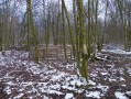
Well-marked hike mainly in the forest, passing near the developed chasms (wooden barriers).
Yellow, white and redPR® markings for theGR® 14 and 14B.
Route des granges à Trois-Fontaines-l’Abbaye
 9.97 mi
+367 ft
-338 ft
4h 55
Moderate
Departure from Trois-Fontaines-l'Abbaye (Marne)
9.97 mi
+367 ft
-338 ft
4h 55
Moderate
Departure from Trois-Fontaines-l'Abbaye (Marne)
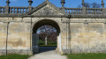
A lovely walk starting from Trois-Fontaines Abbey, passing by the barns – a key site in the region’s history.
Resson Plateau
 5.34 mi
+515 ft
-512 ft
2h 55
Easy
Departure from Bar-le-Duc (Meuse)
5.34 mi
+515 ft
-512 ft
2h 55
Easy
Departure from Bar-le-Duc (Meuse)
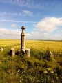
A short route that will take you to the Plateau de Resson. You can enjoy a full 360° panorama.
Circular of the Côtes from Bazincourt-sur-Saulx
 14.63 mi
+1,227 ft
-1,240 ft
7h 50
Difficult
Departure from Bazincourt-sur-Saulx (Meuse)
14.63 mi
+1,227 ft
-1,240 ft
7h 50
Difficult
Departure from Bazincourt-sur-Saulx (Meuse)
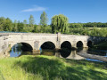
This 24 km circular is quite difficult with an elevation gain of 400 m, hence its name.
Picnic tables are available in all the villages along the route.
The route takes 6 hours (including a picnic). 40% of the route is shaded.
In Stainville, visit the 16th-century Saint-Mathieu Church with its baldachin altar, oil paintings of Christ, the Château de Choiseul and the 19th-century stone fountain.
Long circular around Saint-Dizier
 5.29 mi
+26 ft
-26 ft
2h 25
Easy
Departure from Saint-Dizier (Haute-Marne)
5.29 mi
+26 ft
-26 ft
2h 25
Easy
Departure from Saint-Dizier (Haute-Marne)
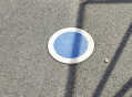
Route around the town of Saint-Dizier, along the Marne and the canals. Markings: large blue dots on the pavements, pedestrian crossings marked "La grande boucle" and blue circle wooden markers.
Belvédère de Tannois circular
 5.58 mi
+623 ft
-594 ft
3h 05
Easy
Departure from Tannois (Meuse)
5.58 mi
+623 ft
-594 ft
3h 05
Easy
Departure from Tannois (Meuse)
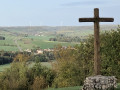
This 9km circular takes you to the Belvédère de Tannois and offers exceptional views over the Ornain valley.
Banks of the Marne between Ambrières and La Neuville-au-Pont
 5.33 mi
+79 ft
-82 ft
2h 30
Easy
Departure from Ambrières (Marne)
5.33 mi
+79 ft
-82 ft
2h 30
Easy
Departure from Ambrières (Marne)
Walk along the banks of the Marne and through the gravel pits, between Ambières and La Neuville-au-Pont.
Sainte-Livière circular via La Lampe
5.99 mi
+23 ft
-23 ft
2h 45
Easy
Departure from Éclaron-Braucourt-Sainte-Livière (Haute-Marne)
A walk through the Dervois countryside, passing through Sainte-Livière, a pretty village in Champagne. During the walk, discover the Memorial to the Aviators of La Lampe (7), who were killed in the crash of their Marauder aircraft in 1945.
Les Bois du Der via the Nemours Peninsula
7.01 mi
+79 ft
-98 ft
3h 15
Moderate
Departure from Éclaron-Braucourt-Sainte-Livière (Haute-Marne)
Walk in the Der woods, passing by the dykes, the port and the Nemours peninsula.
Moderator's warning (03/07/2022): path reported as impassable from (7).
Sainte-Marie-du-Lac circular route via the Moulin du Charme and Écollemont
 6.91 mi
+66 ft
-69 ft
3h 15
Easy
Departure from Sainte-Marie-du-Lac-Nuisement (Marne)
6.91 mi
+66 ft
-69 ft
3h 15
Easy
Departure from Sainte-Marie-du-Lac-Nuisement (Marne)
Starting from the Musée du Der in Sainte-Marie-du-Lac-Nuisement, a lovely walk past an old mill, then through a village in the Champagne region, and back via the Lac du Der embankment.
Yellow and blue markings on part of the route.