Circular Golf course loop from Véel

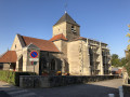
This route, starting from Véel, passes through Fains-les-Sources before reaching the 18-hole golf course at Combles-en-Barrois. It will take you past the churches of Saint-Martin (15th century) in Véel, Sainte-Catherine (15th and 16th centuries) in Fains-les-Sources, and the Saint-Joseph Chapel (19th century) between Fains and Combles.
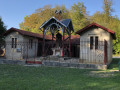
It is an easy walk with little shade. There is a shaded picnic area (4 tables) in front of the Saint-Joseph Chapel.

Details

2588380
Creation:
Last update:
Last review:
  • Walking
    Activity: Walking
  • ↔
    Distance: 7.66 mi
  • ◔
    Average duration: 3h 55 
  • ▲
    Difficulty: Moderate

  • ⚐
    Back to start: Yes
  • ↗
    Ascent: + 440 ft
  • ↘
    Descent: - 456 ft

  • ▲
    Highest point: 840 ft
  • ▼
    Lowest point: 581 ft
  • ⚐ Country: France
  • ⚐ City: Fains-Véel (55000)
  • ⚑
    Start/End: N 48.77041° / E 5.11622°
  • ❏
    IGN map(s): Ref. 3114SB, 3115SB
  • Hour-by-hour weather

Photos

Description of the walk

Starts at Saint-Martin Church in Véel. Car park with around ten parking spaces.

(S/E) Take the path leading down towards the old wash house (signposted ‘Les Trops’). Walk between the wash house and the sports ground, then follow the path uphill.

(1) When you reach the dirt track, turn right and follow it for about 1 km. At the junction, turn onto the dirt track that leads uphill towards the microlight club.

(2) Follow the track to the left, which enters the woods for about 300 metres. A sign warns of chasms; take care.

(3) At the junction with a park ahead of you, turn right and follow the white track towards the village of Fains-les-Sources. You will be on Rue de la Grande Chalaide, which descends onto the D185 road to reach Place de la Mairie. Turn right onto Rue Haute de Véel and continue to number 15.

(4) Between houses nos. 15 and 17, take the steps leading to the cemetery, then walk down the small path towards Avenue de la Vaux Mourot.

(5) Walk up Avenue de la Vaux Mourot, then Avenue de Nolière, and turn right onto Avenue de la Guedotte to reach the bus shelter of the same name. Walk 50 metres to the left and follow the grassy path leading to Cathy’s SPA shelter.

(6) In front of the shelter, turn onto the path on the left which climbs for several hundred metres. After about 1 km, cross the small tarmac road and continue along the path.

(7) Cross the D146 road and enjoy the shaded picnic area in front of the Chapelle Saint-Joseph du Chêne. Continue along the path at the edge of the woods towards Combles-en-Barrois.

(8) When you reach the D3 road, take the pavement on the right which runs alongside the road towards the village. Follow the Grande Rue.

(9) Turn right onto Rue de l’Église.

(10) In front of the church, turn right, then at the bottom, turn left onto Rue Basse and follow it for about a hundred metres.

(11) Turn left and head up Rue de la Galande.

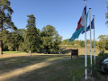
(12) At the junction, turn right and follow the golf course for over a kilometre until you reach the junction with the D185.

(13) Walk a few metres to the left, then head up Rue de la Haie Joubet on the left. Turn right onto Rue d’Égremont, then turn left onto Rue de l’Église to return to your starting point (S/E).


Waypoints

  1. S/E : mi 0 - alt. 771 ft - Saint-Martin Church in Véel
  2. 1 : mi 0.33 - alt. 810 ft - Junction with a dirt track
  3. 2 : mi 1.15 - alt. 814 ft - ULM flying club
  4. 3 : mi 1.54 - alt. 797 ft - Junction: Val d’Ornain on the left and the golf course on the right
  5. 4 : mi 2.31 - alt. 597 ft - Staircase, 15 Rue Haute de Véel
  6. 5 : mi 2.43 - alt. 630 ft - Fains-les-Sources cemetery
  7. 6 : mi 3.1 - alt. 663 ft - Cathy’s SPA Retreat
  8. 7 : mi 4.37 - alt. 807 ft - Saint-Joseph du Chêne Chapel
  9. 8 : mi 5.38 - alt. 827 ft - Entrance to Combles on the D3
  10. 9 : mi 5.83 - alt. 814 ft - Junction with Rue de l’Église
  11. 10 : mi 5.88 - alt. 817 ft - Sainte-Catherine Church, on the right
  12. 11 : mi 6.02 - alt. 771 ft - Combles-en-Barrois Golf Course
  13. 12 : mi 6.2 - alt. 827 ft - Junction at the top of Rue de la Galande
  14. 13 : mi 7.18 - alt. 738 ft - Rue de Combles D185
  15. S/E : mi 7.66 - alt. 764 ft - Saint-Martin Church in Véel

Notes

Easy going and not very shaded.
(7) Picnic area in the shade (4 tables) in front of the Saint-Joseph du Chêne Chapel.

Worth a visit

Combles-en-Barrois 18-hole golf course.

Site of the Roman camp just before Fains-les-Sources.

Reviews and comments

4.8 / 5
Based on 2 reviews

Reliability of the description
5 / 5
Ease of following the route
5 / 5
Route interest
4.5 / 5
Christecol
Christecol

Overall rating : 4.5 / 5

Date of your route : Apr 15, 2026
Reliability of the description : Not used / Not applicable
Ease of following the route : ★★★★★ Very good
Route interest : ★★★★☆ Good
Very busy route : No

A pleasant walk with little elevation gain through a protected forest and farmland. The golf course is really very large and can be seen at the end of the route. The churches add to the charm of the walk.

Machine-translated

Payster
Payster
• Edited:

Overall rating : 5 / 5

Date of your route : Jan 27, 2020
Reliability of the description : ★★★★★ Very good
Ease of following the route : ★★★★★ Very good
Route interest : ★★★★★ Very good

A lovely walk through ever-changing scenery; we did it in winter without any particular difficulties; you’d never guess you were just a few kilometres from Bar-le-Duc!
Varied scenery, and a few villages typical of the Barrois region.

Machine-translated

Other walks in the area

For more walks, use our search engine .

The GPS track and description are the property of this route's author. Please do not copy them without permission.