Val d’Ornain – Fains-les-Sources circular route

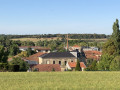
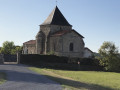
This circular route, which passes through the villages of Bussy-la-Côte, Varney, Fains-les-Sources and Mussey, is very easy and allows you to explore the churches of Saint-André (19th century) in Bussy, Sainte-Catherine (15th and 16th centuries) in Fains and Saint-Nicolas (12th–16th centuries) in Mussey.

Details

2560552
Creation:
Last update:
Last review:
  • Walking
    Activity: Walking
  • ↔
    Distance: 8.92 mi
  • ◔
    Average duration: 4h 30 
  • ▲
    Difficulty: Moderate

  • ⚐
    Back to start: Yes
  • ↗
    Ascent: + 456 ft
  • ↘
    Descent: - 453 ft

  • ▲
    Highest point: 840 ft
  • ▼
    Lowest point: 525 ft
  • ⚐ Country: France
  • ⚐ City: Val-d'Ornain (55000)
  • ⚑
    Start/End: N 48.813014° / E 5.085613°
  • ❏
    IGN map(s): Ref. 3114SB, 3115SB
  • Hour-by-hour weather

Photos

Description of the walk

The starting point for this walk is in front of the church in Bussy-la-Côte, near the village well.

(S/E) Follow Rue Basse towards the former Town Hall and School.

(1) Take the path on the right just before the town hall, follow the track which begins with a steep incline and runs alongside the River Ornain as far as the Varney bridge.

(2) Cross the bridge to the right and take Rue des Fermes (the first on the left) in Varney.

(3) At the junction, turn left, walk past the chapel and continue right onto the dirt track.

(4) At a place called Rembercourt, take the road towards the concrete plant and follow the railway line and the ponds.

(5) At the Fains-les-Sources level crossing, turn right, cross the railway line and the canal, and head towards the Place de la Mairie in the direction of Véel.

(6) 200 metres after the town hall, turn right onto Rue de la Chalaide (the slope is quite steep).

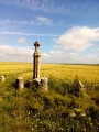
(7) At the fork marked by a cross, take the path on the left which runs alongside the orchards.

(8) Opposite the flying club, head into the woodland on the right (signs warning of sinkholes).

(9) At the junction, turn left and ignore the path on the right leading to the Combles-en-Barrois golf course.

(10) As you emerge from the woodland, take the white track on the right and leave it a few hundred metres further on to take the path on the right. Then walk alongside a fully fenced woodland plantation and pass in front of a farm shed.

(11) Leave the white track and take the grassy path, over 6 metres wide, which runs between orchards and turns left.

(12) In front of Mussey church, turn right onto the path that leads down towards the road running through the village.
Once on the road, turn right and, opposite the town hall, continue to the right towards Bussy-la-Côte. Take the steps to cross over the canal and follow the departmental road (on the right-hand side) leading to Bussy-la-Côte.

(13) Just before the bend and the climb towards Bussy, take the unpaved track on the right.

(14) Take thefirst track on the left which leads up to the village. On the road, keep to the right, then turn into thefirst street on the right and follow it to reach the church at Bussy-la-Côte (S/E).

Waypoints

  1. S/E : mi 0 - alt. 630 ft - Church of Bussy-la-Côte
  2. 1 : mi 0.05 - alt. 633 ft - Bussy-la-Côte Town Hall
  3. 2 : mi 0.69 - alt. 551 ft - Varney Bridge - Ornain (rivière)
  4. 3 : mi 0.91 - alt. 558 ft - Chapel
  5. 4 : mi 1.65 - alt. 564 ft - Rembercourt hamlet
  6. 5 : mi 2.6 - alt. 577 ft - Fains-les-Sources level crossing
  7. 6 : mi 2.9 - alt. 581 ft - Rue de la Chalaide
  8. 7 : mi 3.16 - alt. 722 ft - Junction with a cross
  9. 8 : mi 3.67 - alt. 817 ft - ULM Flying Club
  10. 9 : mi 4.03 - alt. 804 ft - Turn left at the fork
  11. 10 : mi 5.41 - alt. 676 ft - White path on the right
  12. 11 : mi 7.01 - alt. 610 ft - A grassy track over 6 metres wide
  13. 12 : mi 7.36 - alt. 604 ft - Mussey Church
  14. 13 : mi 8.42 - alt. 558 ft - Before the climb, take the white track on the right
  15. 14 : mi 8.65 - alt. 554 ft - Path on the left
  16. S/E : mi 8.92 - alt. 633 ft - Church of Bussy-la-Côte

Notes

It is not advisable to undertake this walk in very hot weather as at least 50 per cent of the route is unshaded.

Reviews and comments

4.5 / 5
Based on 2 reviews

Reliability of the description
5 / 5
Ease of following the route
5 / 5
Route interest
3.5 / 5
confetti
confetti

Overall rating : 5 / 5

Date of your route : May 11, 2024
Reliability of the description : ★★★★★ Very good
Ease of following the route : ★★★★★ Very good
Route interest : ★★★★★ Very good
Very busy route : No

A very interesting and varied route.
Very pleasant walks through villages.
Please note: significant elevation gain and loss (+1,400/-1,400).

Machine-translated

fanfan
fanfan

Overall rating : 4 / 5

Date of your route : Mar 26, 2021
Reliability of the description : ★★★★★ Very good
Ease of following the route : ★★★★★ Very good
Route interest : ★★☆☆☆ Disappointing
Very busy route : No

Hello, and thank you to the author for this route.
Well done on the quality of the route and its description – no complaints, everything’s fine.

We found this route very disappointing as it was too monotonous and lacked points of interest.
Few scenic views, few distinctive features, and above all, too few footpaths; far too many roads and dirt tracks, with rather demoralising straight stretches: points 3 to 5, then points 8 to 11, and finally 12 to 13.
From point 3 onwards, the route offers no opportunity to rest.
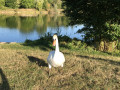
There are a few lovely spots worth noting, notably the picnic area at point 2 and the pond by the roadside between points 12 and 13, as well as a few lovely paths: along the Ornain from points 1 to 2, then through the forest from points 7 to 8. Also, the church at Mussey, which is very pretty in its setting

It is certainly true that in bright sunshine this route is almost impossible, but in wet weather it offers very few sheltered areas.

Apart from points 1 to 2, this route is very well suited to hybrid bikes (all-terrain bikes)

Thanks all the same – there’s something for everyone.

Machine-translated

Other walks in the area

For more walks, use our search engine .

The GPS track and description are the property of this route's author. Please do not copy them without permission.