Route des granges à Trois-Fontaines-l’Abbaye

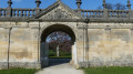
A lovely walk starting from Trois-Fontaines Abbey, passing by the barns – a key site in the region’s history.

Details

1109450
Creation:
Last update:
Last review:
  • Walking
    Activity: Walking
  • ↔
    Distance: 9.97 mi
  • ◔
    Average duration: 4h 55 
  • ▲
    Difficulty: Moderate

  • ⚐
    Back to start: Yes
  • ↗
    Ascent: + 367 ft
  • ↘
    Descent: - 338 ft

  • ▲
    Highest point: 741 ft
  • ▼
    Lowest point: 525 ft

Photos

Description of the walk

Start from the car park at Trois-Fontaines Abbey.

(S/E) From the Abbey car park, on theGR®®14B, head south-east, ignore the path on the left and carry on straight ahead for 1 km.

(1) Pass the first barn, “Trois Fontaines la Grange”, on your left, continue straight on for 1.4 km, go through the gate and carry on straight for a further 400 m through the Malcoutume Forest Reserve.

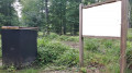
(2) At the corner by the fuel depot, turn right and carry on for about 700 metres.

(3) After a gas installation, turn left heading south-west for 300 metres.

(4) Follow the path on the left at the edge of the forest, with a view of the second barn, “Ferme de Beaulieu”. Continue for 1.4 km. The path enters the forest and leads to the Route Forestière des Hattons.

(5) Turn left, heading north-north-east along this forest road, and continue for 1 km until you reach the junction with theGR®®14B.

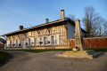
(6) Turn right, heading south-east, onto theGR®®14B, along the Route Forestière de Lombroie, which leads to “Les Écuries de Lombroie”, the third barn on the route, 600 metres away.

(7) Turn right, walk past the pond and the Écuries de Lombroie, and continue straight on for 300 metres.

(8) Turn left, heading north-east, leaving theGR®®14Bvia the footpath and then the track, and carry on straight ahead for 500m.

(9) At the four-way junction, turn left, heading north-west, onto the Route Forestière des Étocs, then carry on straight ahead to join thePR®® on the Route Forestière de Brassa. Pass close to the Source de la Bruxenelle, then continue north-east for 800 metres.

(10) First turn right then left onto the Route Forestière de La Belle Épine and continue north-east for 350 metres.

(11) Leave thePR®® by turning left, heading north-west, to join theGR®®14after 1 km, then carry on straight ahead for 300 metres.

(12) Turn left towards the south-west, then take the first signposted path 80 metres ahead on the right, heading north-west for 400 metres. Leave theGR®®14on your left and follow the path straight ahead for 300 metres, then rejoin thePR®® for a further 300 metres.

(13) At the junction before a bend to the left, head diagonally left towards the south-west, pass the “Neuve Grange” (the fourth barn on the route), and continue along Rue de la Neuve Grange on theGR®®14to the Abbey car park (S/E).

Waypoints

  1. S/E : mi 0 - alt. 525 ft - Abbey car park
  2. 1 : mi 0.72 - alt. 551 ft - Trois Fontaines la Grange
  3. 2 : mi 2 - alt. 640 ft - Turn right at the corner by the petrol station
  4. 3 : mi 2.51 - alt. 600 ft - Turn left after a gas installation
  5. 4 : mi 2.69 - alt. 623 ft - Path on the edge of the forest
  6. 5 : mi 3.5 - alt. 640 ft - Turn left onto the Route Forestière des Hattons
  7. 6 : mi 4.14 - alt. 666 ft - Turn right onto the GR
  8. 7 : mi 4.62 - alt. 630 ft - Lombroie Stables
  9. 8 : mi 4.83 - alt. 633 ft - Turn left as you leave the GR
  10. 9 : mi 5.25 - alt. 673 ft - Turn left onto the Route Forestière des Étocs
  11. 10 : mi 6.52 - alt. 741 ft - Left/right Route Forestière de La Belle Épine
  12. 11 : mi 6.82 - alt. 696 ft - Turn left as you leave the PR
  13. 12 : mi 7.76 - alt. 666 ft - Turn left, then right after 80 m onto the GR14
  14. 13 : mi 8.53 - alt. 640 ft - Turn left onto Rue de la Neuve Grange
  15. S/E : mi 9.97 - alt. 525 ft - Abbey car park

Notes

Water points and shelter at the abbey at the start and finish.

Water points and shelters at the farms along the route.

Equipment: sturdy shoes, water, cereal bars, dried fruit, walking poles.

Worth a visit

Information on the history of the barns available at the Abbey

Tour of the Abbey,

Tour of the bicycle museum at the Abbey.

Further information here

Always be cautious and plan ahead when you're outdoors. Visorando and the author of this route cannot be held responsible for any accidents occurring on this route.

The GR® and PR® markings are the intellectual property of the Fédération Française de Randonnée Pédestre.

Reviews and comments

3.3 / 5
Based on 1 review

Reliability of the description
4 / 5
Ease of following the route
4 / 5
Route interest
2 / 5
virgule
virgule
• Edited:

JF:

Rating of the walking route: Disappointing

When you post a route, you put your heart and soul into it, and you want others to enjoy it. In this case, it took three years for anyone to complete this route. So to rate it as ‘disappointing’ – even if you’re disappointed at having got lost – I think that’s a bit harsh.

Visorando isn’t a fan club – you should point out what’s wrong, but you need to bear in mind that writing a route description takes time, and that contributors are entirely volunteers.

Machine-translated

courjus52
courjus52

Hello JF55260, when I say I’ll go back there to update it, I’m referring to the route, not the signposting, which isn’t planned for the moment. I’ll raise this with the club’s signposting team.
You should use the Visorando app as well as the PDF route map; it’ll be better, as you’ll know where you are to within 10 metres, and with the audio alert (vibration and/or a sound when you stray from the route) you’ll stay on the right track. (Menu, Settings, Audio Alert).
The aim of Visorando is also to enjoy trails off the beaten track – dare to explore…
Kind regards.

Machine-translated

JF55260
JF55260

Hello, I didn’t say that this route wasn’t interesting at all, but my friends and I had a tricky finish on this course. If, however, a little extra could be done, thank you.

Machine-translated

virgule
virgule

Hello,

the solution for people who can’t read a map or a guidebook is the app.

It’s not my route, but to say that a route is of no interest just because it isn’t signposted strikes me as rather unfair.

Machine-translated

courjus52
courjus52

Hello JF55260, Visorando is designed not to use waypoints; otherwise, you’ll need to plot the route on an IGN map. The ‘granges’ route isn’t marked with waypoints everywhere – it’s a route used by the club but it isn’t a PR.
I’ll go back there to update it. Best regards.

Machine-translated

JF55260
JF55260

Overall rating : 3.3 / 5

Date of your route : Sep 16, 2021
Reliability of the description : ★★★★☆ Good
Ease of following the route : ★★★★☆ Good
Route interest : ★★☆☆☆ Disappointing
Very busy route : No

Signposting is virtually non-existent – very disappointing and a let-down.

Machine-translated

Other walks in the area

For more walks, use our search engine .

The GPS track and description are the property of this route's author. Please do not copy them without permission.