Country:
 City:


Park in the car park near the cemetery, Rue du Moulin.
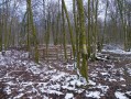
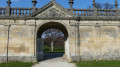
(S/E) Climb the steps to the gate and set off to the left onto the Sentier de la Prêle (marked with a leaf symbol). Continue straight on, due south, for approximately 1,300 metres, ignoring any side paths; the route is marked with themed information boards. You will reach the start of the path leading to the resurgence of the Rupt du Puits.
(1) Head down the maintained path to the left for about 80 m. This is where the waters from the nearby chasms and caves resurface. Head back up towards the track.
(1) Turn left, heading south, until you reach a junction about 150 metres away, where the paths cross.
(2) Turn right onto the Karst Trail (marked with a salamander symbol) and follow it for about 600 metres to reach the Gouffre de la Laie and the dolines. Return to the crossroads.
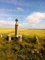
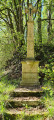
(2) Continue straight ahead and follow the path down to a bend in the Route de Trois Fontaines, near a cross and two benches.
(3) Pass the cross and a path on your left, and take the path towards the village, the Sentier de la Saulx (marked with a heron). When you reach Rue de la Moucherie, turn right and continue to the junction.
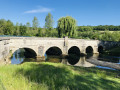
(4) Turn left onto Rue des Marauds, join Rue de Revigny, turn left onto it, cross the bridge over the Saulx, and continue to thesecond street on the left, Rue des Castors.
(5) Walk to the end of the street and take the path on the right, then turn left and follow it for about a hundred metres.
(6) Turn left (towards Les Habitants de la Saulx) until you reach the banks of the Saulx. Return to the crossroads, then turn left after about 250 metres; do not continue all the way to the tarmac road (D997). Just before a farm, turn onto the path on the left, then immediately right. Carry on straight ahead along a narrow lane (Rue du Tacot). It joins the D997 at a Stop sign.
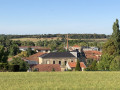
(7) Walk along the road (on the left-hand pavement), then turn left onto Rue des Pressoirs. At the end of the street, turn right onto Rue du Château until you reach Rue du Pont.
(8) Turn left onto it, cross the Saulx and turn right to reach the cemetery and the car park (S/E).

 Visorando Member
 Difficult

 Moderate