In the footsteps of the Tacot

A lovely walk, best done by bike, along the route of the old railway lines in the Saulx Valley, including the line known as the ‘Tacot’ or the ‘Meusien’, which was in service from 1883 to 1971.
It is not a circular route, but the return journey is easy as there is little incline.
The route is often shaded.

Details

1299964
Creation:
Last update:
Last review:
  • Mountain biking
    Activity: Mountain biking
  • ↔
    Distance: 9.69 mi
  • ◔
    Duration according to the author: 1.5 hrs 
  • ▲
    Difficulty: Easy

  • ⚐
    Back to start: No
  • ↗
    Ascent: + 233 ft
  • ↘
    Descent: - 115 ft

  • ▲
    Highest point: 623 ft
  • ▼
    Lowest point: 489 ft
  • ⚐ Country: France
  • ⚐ City: Mognéville (55800)
  • ⚑
    Start: N 48.77493° / E 5.013491°
  • ⚑
    End: N 48.684516° / E 5.084774°
  • ❏
    IGN map(s): Ref. 3015E, 3114SB, 3115SB

  • ◶
    Type of surface:
  •  
     
     
     33% Road  34% Byway  33% Path
  • ⇧
    Bike carrying: Not specified
  • ▲
    Difficulty: Not specified
  • Hour-by-hour weather

Photos

Description of the route

Starting from Mognéville; you can park your car at the side of the road near the D997 between Mognéville and Couvonges.

(S) Take the unpaved track heading south-east to quickly reach the ‘spider’ embankment.

(1) Carry on straight ahead until you reach a new crossroads where there is a former railway station, now converted into a house, on the right.

(2) Continue due south to reach the resurgence point of an underground river.

(3) Carry on straight ahead, passing under a bridge, and you’ll see the terminal siphon of a karst system, the Rupt-du-Puits. Stay on the path until you reach the area near the cemetery.

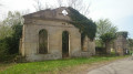
(4) Turn left, then right towards the D997; turn right onto it to reach the other side of the cemetery.
Carry on straight ahead to the junction leading to Baudonvilliers (a rare stretch of road on the route).

(5) Turn right towards Baudonvilliers (D3); you’ll soon come to a junction with a path.

(6) Turn left onto this track and cross the Saulx twice. Ride past the village of Jean d’Heurs. Make a large circular loop around the village of Lisle-en-Rigault. At the end of the loop, rejoin the junction with the D117 or Rue du Maréchal Foch.

(7) Continue straight ahead along Rue du Tacot. Then make two further circular loops, the first to the right and the second to the left, to reach the Carrefour du Sarcophage.

(8) Take the path on the right to discover, in the middle of a meadow, the remains of a Merovingian cemetery.

(9) Head back down the path to this crossroads.

(8) Take the path on the right again and, via another circular route, reach the village of Saudrupt. Opposite, take a short stretch of road towards Saint-Dizier (D635).

(10) Turn left almost immediately onto the Chemin du Tacot at the picnic benches. Follow the River Saulx to reach the junction with the D4 at a fountain.

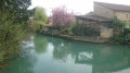
(11) Turn left towards the wash house and the 12-arched bridge spanning the Saulx, dating from 1618, to reach the Haironville car park (E).


Waypoints

  1. S : mi 0 - alt. 489 ft - Starting point: Mognéville (junction of the D997 and the dirt track)
  2. 1 : mi 0.43 - alt. 551 ft - Straight ahead, the ‘spider’ embankment
  3. 2 : mi 1.19 - alt. 535 ft - Straight ahead, the restored railway station – Near the - Saulx (rivière) à finaliser
  4. 3 : mi 2.1 - alt. 564 ft - Straight ahead: the Rupt-du-Puits bridge
  5. 4 : mi 2.97 - alt. 597 ft - On the right: the D997 and the former Robert-Espagne railway station
  6. 5 : mi 3.36 - alt. 554 ft - On the right: Baudonvilliers crossroads
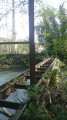
  7. 6 : mi 3.63 - alt. 545 ft - On the left, an old railway bridge
  8. 7 : mi 5.49 - alt. 561 ft - D117 junction
  9. 8 : mi 6.9 - alt. 581 ft - On the right, the ‘sarcophagus’ path
  10. 9 : mi 7.04 - alt. 617 ft - Merovingian sarcophagus
  11. 10 : mi 8.13 - alt. 587 ft - On the left at the picnic area
  12. 11 : mi 9.57 - alt. 594 ft - On the left: a bridge and a wash house
  13. E : mi 9.69 - alt. 587 ft - Haironville (Pont-sur-la-Saulx)

Notes

(1) On the embankment, on the limestone grass, lives a protected species of spider.
Between (4) and (5), look out for two water towers on the right, built to supply steam locomotives, as well as the station.
Between (5) and (6), on the left, you can see the monument dedicated to the victims of the massacre of 29 August 1944.

Worth a visit

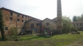
Throughout the route, you can see the remains of the old railway lines (stations, bridges, water towers for supplying steam engines, etc.).

These trains played a major role in the industrial boom of the Saulx Valley from the late19th century onwards (transporting paper, timber, foundry castings, ultramarine blue… and passengers).

Further information at and

Reviews and comments

5 / 5
Based on 2 reviews

Reliability of the description
5 / 5
Ease of following the route
5 / 5
Route interest
5 / 5
Lucie2018
Lucie2018

Overall rating : 5 / 5

Date of your route : Sep 07, 2020
Reliability of the description : ★★★★★ Very good
Ease of following the route : ★★★★★ Very good
Route interest : ★★★★★ Very good
Very busy route : No

A lovely walk, very well described and easy to find, even for people who aren’t from the area at all. A varied and very pleasant route.
We did this route on electric hybrid bikes ;-)) It was easier, but we did a circular route from Pargny to Saulx via Sermaize-les-Bains and Andernay to reach the start of the described route, and on the way back via Sommelonne, Baudonvilliers, Trois Fontaines and Cheminon, completing the circle at Pargny via small roads and farm tracks – 63 km in total. Absolutely brilliant – highly recommended for enthusiasts!!!

Machine-translated

gbuffet
gbuffet

Overall rating : 5 / 5

Date of your route : Apr 22, 2019
Reliability of the description : ★★★★★ Very good
Ease of following the route : ★★★★★ Very good
Route interest : ★★★★★ Very good

We cycled part of the route on mountain bikes with my two children, aged 8 and 10, going in the opposite direction.
The route starts at the village hall in Haironville, which is handy for parking.
The path is wide and practically flat all the way along – perfect for children.
The Merovingian sarcophagus is an interesting little detour, although it could do with being showcased a bit better.
Leaving the meadow, you can join a path opposite in the woods and head back down via a fun, winding little track.
Before reaching L’Isle-en-Rigault, there’s a lovely path along the riverbank to follow (accessed via a small metal footbridge), which is more pleasant than the old railway line, which is stony at this point. Carry on through the village to the bridge and continue along the riverbank to rejoin the railway line via a very pretty path alongside the River Saulx.
We went as far as the riding centre halfway along; it was already quite a round trip for little legs.

Thank you for this lovely walk.

Machine-translated

For more walks, use our search engine .

The GPS track and description are the property of this route's author. Please do not copy them without permission.