


Refine your search for walks in Menthon-Saint-Bernard
Menthon-Saint-Bernard walks


 Roc de Chère by Menthon-Saint-Bernard: a forest full of life
 Association / Club / Walk leader
 3.57 mi
 +581 ft
 -564 ft
 2h 10
2h 10
 Easy
Easy
 Departure from Menthon-Saint-Bernard (Haute-Savoie)
This forest walk takes you through very contrasting natural environments. Crossing the Roc de Chère, you pass from alpine to Mediterranean environments. Flora and fauna of opposing affinities find refuge on this rocky outcrop overlooking Lake Annecy.
From Château de Menthon to Talloires
 Visorando Member
 8.36 mi
+2,133 ft
-2,136 ft
5h 40
8.36 mi
+2,133 ft
-2,136 ft
5h 40
 Moderate
Departure from Menthon-Saint-Bernard (Haute-Savoie)
Moderate
Departure from Menthon-Saint-Bernard (Haute-Savoie)
A beautiful hike on the right bank of Lake Annecy. It will take you to the paragliding launch site and then to the pretty village of Talloires.
Tour du Roc de Chère
 3.93 mi
+751 ft
-738 ft
2h 30
Easy
Departure from Talloires (Haute-Savoie)
3.93 mi
+751 ft
-738 ft
2h 30
Easy
Departure from Talloires (Haute-Savoie)
Discover the whole of Lake Annecy from this rock in Charvines between Menthon-Saint-Bernard and Talloires, which is home to a magnificent golf course.
The Mont Baret loop from the Col de Bluffy
 5.15 mi
+2,224 ft
-2,215 ft
4h 20
Moderate
Departure from Menthon-Saint-Bernard (Haute-Savoie)
5.15 mi
+2,224 ft
-2,215 ft
4h 20
Moderate
Departure from Menthon-Saint-Bernard (Haute-Savoie)
A little-used ridge route, mainly in forest, with a beautiful alpine climb. A few views of Lake Annecy, Mont Veyrier and the Dents de Lanfon.
⚠️ A decree issued by the municipalities of Annecy and Veyrier-du-Lac prohibits motor vehicles from accessing the Col des Contrebandiers and Pré Vernet.
The Saint-Jorioz reed bed trail
 2.62 mi
+3 ft
-3 ft
1h 15
Easy
Departure from Saint-Jorioz (Haute-Savoie)
2.62 mi
+3 ft
-3 ft
1h 15
Easy
Departure from Saint-Jorioz (Haute-Savoie)
A short round trip hike along Lake Annecy to discover the reed beds that line the lake in this area. Superb views of the lake and the peaks above it await you.
Sarrazins Cave, starting from Veyrier-du-Lac
 1.86 mi
+909 ft
-909 ft
1h 40
1.86 mi
+909 ft
-909 ft
1h 40
 Difficult
Departure from Veyrier-du-Lac (Haute-Savoie)
Difficult
Departure from Veyrier-du-Lac (Haute-Savoie)
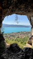
A short but challenging hike starting from Veyrier-du-Lac, leading to one of the most beautiful views of Lake Annecy. Short in distance and with little elevation gain, but featuring a vertiginous final section with a safety cable. Since the cave was opened, the view over Lake Annecy and the Bauges massif has been exceptional.Strongly not recommended for those prone to vertigo, or in wet weather. Suitable only for walkers comfortable with exposed terrain.
Circular route via the Col des Contrebandiers starting from Veyrier-du-Lac
 5.46 mi
+2,178 ft
-2,172 ft
4h 25
Moderate
Departure from Veyrier-du-Lac (Haute-Savoie)
5.46 mi
+2,178 ft
-2,172 ft
4h 25
Moderate
Departure from Veyrier-du-Lac (Haute-Savoie)
A walk through the woods between Veyrier-du-Lac and the Col de Bluffy, via the Col des Contrebandiers.Best done in winter when the trees have shed their leaves to enjoy the views over Lake Annecy.
⚠️ A decree issued by the municipalities of Annecy and Veyrier-du-Lac prohibits motor vehicles from accessing the Col des Contrebandiers and Pré Vernet.
Mont Veyrier from end to end
 7.82 mi
+3,540 ft
-3,537 ft
6h 40
Difficult
Departure from Veyrier-du-Lac (Haute-Savoie)
7.82 mi
+3,540 ft
-3,537 ft
6h 40
Difficult
Departure from Veyrier-du-Lac (Haute-Savoie)
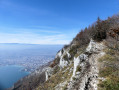
Mont Veyrier is one of the mountains most familiar to residents of the Annecy region: I suggest you explore it from north to south.Please note that the route includes a few tricky sections: see below for details.
⚠️ A decree issued by the municipalities of Annecy and Veyrier-du-Lac prohibits motorised vehicles from accessing the Col des Contrebandiers and the Pré Vernet.
Talloires - Chalets de l'Aulp via the Angon Waterfall and the Pont des Fées
 8.52 mi
+3,553 ft
-3,553 ft
7h 00
Difficult
Departure from Talloires (Haute-Savoie)
8.52 mi
+3,553 ft
-3,553 ft
7h 00
Difficult
Departure from Talloires (Haute-Savoie)
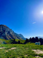
A lovely walk to a magnificent high-altitude mountain pasture with spectacular views of the Tournette rocks and Lake Annecy. The first part (Angon Waterfall, Pont des Fées, Rovagny) is suitable for families (direct return possible). Then, a steady, shaded path leads to the vast cirque of the Aulp chalets and its unique view of Lake Annecy and the Tournette rocks.
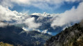
Saint-Germain Hermitage, Dents de Lanfon, Combe Noire Forest
 8.34 mi
+4,022 ft
-3,993 ft
7h 20
Difficult
Departure from Talloires (Haute-Savoie)
8.34 mi
+4,022 ft
-3,993 ft
7h 20
Difficult
Departure from Talloires (Haute-Savoie)
A long but magnificent hike. The route takes you through woodland and then along the ridge, offering superb views of the Dents de Lanfont,the Dent de Cruet, the Tournette, the lovely stretch at the Pas de l’Aulp, and finally the return via the Chalet des Crottes and the Combe Noire Forest.
The Mont Veyrier circular
 4.75 mi
+2,490 ft
-2,467 ft
4h 20
Difficult
Departure from Veyrier-du-Lac (Haute-Savoie)
4.75 mi
+2,490 ft
-2,467 ft
4h 20
Difficult
Departure from Veyrier-du-Lac (Haute-Savoie)
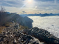
Mont Veyrier proudly overlooks Lake Annecy and offers magnificent views. The Sentier des Crêtes trail allows you to walk from north to south, from Col des Sauts to Vallon des Contrebandiers. The proposed circular route reduces the distance by starting from Hameau de la Combe, in the centre of the western slope, with two somewhat steep passages at the ends of the ridge trail.
Col des Frêtes and Arête de Talamarche
 8.00 mi
+3,819 ft
-3,812 ft
7h 00
Moderate
Departure from Alex (Haute-Savoie)
8.00 mi
+3,819 ft
-3,812 ft
7h 00
Moderate
Departure from Alex (Haute-Savoie)
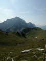
A beautiful, steep hike that follows a stream through the forest before arriving at a small alpine valley, then on a ridge where you can enjoy the view of the lake.
The Montagne d'Entrevernes circular route
 8.60 mi
+3,934 ft
-3,917 ft
7h 25
Difficult
Departure from Duingt (Haute-Savoie)
8.60 mi
+3,934 ft
-3,917 ft
7h 25
Difficult
Departure from Duingt (Haute-Savoie)
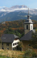
The two ridges around Entrevernes on the northern Bauges massif.
Taillefer Ridge
 4.47 mi
+1,224 ft
-1,224 ft
3h 05
Moderate
Departure from Duingt (Haute-Savoie)
4.47 mi
+1,224 ft
-1,224 ft
3h 05
Moderate
Departure from Duingt (Haute-Savoie)
An atypical route through bushes and over Annecy's lake.
A circular route around the Taillefer and Entrevernes ridges starting from Duingt
 9.47 mi
+3,330 ft
-3,317 ft
7h 15
Difficult
Departure from Duingt (Haute-Savoie)
9.47 mi
+3,330 ft
-3,317 ft
7h 15
Difficult
Departure from Duingt (Haute-Savoie)
This double ridge walk across two folds of the Bauges range, which plunge into Lake Annecy, offers both the appeal of a varied ridge walk and exceptional views of the lake and the surrounding mountains. La Tournette, in particular, is visible all day long.
The North Peak of the Dents de Lanfon
 5.90 mi
+3,730 ft
-3,714 ft
6h 00
Difficult
Departure from Alex (Haute-Savoie)
5.90 mi
+3,730 ft
-3,714 ft
6h 00
Difficult
Departure from Alex (Haute-Savoie)
A very scenic hike in the Annecy region, taking you to the northern tip of the Dents de Lanfon, set in unspoilt countryside and exceptional scenery. From the summit, there are superb views, particularly of Lake Annecy, the Tête à Turpin and the Grandes Lanches (Dent du Cruet).Please note: a helmet is recommended due to the risk of rockfalls.
Circular route from the foot of the Dents de Lanfon to Pointe de Talamarche
 8.76 mi
+5,125 ft
-5,148 ft
6 hrs
8.76 mi
+5,125 ft
-5,148 ft
6 hrs
 Very difficult
Departure from Alex (Haute-Savoie)
Very difficult
Departure from Alex (Haute-Savoie)
I suggest a circular route from the foot of the Dents de Laffon to the Pointe de Talamarche, all set against a backdrop of beautiful and varied scenery.There are challenging sections in two areas:- below the Dents de Lanfon in the scree slope: moderate navigation in an area exposed to rockfalls.- access to the Trou de la Chapelle: sections equipped with chains and rungs,A torch is strongly recommended for the crossing of the Grotte de la Chapelle. This route is best undertaken outside periods when snow is present and ideally on dry ground.Please read the Practical Information carefully.Three alternative routes are available: please also read the practical information.
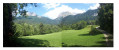
The Angon waterfall circuit
 3.10 mi
+1,289 ft
-1,299 ft
2h 35
Moderate
Departure from Talloires (Haute-Savoie)
3.10 mi
+1,289 ft
-1,299 ft
2h 35
Moderate
Departure from Talloires (Haute-Savoie)
A lovely, varied walk with undergrowth, meadows and small villages, with the added bonus of the Angon waterfall and superb views of the lake, La Tournette and the Dents de Lanfon.
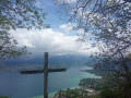
The 3 Crosses Trail in Sévrier
 3.64 mi
+1,129 ft
-1,129 ft
2h 40
Moderate
Departure from Sévrier (Haute-Savoie)
3.64 mi
+1,129 ft
-1,129 ft
2h 40
Moderate
Departure from Sévrier (Haute-Savoie)
A beautiful loop with views of the magnificent Lake Annecy
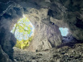
La Rochette and the Trou de la Chapelle, as seen from Alex
 6.41 mi
+3,199 ft
-3,186 ft
5h 45
Difficult
Departure from Alex (Haute-Savoie)
6.41 mi
+3,199 ft
-3,186 ft
5h 45
Difficult
Departure from Alex (Haute-Savoie)
A walk through the forest and then across the mountain pastures of La Rochette, followed by a slightly more challenging climb to the Trou de la Chapelle, a cave running through the Arête des Lanches.
A beautiful viewpoint and lovely spot at La Rochette below.
The upper reaches of Sevrier
 4.85 mi
+1,952 ft
-1,946 ft
3h 55
Difficult
Departure from Sévrier (Haute-Savoie)
4.85 mi
+1,952 ft
-1,946 ft
3h 55
Difficult
Departure from Sévrier (Haute-Savoie)
Please note that the descent along the Chemin des Lézards can be technical depending on the terrain and weather conditions. Furthermore, the junction onto this path is difficult to find.Highlights of this hike: cool forest air, walking along beautiful forest paths, and a few panoramic views of Lake Annecy
Morette Waterfall as seen from Provenat near Dingy-Saint-Clair
9.33 mi
+502 ft
-522 ft
4h 45
Moderate
Departure from Dingy-Saint-Clair (Haute-Savoie)
A mostly shaded route, a return walk from the Provenat outdoor fitness area, along the River Fier to the Nant Debout Waterfall at Morette. It provides access to the outdoor fitness trail, which features modern, well-maintained equipment. All along the green and yellow-marked trail, it is possible to descend to the banks of the Fier with its clear, crystal-clear waters. The Morette Waterfall is reached via a steep climb where children must be supervised, as the numerous tree roots can cause them to slip.
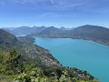
Mont Veyrier
 6.57 mi
+2,795 ft
-2,795 ft
5h 25
Difficult
Departure from Annecy-le-Vieux (Haute-Savoie)
6.57 mi
+2,795 ft
-2,795 ft
5h 25
Difficult
Departure from Annecy-le-Vieux (Haute-Savoie)
The ridge trail from Mont Veyrier to Mont Baron overlooks Lake Annecy from a height of over 800 metres and offers panoramic views of the Bauges peaks.
⚠️ A decree issued by the municipalities of Annecy and Veyrier-du-Lac prohibits motorised vehicles from accessing the Col des Contrebandiers and Pré Vernet.
La Tête à Turpin and the Col du Pertuis as a circular route from Chessenay
 9.18 mi
+4,406 ft
-4,386 ft
7 hrs
Very difficult
Departure from Dingy-Saint-Clair (Haute-Savoie)
9.18 mi
+4,406 ft
-4,386 ft
7 hrs
Very difficult
Departure from Dingy-Saint-Clair (Haute-Savoie)
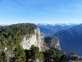
From Dingy-Saint-Clair, I suggest you head for the Tête à Turpin and then the Mont Téret plateau, whilst enjoying lovely scenery and numerous viewpoints. Please note that this is a challenging hike: there are difficulties on a few tricky sections requiring caution in exposed areas, and the route is not always easy to follow. Please read the description and practical information.