Country:

 City:
City:


Car park near Alex Church
(S/E) From the signpost opposite the church, take the Route du Château past the restaurant and, a little further on, turn right onto the Chemin du Crêt Vert, then follow the forest track as far as Chez Longet.
(1) Next, a pleasant path winds upwards in regular hairpin bends (the path is somewhat overgrown) and eventually joins the Chemin du Ragy. Continue due south along the hairpin bends.
Please note: just before Les Devins (860m), a track branches off to the left; ignore this as the path descends slightly before reaching the hamlet of Les Devins (signpost).
(2) From here, turn left onto the wide path – which has a few steep sections – and you’ll reach La Rochette en dessous without any difficulty.
(3) The track continues uphill, heading south-east, through the mountain pasture and on into the forest.
When you emerge onto the Rochette Dessus mountain pasture, do not head towards the ruins of La Rochette on the right; instead, at around 1,430 m, look out for a rock with a faded marker.
(4) The path heads eastwards, rising very slightly; look out for a post about 100 m away. Please note: the path is now 10 m before this post.
(5) Follow the edge of the forest for about 150 m, until you see the path entering the forest on your left.
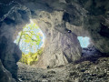
(6) The path is now clearly marked; it descends at first, then crosses two ravines and climbs steeply towards the Trou de la Chapelle.
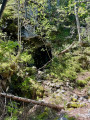
(7) There is a tunnel about 50 m long; use a head torch to get through it.
Return via the same route in the opposite direction to ‘Les Devins’.
(2) Take the track on the left, passing through Le Grépon.
(8) Continue along the road back to Alex (S/E).


 Visorando Member
 Moderate
 Very difficult