Country:

 City:
City:


From Annecy, heading towards Thônes, take the exit for Dingy-Saint-Clair, follow the Route du Fier, then take the third road on the right (Route de Provenat) to park in the car park above the recycling centre.
(S/E) Set off south from the car park along the fitness trail and follow the signposts from the start (yellow and green markings). A long walk then follows, mostly in the shade with a few possible descents down to the banks of the Fier.
(1) Ignore the return path on the left, continue straight on and arrive at Morette near a timber processing plant opposite a footbridge over the Nant Debout stream.
(2) Cross the footbridge and arrive near a car park on the Route des Cascades (D216). Cross the road opposite the Morette Cave (a reconstruction of the Grotto of Lourdes). Follow the road for a few dozen metres to the left, towards the exit from Morette along the rock faces (on your right). (Just before the exit sign, there is a signposted prehistoric site, though it is not open to visitors.) Cross the bridge over the Nand Debout and turn right. Walk uphill for about a hundred metres to reach a car park and a picnic area. A shelter provides an engaging description of the site’s history. Dry toilets are available. If the picnic area is occupied, you may be able to find another picnic spot before heading back.
(3) The Sentier des Cascades trail begins at the far end of the car park. The climb to the waterfall passes an archaeological excavation site and then follows the rock face before reaching, after a short, steep climb, the Morette Waterfall.
(4) Enjoy the scenery, then retrace your steps along the route back to the footbridge you crossed on your way to Morette.
(2) Turn right into the woodland alongside a branch of the River Fier;after a few dozen metres, you’ll reach a shaded picnic area facing a refreshing mini-waterfall. Continue along the stream; the path rejoins the route you took on the way there.
(1) Turn right and head back in the opposite direction to the outward journey, following the yellow and green markings, to return to the car park (S/E).
 Visorando Member

 Very difficult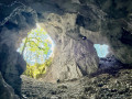
 Difficult
 Easy
Easy