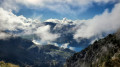
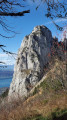
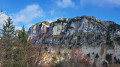
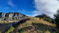
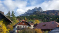
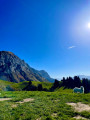
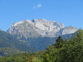
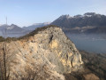
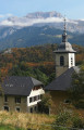
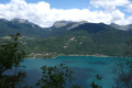
Saint-Germain Hermitage, Dents de Lanfon, Combe Noire Forest

A long but magnificent hike. The route takes you through woodland and then along the ridge, offering superb views of the Dents de Lanfont,
the Dent de Cruet, the Tournette, the lovely stretch at the Pas de l’Aulp, and finally the return via the Chalet des Crottes and the Combe Noire Forest.

Details

28796046
Creation:
Last update:
Last review:
  • Walking
    Activity: Walking
  • ↔
    Distance: 8.34 mi
  • ◔
    Average duration: 7h 20 
  • ▲
    Difficulty: Difficult

  • ⚐
    Back to start: Yes
  • ↗
    Ascent: + 4,022 ft
  • ↘
    Descent: - 3,993 ft

  • ▲
    Highest point: 5,482 ft
  • ▼
    Lowest point: 2,388 ft

Photos

Description of the walk

To reach the Saint-Germain hermitage: from Talloires, take the road to the Col de la Forclaz, then, 300 metres after thesecond tunnel, turn left onto a road. There is a car park above the hermitage on the road to Ponnay (4 to 5 spaces).

(S/E) From the car park, walk up the road and, just before the bend, take the path opposite which leads to Ponnay.

(1) Head north along a path towards a secluded chalet, which leads further on to the Route de Planfait.

(2) Leave this road immediately and take the path opposite, which runs alongside the Nant Sec.
Please note: after about 300 m, where the path crosses the Nant Sec, a barely visible track on the right leads back to the Route de Planfait.

(3) Follow this path uphill, then turn left onto the road for about 50 m to reach another path starting on the left.

(4) This path takes you back onto the Route de Planfait for the last time. Cross it to reach the path opposite.
At the junction of paths, at the 1000-metre mark, turn right (signposted ‘Lanfon’). Then turn left for 100 metres before turning right to join theGR®® 96.

(5) Cross it and follow the signposted direction for the Col des Frêtes (sign). Reach the ridge.

(6) Turn right and walk along level ground to the Col des Frêtes at an elevation of 1570. Look out for theGR®® below you and begin the descent to join it.

(7) Head right, towards the Chalets de l’Aulp, then continue on. Reach the junction with the Talamarche path.

(8) Continue towards the Col des Nantets along a path climbing up a small valley towards the Roc de Lancrenaz and the Pas de l’Aulp.

(9) This rocky section requires care; the path descends steeply, passes in front of the Chalet de la Froulaz and leads to the Col des Nantets at an altitude of 1426.

(10) Turn right towards the Chalet des Crottes.

(11) At the chalet, ignore the path on the left which descends to the Chalet de l’Aulp; turn right towards
Forêt de Combe Noire and Sauffaz. Follow a wider path, although there are significant marked sections that allow you to shorten the route. Continue to the Sauffaz–Talloires junction.

(12) Take the path that climbs towards Talloires, covering an elevation gain of around 150 m.
Continue along this path for 45 minutes (approximately 2 km), cross the Nant de Sallier, then, after 200 m, you’ll find the start of a path on your left.

(13) Head straight down the steep path into the valley; further on, the path becomes easier to walk on and joins a track suitable for vehicles. Follow it to the right until, after 600 m, you reach the Route de Planfait. Follow this road downhill to a junction you passed on the way there.

(2) Turn left onto the path leading back the way you came to return to the hermitage car park (S/E).

Waypoints

  1. S/E : mi 0 - alt. 2,388 ft - The Hermitage car park
  2. 1 : mi 0.34 - alt. 2,654 ft - Ponnay
  3. 2 : mi 0.48 - alt. 2,805 ft - Common junction for out-and-back route
  4. 3 : mi 0.65 - alt. 2,943 ft - Path towards the Route de Planfait
  5. 4 : mi 0.71 - alt. 2,989 ft - Path on the left
  6. 5 : mi 1.19 - alt. 3,458 ft - GR96 junction
  7. 6 : mi 2.25 - alt. 5,364 ft - Ridge
  8. 7 : mi 2.84 - alt. 5,036 ft - GR 96
  9. 8 : mi 3.15 - alt. 5,295 ft - Chalet de l’Aulp Riant above
  10. 9 : mi 3.59 - alt. 5,463 ft - Pas de l’Aulp. Roc de Lancrenaz
  11. 10 : mi 4.28 - alt. 4,678 ft - Col des Nantes (1426m)
  12. 11 : mi 4.63 - alt. 4,367 ft - Chalet des Crottes
  13. 12 : mi 5.4 - alt. 3,333 ft - Sauffaz junction, Talloires
  14. 13 : mi 6.97 - alt. 3,451 ft - Nant de Sallier
  15. S/E : mi 8.34 - alt. 2,395 ft - The hermitage car park

Notes

⚠️ 08/07/2026 – Sensitive area – Dents de Lanfon
The Dents de Lanfon couloir is currently the subject of particular vigilance. Significant instability has been observed in the upper part of the couloir, with a developing fracture zone and several large, unstable boulders that are at risk of dislodgement.
Furthermore, unauthorised fixed ropes have been installed along the route. As these are unsuitable and now severely deteriorated, they may give a false sense of security whilst actually constituting a risk factor in themselves.
It is recommended that you stay strictly on the official paths, do not use this unauthorised equipment, and observe the signage in place. As access conditions may change, it is advisable to check with Bluffy Town Hall before setting off.

Important: the route from the hermitage to (6) is not signposted. (The signposts otherwise direct you towards the Planfait site). Then, from (7) to (12), follow the yellow-green markings.
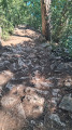
Furthermore, the path leading to the Col des Frêtes is very steep and muddy when wet. (You can slip even with good footwear).
The descent via the Vallon du Stream of Sallier is steep but nothing more; if in doubt, head back to the (5) to reach the hermitage via the same route as on the way there.

Worth a visit

Visit the hermitage of St-Germain and the cave.
The Col de la Forclaz, a paragliding take-off site, with views over Lake Annecy.

Always be cautious and plan ahead when you're outdoors. Visorando and the author of this route cannot be held responsible for any accidents occurring on this route.

The GR® and PR® markings are the intellectual property of the Fédération Française de Randonnée Pédestre.

Reviews and comments

4 / 5
Based on 1 review

Reliability of the description
Not used
Ease of following the route
5 / 5
Route interest
3 / 5
maxcaviso
maxcaviso

When we posted this walk, my wife and I were 70 and 75 years old, so yes, it was challenging. But doable. The steepest part is the climb up to the Dents, so you do need to be fit.

Machine-translated

_Sosnowski_
_Sosnowski_
• Edited:

Overall rating : 4 / 5

Date of your route : May 06, 2023
Reliability of the description : Not used / Not applicable
Ease of following the route : ★★★★★ Very good
Route interest : ★★★☆☆ Average
Very busy route : No

We went on this hike as a couple in early May instead of climbing the Col de la Tournette (due to the risk of mudslides). The distance and elevation gain seemed very appealing to us; we love a challenge.
However, the hike was rather disappointing for one reason alone: the ascents and descents from the peaks were incredibly steep! We’re not beginners, and yet we struggled to finish it. It wasn’t so much the physical exertion as having to contort our bodies in all sorts of directions because of the slopes, which were constantly steeper than 20 per cent! Our ankles, knees and backs took a particularly heavy knock… The only respite came once we reached the Col des Nantets, all the way to the Pointe du Sud, where the view is magnificent and the paths are accessible.
In short, be prepared to suffer for several hours before enjoying an unobstructed view of the lake at 1,400 metres. Based on our experience, we’d rate this hike as ‘very difficult’ rather than ‘difficult’.

Machine-translated

Other walks in the area

For more walks, use our search engine .

The GPS track and description are the property of this route's author. Please do not copy them without permission.