Sarrazins Cave, starting from Veyrier-du-Lac

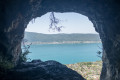
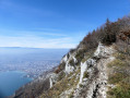
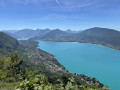
A short but challenging hike starting from Veyrier-du-Lac, leading to one of the most beautiful views of Lake Annecy. Short in distance and with little elevation gain, but featuring a vertiginous final section with a safety cable. Since the cave was opened, the view over Lake Annecy and the Bauges massif has been exceptional.
Strongly not recommended for those prone to vertigo, or in wet weather. Suitable only for walkers comfortable with exposed terrain.

Details

100428104
Creation:
Last update:
Last review:
  • Walking
    Activity: Walking
  • ↔
    Distance: 1.86 mi
  • ◔
    Average duration: 1h 40 
  • ▲
    Difficulty: Difficult

  • ⚐
    Back to start: Yes
  • ↗
    Ascent: + 909 ft
  • ↘
    Descent: - 909 ft

  • ▲
    Highest point: 2,546 ft
  • ▼
    Lowest point: 1,637 ft

Photos

Description of the walk

(S/E) From the car park at the Veyrier-du-Lac school, cross the village by taking the Route de Morat, then turning left onto the Chemin des Mottes, before joining the Route de la Corniche (no. 48).

(1) Cross this road and head up into the woods opposite via the Chemin de la Merle (listed as Chemin des Mottes by IGN), a path that runs alongside a stream and climbs for about 15 minutes before quickly disappearing into the woods.

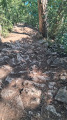
(2) At the junction, there is a small scree slope of white pebbles on your right, but turn left. Be careful: the path may be covered in leaves depending on the season. Several side paths lead to the climbing cliffs: stay on the main path, which becomes narrow and exposed; there are a few sections where you’ll need to scramble.

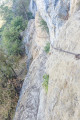
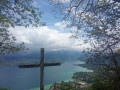
As you approach the cave, a cable is fixed to the cliff face to hold on to. This section is short but exposed: turn back if you do not feel comfortable. In wet weather, the rock is slippery, so caution is advised.

(3) Grotte des Sarrazins (776 m). The return to the car park (S/E) follows the same route as the outward journey.


Waypoints

  1. S/E : mi 0 - alt. 1,637 ft - Car park at the Veyrier-du-Lac school
  2. 1 : mi 0.41 - alt. 1,798 ft - Crossing the Route de la Corniche
  3. 2 : mi 0.81 - alt. 2,323 ft - Common junction (out and back)
  4. 3 : mi 0.93 - alt. 2,546 ft - Sarrazins Cave - Grotte des Sarrazins (Veyrier-du-Lac)
  5. S/E : mi 1.86 - alt. 1,637 ft - Car park at the Veyrier-du-Lac school

Notes

  • Cable section: the final stretch before the cave is narrow, with a drop below, and requires you to hold onto the cable for a few metres. Strongly not recommended for those prone to vertigo or in wet weather (slippery rocks). Although the walk is short, good physical fitness and sure-footedness are essential to tackle this section safely. If in doubt, turn back before reaching it — the view from the bottom of the section is still very beautiful.
  • Children: only possible with experienced children (aged 8–10 or over) equipped with a via ferrata lanyard for the cable section; two adults are required.
  • Dogs: the final section is not recommended for large dogs.
  • Recommended equipment: walking boots (stony ground, roots, slippery sections). A head torch is recommended for exploring inside the cave.
  • Parking: large car park at the school in Veyrier-du-Lac (free).
  • Water point: available at the start of the trail.

Worth a visit

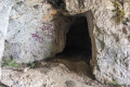
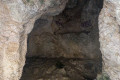
  • The Grotte des Sarrazins: a natural cavity in the limestone cliff of the Grandes Suites, known since the 17th century. Its name evokes medieval legends of Saracen hideouts during the invasions of the 8th century. Nestled in the Grandes Suites cliff, the cave consists of a main chamber and two secondary cavities.
  • La Table des Fées: a large flat rock in the heart of the cave, a must-see photo spot.
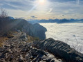
  • Panoramic view of Lake Annecy from the cave’s entrance: a 180° view of the lake and the Bauges massif.
  • A nearbyclimbing site on the Grandes Suites cliffs.
  • Karst flora: ferns, mosses and lichens characteristic of damp cliff environments.

Reviews and comments

4.7 / 5
Based on 1 review

Reliability of the description
5 / 5
Ease of following the route
4 / 5
Route interest
5 / 5
Flatronwow
Flatronwow

Overall rating : 4.7 / 5

Date of your route : Aug 13, 2026
Reliability of the description : ★★★★★ Very good
Ease of following the route : ★★★★☆ Good
Route interest : ★★★★★ Very good
Very busy route : No

Throughout the entire walk, I felt that the ‘difficult’ rating was really overrated. It is, in fact, a fairly short walk (less than an hour’s climb), with just a few fairly steep, gravelly sections at the start (which are trickier on the way down than on the way up). Only the final section with the cable handrail might be a bit daunting, though it isn’t actually particularly challenging. As mentioned in the description, if you’re prone to vertigo or easily unnerved, you can easily stop just before this section and enjoy the magnificent panoramic view from this spot. Compared to other walks in the area, such as the Angon Waterfall route, which is rated as ‘moderate’, I think this route to the Grotte des Sarrazins deserves the same rating.
In any case, for those who make it all the way to the end, the reward is well worth the effort.

Machine-translated

gazet
gazet

Hello,
This spot has become a magnet for Instagrammers and their hordes of followers, and when you see the result for yourself – ‘sunset drinks’, music, litter… Most of the trail and the cave itself are on private land: it won’t be long before access is banned!

Machine-translated

Other walks in the area

For more walks, use our search engine .

The GPS track and description are the property of this route's author. Please do not copy them without permission.