Refine your search for walks in Juville
Juville walks


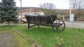
 Orientation tables on the Côte de Delme
 Visorando Member
 4.26 mi
 +230 ft
 -213 ft
 2h 10
2h 10
 Easy
Easy
 Departure from Juville (Moselle)
Walk on the limestone plateau of the Côte de Delme, between the north (Juville) and south (Puzieux) orientation tables, passing by the Juville quarry. You will discover many views of the Seille valley.
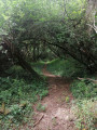
Xocourt circular loop via its splendid tunnel of greenery
 4.20 mi
+535 ft
-525 ft
2h 25
Easy
Departure from Xocourt (Moselle)
4.20 mi
+535 ft
-525 ft
2h 25
Easy
Departure from Xocourt (Moselle)
The main highlight of this route is the extraordinary tunnel of greenery, stretching for over a kilometre. This path has recently been restored thanks to the municipality of Xocourt. It was originally a narrow-gauge railway used to transport limes produced in the village of Tincry in the early 20th century. This tunnel offers some remarkable views. It is also worth noting that half of the route offers superb panoramic views towards Delme.
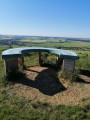
The Delme Hill
 6.52 mi
+653 ft
-659 ft
3h 35
6.52 mi
+653 ft
-659 ft
3h 35
 Moderate
Departure from Delme (Moselle)
Moderate
Departure from Delme (Moselle)
A route allowing you to discover one of the highest points in the Saulnois region, at the summit of the Côte de Delme, offering an unrivalled view of the Moselle hillsides.
Around Tincry via its "Roman Camp"
 5.64 mi
+443 ft
-443 ft
3h 00
Easy
Departure from Tincry (Moselle)
5.64 mi
+443 ft
-443 ft
3h 00
Easy
Departure from Tincry (Moselle)
This walk takes place on wide, often shaded paths. It plunges us into the heart of history as we traverse the hill crowned by a forest known as the ‘Camp des Romains’. This is a protohistoric oppidum. There are many traces of it to be seen. We owe much of the discovery of the cave to Régis, our fellow explorer. He is the great-nephew of Jacques Marsal, one of the three discoverers of the Lascaux cave. The apple doesn’t fall far from the tree...
From the old railway line to the longest tunnel in the Saulnois region
 11.47 mi
+1,109 ft
-1,086 ft
6h 15
Moderate
Departure from Delme (Moselle)
11.47 mi
+1,109 ft
-1,086 ft
6h 15
Moderate
Departure from Delme (Moselle)
From Delme onwards, this route follows the old railway line. After the stunning panoramic views from the hill, it also offers another point of interest. Indeed, Xocourt has restored an old path which forms a truly extraordinary ‘tunnel of greenery’ stretching for over a kilometre. This marvel is, in fact, the focus of a shorter walk that is also suggested. Ideally, you should complete the route in a day, with the option of having a picnic at the second orientation table or in Juville.
Walk along the Chemin des Étangs in Flocourt
 2.03 mi
+66 ft
-66 ft
1h 00
Easy
Departure from Flocourt (Moselle)
2.03 mi
+66 ft
-66 ft
1h 00
Easy
Departure from Flocourt (Moselle)
Short hike suitable for children to discover the Petit Étang and Grand Étang lakes. You can observe the flora and fauna... birds of prey, herons, muskrats, frogs, ducks, Egyptian geese, swans, cuckoos, deer... depending on the time of day and the season... there's something for everyone.
Jeandelaincourt – The Pond Route
 3.29 mi
+167 ft
-164 ft
1h 40
Easy
Departure from Jeandelaincourt (Meurthe-et-Moselle)
3.29 mi
+167 ft
-164 ft
1h 40
Easy
Departure from Jeandelaincourt (Meurthe-et-Moselle)
A short route that passes by the pleasant Jeandelaincourt pond.
Circular Rumont starting from Moivrons
11.77 mi
+971 ft
-971 ft
6h 15
 Difficult
Departure from Moivrons (Meurthe-et-Moselle)
Difficult
Departure from Moivrons (Meurthe-et-Moselle)
A pleasant and varied walk. Views over the Seille Valley, the Natagne Valley and the Mauchère Valley.
Route panoramique autour de Moivrons
 7.91 mi
+883 ft
-883 ft
4h 25
Moderate
Departure from Moivrons (Meurthe-et-Moselle)
7.91 mi
+883 ft
-883 ft
4h 25
Moderate
Departure from Moivrons (Meurthe-et-Moselle)
This route offers a variety of landscapes typical of the Grand Couronné coastline. Orchards and vineyards at the start of Moivrons, then discover the magnificent panorama of the Seille and Natagne valleys from the limestone lawns of Mont Saint-Jean or at the edge of the Bois de la Dame.
Around Mont Saint-Jean
 7.43 mi
+794 ft
-810 ft
4h 05
Moderate
Departure from Moivrons (Meurthe-et-Moselle)
7.43 mi
+794 ft
-810 ft
4h 05
Moderate
Departure from Moivrons (Meurthe-et-Moselle)
A very pleasant walk offering magnificent views stretching over 100 km in all directions, depending on weather conditions (before a spell of rain).
 Moivrons, Mauchère Greenway, return via Millery, Belleau and Sivry
 Association / Club / Walk leader18.76 mi
+1,056 ft
-1,033 ft
3 hrs
Moderate
Departure from Moivrons (Meurthe-et-Moselle)
Association / Club / Walk leader18.76 mi
+1,056 ft
-1,033 ft
3 hrs
Moderate
Departure from Moivrons (Meurthe-et-Moselle)
Setting off from Moivrons (54760) towards Leyr, join the Mauchère Greenway (cycle path), which links Montenoy to Custines whilst passing through pretty villages in the Meurthe-et-Moselle department.
North of Custines, you’ll cycle alongside the Moselle as far as the village of Millery, then head further north before turning east to return to Moivrons via the quiet D10 and the villages of Belleau (with an optional visit to Morey and its Romanesque church) and Sivry.
Four valleys starting from Moivrons
18.75 mi
+1,732 ft
-1,745 ft
7 hrs
 Very difficult
Departure from Moivrons (Meurthe-et-Moselle)
Very difficult
Departure from Moivrons (Meurthe-et-Moselle)
A circular route allowing you to discover the Seille, Natagne, Moselle and Mauchère valleys, starting from Moivrons. A varied and very pleasant route allowing you to hike on the plateaus with superb views. Halfway along the route, refreshments are available in Custines.
Between Seille and Mauchère, starting from Moivrons
6.17 mi
+597 ft
-623 ft
3h 20
Moderate
Departure from Moivrons (Meurthe-et-Moselle)
A lovely circular route offering a variety of scenery; valleys and plateaus are on the itinerary, with some beautiful views.
The panoramic view of Moivrons
 5.95 mi
+682 ft
-673 ft
3h 20
Easy
Departure from Moivrons (Meurthe-et-Moselle)
5.95 mi
+682 ft
-673 ft
3h 20
Easy
Departure from Moivrons (Meurthe-et-Moselle)
It's all in the title. The views along the route are breathtaking. When you reach the Sivry valley, you'll find yourself in a truly enchanting landscape. This hike is full of discoveries, including animals (llamas, mouflons, etc.) whose presence is unexpected at the site of the former microlight flying club. What's more, there is great variety, with part of the route in the forest and the other in open fields. Remember to bring a pair of binoculars, as they will come in handy.
Circular route from the Priory of Blanzey starting from Moivrons
 12.12 mi
+1,381 ft
-1,371 ft
6h 45
Difficult
Departure from Moivrons (Meurthe-et-Moselle)
12.12 mi
+1,381 ft
-1,371 ft
6h 45
Difficult
Departure from Moivrons (Meurthe-et-Moselle)
Panoramic view of the Seille and Mauchère valleys and beautiful views of the Amance coast and beyond. Route combining challenging climbs and peaceful paths on the plateau.
Bois Pétard Circular Loop
 5.62 mi
+561 ft
-558 ft
3h 05
Moderate
Departure from Fresnes-en-Saulnois (Moselle)
5.62 mi
+561 ft
-558 ft
3h 05
Moderate
Departure from Fresnes-en-Saulnois (Moselle)
This short walk has been designed to allow you to go for a stroll in the Château-Salins area even in very hot weather. Only 50 metres of the route are in the open, and you can park your car in the shade at the starting point. Please note that Coutures is a village associated with Château-Salins (it lies just beyond it). You will only find it on a sat-nav by entering: Coutures, Château-Salins.
Between Grémecey and Vic-sur-Seille
 17.68 mi
+804 ft
-817 ft
8h 50
Difficult
Departure from Grémecey (Moselle)
17.68 mi
+804 ft
-817 ft
8h 50
Difficult
Departure from Grémecey (Moselle)
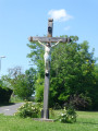
A loop between Grémecey and Vic-sur-Seille, starting on the GR®5, mainly in the woods, returning on minor roads.
You'll need a GPS, as the signposting is poor in places and there are many false trails. By false trails, we mean beautiful, wide paths where you can walk happily, forgetting to turn off onto small paths where the start is hard to see.
The start through the woods is pleasant and shady, after the visit to Vic-sur-Seille, which is well worth the effort. You have to get back by the shortest route, and the small roads make this possible. An attempt to return via the old railway line proved impossible.
Before entering the Forêt Domaniale de Grémecey, there are some very fine views.
Grémecey Circular, in honour of Paul Beugnette
 5.92 mi
+262 ft
-243 ft
2h 55
Easy
Departure from Grémecey (Moselle)
5.92 mi
+262 ft
-243 ft
2h 55
Easy
Departure from Grémecey (Moselle)
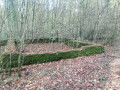
This route offers superb panoramic views and consists mainly of forest tracks. In the Saulnois region, the village of Grémecey is associated with the Gallo-Roman villa located in the communal forest. It was unearthed in 1960 and then reburied some thirty years later. This route pays tribute to Paul Beugnette, from Fresnes-en-Saulnois, who collected numerous artefacts. He set up a small museum which delighted many schoolchildren in the Saulnois region.
Sivry Circular Route
 7.78 mi
+830 ft
-833 ft
4h 20
Moderate
Departure from Sivry (Meurthe-et-Moselle)
7.78 mi
+830 ft
-833 ft
4h 20
Moderate
Departure from Sivry (Meurthe-et-Moselle)
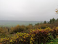
There are some stunning panoramic views along this route starting from Sivry. Don’t miss the animals at the site of a former airfield. The sections through the forest are particularly pleasant, with picturesque paths and a remarkable setting.
Let’s go and see the daffodils at Château-Salins
 3.06 mi
+200 ft
-200 ft
1h 35
Easy
Departure from Château-Salins (Moselle)
3.06 mi
+200 ft
-200 ft
1h 35
Easy
Departure from Château-Salins (Moselle)
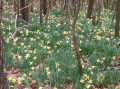
This walk has been designed to share with you a hidden gem close to Château-Salins. It takes you straight to an area teeming with daffodils (mid-March).
Reminder of the law: you may only pick one bunch of ten daffodils per person; picking flowers in bud is prohibited, as is picking leaves or digging up bulbs.
Discovering the Gallo-Roman villa at Grémecey
 6.96 mi
+545 ft
-512 ft
3h 40
Moderate
Departure from Château-Salins (Moselle)
6.96 mi
+545 ft
-512 ft
3h 40
Moderate
Departure from Château-Salins (Moselle)
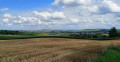
Back in the 1970s, like many schoolchildren from the Saulnois region, I visited the Gallo-Roman villa at Grémecey. It was subsequently buried and somewhat forgotten. For a long time, I believed that no remains of it existed. It has indeed become difficult to find, as it is surrounded by dense vegetation. This route takes you there, allowing you to see the remains of this building steeped in history. The route presents no significant difficulty.
The Chemin de la Reine in Château-Salins
 7.65 mi
+584 ft
-581 ft
4h 00
Moderate
Departure from Château-Salins (Moselle)
7.65 mi
+584 ft
-581 ft
4h 00
Moderate
Departure from Château-Salins (Moselle)
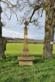
This walk around Château-Salins will offer you some superb panoramic views of the Saulnois region. Two-thirds of the route takes place in the forest. You’ll have the great honour of walking along the Chemin de la Reine, so named because it was trodden (after being restored) in 1725 by the new Queen of France, Marie Leszczynska. She was travelling with her entire entourage to join Louis XV. It’s worth noting that one section of this path is a particularly impressive tunnel of greenery.
Exploring Vic-sur-Seille from Château-Salins
 10.46 mi
+751 ft
-728 ft
5h 30
Moderate
Departure from Château-Salins (Moselle)
10.46 mi
+751 ft
-728 ft
5h 30
Moderate
Departure from Château-Salins (Moselle)
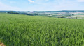
This walk will introduce you to one of the jewels of the Saulnois region: Vic-sur-Seille. The route offers a leisurely stroll through the village.
You’ll also be able to enjoy exceptional panoramic views, particularly from the Chemin du Haut de Phara.
The Majurin valley
 4.93 mi
+397 ft
-374 ft
2h 35
Easy
Departure from Château-Salins (Moselle)
4.93 mi
+397 ft
-374 ft
2h 35
Easy
Departure from Château-Salins (Moselle)
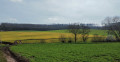
This route takes you to the Majurin valley from Château-Salins. The Majurin is a stream that flows through a plain surrounded by small woods. The valley is very close to Coutures and Château-Salins, yet you feel as though you are in the heart of the countryside, far from it all. The walk offers some beautiful panoramic views. It alternates pleasantly between sections deep in the forest and out in the open. As it presents no difficulties, this circular walk is ideal for a family outing.
Montenoy, Brattes, Faulx via Vassuchamp
 7.53 mi
+863 ft
-856 ft
4h 15
Moderate
Departure from Montenoy (Meurthe-et-Moselle)
7.53 mi
+863 ft
-856 ft
4h 15
Moderate
Departure from Montenoy (Meurthe-et-Moselle)
A circular walk starting from Montenoy with views of the Natagne and Mauchère valleys. The route alternates between countryside and forest landscapes.
Walk around the Bois de l’Hôpital from Peltre
10.16 mi
+266 ft
-269 ft
4h 55
Moderate
Departure from Peltre (Moselle)
This lovely route will allow you to explore the ‘green lung’ of the southern part of the Metz conurbation. Situated between Peltre and Pournoy-la-Grasse, the Bois de l’Hôpital is six kilometres long and three kilometres wide. It’s an ideal walk for a change of scenery whilst still being in the heart of the metropolitan area; in particular, you’ll be able to enjoy the tranquillity of the place as well as a wide variety of tree species. As a historic site, you’ll also find information boards along the route explaining the history of this former military zone.