


Refine your search for walks in Jully-lès-Buxy
Jully-lès-Buxy walks


 The Château du Ponneau
 Visorando Member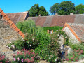
 6.73 mi
 +230 ft
 -217 ft
 3h 20
3h 20
 Moderate
 Departure from Jully-lès-Buxy (Saône-et-Loire)
Nestled against the Montagny vineyards and the Montagne de Saint-Vallerin, the village of Jully-les-Buxy enjoys a pleasant living environment.
The forest features prominently along a route that is almost entirely flat, allowing you to discover a small castle in an unlikely spot as you pass by.
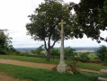
The Chemin des Frères in Montagny-lès-Buxy
 7.16 mi
+676 ft
-666 ft
3h 55
Moderate
Departure from Montagny-lès-Buxy (Saône-et-Loire)
7.16 mi
+676 ft
-666 ft
3h 55
Moderate
Departure from Montagny-lès-Buxy (Saône-et-Loire)
A hilly hike south of the Côte Chalonnaise, where calcareous grasslands have not entirely given way to vineyards. Although the forest is never far away, the walk offers unobstructed views for most of the route.
Circular route from Cruchaud to Montagny-lès-Buxy
3.96 mi
+466 ft
-476 ft
2h 15
 Easy
Departure from Montagny-lès-Buxy (Saône-et-Loire)
Easy
Departure from Montagny-lès-Buxy (Saône-et-Loire)
Best enjoyed from autumn through to spring; perhaps best avoided under the hot summer sun.
Several beautiful landscapes. Very little tarmac. There may be muddy patches in very wet weather. Best done in a circular direction to avoid muddy paths on the descent.
Saules - Rimont - Saules
 12.29 mi
+1,421 ft
-1,414 ft
6h 55
Moderate
Departure from Saules (Saône-et-Loire) (Saône-et-Loire)
12.29 mi
+1,421 ft
-1,414 ft
6h 55
Moderate
Departure from Saules (Saône-et-Loire) (Saône-et-Loire)
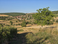
A pleasant hike of around 20 kilometres with no particular difficulties, this hike can be done in the opposite direction to that indicated.
The Crainseny Valley
 7.10 mi
+715 ft
-732 ft
3h 55
Moderate
Departure from Saules (Saône-et-Loire) (Saône-et-Loire)
7.10 mi
+715 ft
-732 ft
3h 55
Moderate
Departure from Saules (Saône-et-Loire) (Saône-et-Loire)
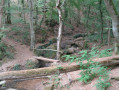
A peaceful and relatively shaded route between vineyards and forest to discover, in the heart of nature, the surprising Crainseny Viaduct that spans the entire valley.
The Gorges de la Mouille, near Culles-les-Roches, offer a charming passage without being too dizzying.
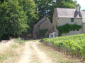
Les Hauts de Buxy
 7.45 mi
+909 ft
-906 ft
4h 15
Moderate
Departure from Bissey-sous-Cruchaud (Saône-et-Loire)
7.45 mi
+909 ft
-906 ft
4h 15
Moderate
Departure from Bissey-sous-Cruchaud (Saône-et-Loire)
An undulating route in the heart of a landscape typical of the Côte Chalonnaise. Enjoy discovering a few sheltered passages off the beaten track and treating yourself to a succession of pretty views, including a perspective of the old town of Buxy.
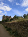
Château de Pontus or Pontus Castle
 7.62 mi
+915 ft
-886 ft
4h 20
Moderate
Departure from Fley (Saône-et-Loire)
7.62 mi
+915 ft
-886 ft
4h 20
Moderate
Departure from Fley (Saône-et-Loire)
A hill walk with no major challenges, in an unspoilt setting with villages overlooked by Mont Bouzu. Changing views all along the way, including a wide shot of Mont Saint-Vincent and a visit to the Château de Pontus-de-Thyard.
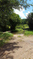
Between La Guye and Rimont
 4.53 mi
+719 ft
-702 ft
2h 45
Moderate
Departure from Cersot (Saône-et-Loire)
4.53 mi
+719 ft
-702 ft
2h 45
Moderate
Departure from Cersot (Saône-et-Loire)
A circular route offering stunning views in a rural setting amidst vineyards and hedgerows.
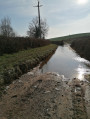
Between fields and streams around Sassangy
 8.92 mi
+1,165 ft
-1,152 ft
5h 05
Moderate
Departure from Sassangy (Saône-et-Loire)
8.92 mi
+1,165 ft
-1,152 ft
5h 05
Moderate
Departure from Sassangy (Saône-et-Loire)
A pleasant walk with a very varied landscape (meadows, streams, limestone plateaus, vineyards). You’ll follow the Guye river towards Cersot, with a short climb towards Montagny-lès-Buxy and a return via Mont Brogny after passing through the village of Bissey-sous-Cruchaud. Best done between September and May to avoid the intense heat, as there is very little shade. It’s possible to do it with a head torch in summer, which is very pleasant.
Lys Walk
 6.60 mi
+771 ft
-784 ft
3h 40
Moderate
Departure from Moroges (Saône-et-Loire)
6.60 mi
+771 ft
-784 ft
3h 40
Moderate
Departure from Moroges (Saône-et-Loire)
This undulating route around Mont Brogny is not difficult and offers unobstructed views throughout.
The hamlet of Le Lys, nestled beneath a small rocky outcrop, seems to be there just to surprise hikers at the edge of the woods.
Sources du Reuil (springs)
 4.71 mi
+397 ft
-407 ft
2h 30
Easy
Departure from Saint-Désert (Saône-et-Loire)
4.71 mi
+397 ft
-407 ft
2h 30
Easy
Departure from Saint-Désert (Saône-et-Loire)
A peaceful crossing of the Plateau de Saint-Désert in the vicinity of Mont Avril and Mont Brogny. In the distance, the perched hamlet of Cruchaud stands guard to the South, before the route offers an escape to the Plaine de Saône.
The Moulin de la Roche in Marcilly-lès-Buxy
 6.92 mi
+741 ft
-751 ft
3h 50
Moderate
Departure from Marcilly-lès-Buxy (Saône-et-Loire)
6.92 mi
+741 ft
-751 ft
3h 50
Moderate
Departure from Marcilly-lès-Buxy (Saône-et-Loire)
A peaceful walk through the remote forests and wooded countryside of Saône-et-Loire, where the villages along the way have managed to preserve their rural character.
From Maizeray to Saint-Martin-du-Tartre
 5.22 mi
+515 ft
-515 ft
2h 50
Easy
Departure from Saint-Martin-du-Tartre (Saône-et-Loire)
5.22 mi
+515 ft
-515 ft
2h 50
Easy
Departure from Saint-Martin-du-Tartre (Saône-et-Loire)
A short walk through meadows and vineyards, taking in the village of Saint-Martin-du-Tartre and its beautiful views.
A circular walk starting from La-Chapelle-de-Bragny
 Association / Club / Walk leader
 6.29 mi
+30 ft
-30 ft
2h 55
Easy
Departure from La Chapelle-de-Bragny (Saône-et-Loire)
6.29 mi
+30 ft
-30 ft
2h 55
Easy
Departure from La Chapelle-de-Bragny (Saône-et-Loire)
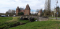
This La Chapelle-Hauterive-Messey-La Chapelle circular route follows the Grosne valley along the right bank from La Chapelle to Hauterive, then the left bank from Hauterive to Messey, before returning to La Chapelle via the mill.
Saint-Gengoux-le-National and Crainseny viaduct
 8.94 mi
+1,430 ft
-1,404 ft
5h 20
Easy
Departure from Saint-Gengoux-le-National (Saône-et-Loire)
8.94 mi
+1,430 ft
-1,404 ft
5h 20
Easy
Departure from Saint-Gengoux-le-National (Saône-et-Loire)
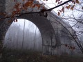
This walk starts in the medieval town of Saint-Gengoux-le-National, continues to Culle-les-Roches, a village below a cliff with a cave, and returns via a lost viaduct in the forest.
The box trees
 6.66 mi
+702 ft
-709 ft
3h 40
Moderate
Departure from Saint-Gengoux-le-National (Saône-et-Loire)
6.66 mi
+702 ft
-709 ft
3h 40
Moderate
Departure from Saint-Gengoux-le-National (Saône-et-Loire)
From the medieval town of Saint-Gengoux-le-National, a route via the Crainseny Viaduct and Culles-les-Roches.
Simone Boudriot Trail in Saint-Gengoux-le-National
 5.62 mi
+659 ft
-679 ft
3h 10
Easy
Departure from Saint-Gengoux-le-National (Saône-et-Loire)
5.62 mi
+659 ft
-679 ft
3h 10
Easy
Departure from Saint-Gengoux-le-National (Saône-et-Loire)
Route proposed and maintained by the Balades et Patrimoine association. It offers a walk through the woods surrounding the villages of Saint-Gengoux and Saint-Martin-de-Croix.
The washhouses of Jambles and Mont Avril
 6.13 mi
+974 ft
-978 ft
3h 40
Easy
Departure from Jambles (Saône-et-Loire)
6.13 mi
+974 ft
-978 ft
3h 40
Easy
Departure from Jambles (Saône-et-Loire)
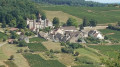
Continuing to discover the Saône-et-Loire region through this wine-growing village and its many small wash-houses. The trail ends at Mont Avril, with its panoramic view over the whole valley. I advise you to do this trail in autumn to get the most out of it.
Michelle Commerson Trail
5.33 mi
+141 ft
-148 ft
2h 35
Easy
Departure from Saint-Gengoux-le-National (Saône-et-Loire)
Route proposed and maintained by the “Balade et Patrimoine” association. It offers a walk through the Grosne Valley, starting from Saint-Gengoux-le-National.
Givry - Saint-Denis-de-Vaux circular through the woods
 6.05 mi
+1,007 ft
-994 ft
3h 40
Moderate
Departure from Givry (Saône-et-Loire) (Saône-et-Loire)
6.05 mi
+1,007 ft
-994 ft
3h 40
Moderate
Departure from Givry (Saône-et-Loire) (Saône-et-Loire)
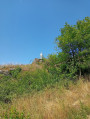
A beautiful circular through the woods, well shaded in summer. Pass near Saint-Denis de Vaux, at the top of the cliffs. Beautiful views over the Chalon-sur-Saône plain, then over the Vaux valley. Return near the stubble fields in the woods. Possible extension to Russilly.
Discovering Givry and the surrounding area
 10.14 mi
+1,417 ft
-1,394 ft
5h 55
Moderate
Departure from Givry (Saône-et-Loire) (Saône-et-Loire)
10.14 mi
+1,417 ft
-1,394 ft
5h 55
Moderate
Departure from Givry (Saône-et-Loire) (Saône-et-Loire)
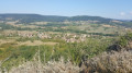
A stroll along old stones, vineyards and footpaths. The journey is much like a pilgrimage in this part of the Saône-et-Loire region, with many religious ornaments.
La Chaume Sacrée in Givry
 Tourist office
 4.09 mi
+748 ft
-748 ft
2h 30
Easy
Departure from Givry (Saône-et-Loire) (Saône-et-Loire)
4.09 mi
+748 ft
-748 ft
2h 30
Easy
Departure from Givry (Saône-et-Loire) (Saône-et-Loire)
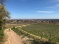
This route will take you to the top of the Givry hill, the forest planted with Austrian pines, cedars and deciduous trees, and the limestone grassland classified as a Natura 2000 site. Along the way, you will discover the charming hamlet of Russilly, nestled in a valley overlooking the vineyards. This walk offers multiple views of the Côte Chalonnaise and the Saône plain.
La Ferme des Couleurs in Châtel-Moron
6.91 mi
+846 ft
-850 ft
3h 55
Moderate
Departure from Châtel-Moron (Saône-et-Loire)
Discover a small area of Burgundy nestled between the Vallée des Vaux and the Vallée de la Dheune.
A succession of narrow paths connect these remote and charming hamlets, which seem to be "supplied by crows".
From Carapone to Rains on stone-lined paths
 6.22 mi
+610 ft
-627 ft
3h 25
Moderate
Departure from Saint-Clément-sur-Guye (Saône-et-Loire)
6.22 mi
+610 ft
-627 ft
3h 25
Moderate
Departure from Saint-Clément-sur-Guye (Saône-et-Loire)
This 10km loop hike starts from Saint-Clément-sur-Guye, with the Carapone at its highest point (440m), and takes in the villages of Saint-Clément-sur-Guye (Romanesque church listed as a historic monument in 1927, a tower to the east of the church), Rains, commune of Joncy (pretty stone houses), Le Petit Ballay, its square tower, its 'Murgers' (piles of stones removed from the vines), before Corcelles (hamlet of Saint-Clément).