Michelle Commerson Trail

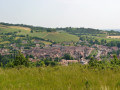
Route proposed and maintained by the “Balade et Patrimoine” association. It offers a walk through the Grosne Valley, starting from Saint-Gengoux-le-National.

Details

18938475
Creation:
Last update:
Last review:
  • Walking
    Activity: Walking
  • ↔
    Distance: 5.33 mi
  • ◔
    Average duration: 2h 35 
  • ▲
    Difficulty: Easy

  • ⚐
    Back to start: Yes
  • ↗
    Ascent: + 141 ft
  • ↘
    Descent: - 148 ft

  • ▲
    Highest point: 810 ft
  • ▼
    Lowest point: 640 ft

Description of the walk

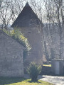
The starting point is opposite the cooperative winery: parking is available. In the middle of a meadow, you can see the Tour des Archers, which is thought to date from the 12th century.

(S/E) Opposite the co-operative winery, turn right onto the path known as the ‘Chemin de la Lagune’. You’ll come out onto the road at the Buet housing estate and follow it to the right.

(1) At the Stop sign, cross with care to take the road on the left, join the Route de Cluny and follow it to the right with care until you reach the bridge over the old railway line, now a cycle path.

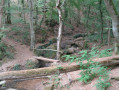
(2) Turn right onto the shaded path known as the ‘Chemin des Voleurs’. Once at the end, turn right, then left twice in succession to join the ‘Chemin de Messeau’. You’ll rejoin the ‘Voie Verte’.

(3) Follow this on the right until you reach the former gatekeeper’s house at Savigny-sur-Grosne.

(4) Leave the Voie Verte, take the road on the left for about 50 metres, then turn right onto the path and follow it for about 1 km.

(5) Turn right at a 90° angle towards the village of Savigny, cross the Voie Verte and head straight on.

(6) In the centre of Savigny (town hall), turn left, then right to follow the road leading to the Grand Munot. Continue for 500 m, then take the path on the right. Pass under the power lines, ignore a path on the right and head towards a junction where the route meets theGR®76: just before this, on your left, you’ll find a shelter fitted out for walkers.

(7) Carry on to the right to reach the D84; follow it to the right for about 150 metres, then turn onto the path on the left.

(8) Pass by the Moulin de Foulot, then turn left onto the Route de Curtil towards Saint-Gengoux-le-National.

(1) Stay on the road, going straight ahead (in the opposite direction to the outward journey), then turn left onto Chemin de la Lagune to return to the starting car park (S/E).

Waypoints

  1. S/E : mi 0 - alt. 732 ft - Car park opposite the co-operative wine cellar
  2. 1 : mi 0.39 - alt. 715 ft - Junction of the circular loop
  3. 2 : mi 0.56 - alt. 735 ft - Railway bridge
  4. 3 : mi 1.43 - alt. 692 ft - Greenway
  5. 4 : mi 1.89 - alt. 656 ft - Former level crossing
  6. 5 : mi 2.51 - alt. 643 ft - Crossroads, on the right. Near the - Grosne (rivière)
  7. 6 : mi 2.88 - alt. 656 ft - Savigny-sur-Grosne
  8. 7 : mi 3.98 - alt. 771 ft - Junction GR°°®°°76
  9. 8 : mi 4.73 - alt. 696 ft - Foulot Mill
  10. S/E : mi 5.33 - alt. 732 ft - Car park opposite the co-operative wine cellar

Notes

Before (7), you will find a cadole fitted out by the association to serve as a shelter for walkers looking for somewhere to sleep or for day-trippers wishing to eat out of the rain.

Always be cautious and plan ahead when you're outdoors. Visorando and the author of this route cannot be held responsible for any accidents occurring on this route.

The GR® and PR® markings are the intellectual property of the Fédération Française de Randonnée Pédestre.

Reviews and comments

4.7 / 5
Based on 2 reviews

Reliability of the description
5 / 5
Ease of following the route
5 / 5
Route interest
4 / 5
Team Ten
Team Ten

Overall rating : 4.7 / 5

Date of your route : May 13, 2024
Reliability of the description : ★★★★★ Very good
Ease of following the route : ★★★★★ Very good
Route interest : ★★★★☆ Good
Very busy route : No

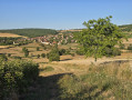
A lovely spring walk, with three young children (aged 6, 8 and 9), and a dog that was off the lead for most of the route as there were very, very few roads. Beautiful scenery, no significant elevation changes, but not much shade.

Machine-translated

Lechad
Lechad

Overall rating : 4.7 / 5

Date of your route : Jan 28, 2024
Reliability of the description : ★★★★★ Very good
Ease of following the route : ★★★★★ Very good
Route interest : ★★★★☆ Good
Very busy route : No

A lovely walk. Very well signposted. Ideal for getting back into walking after the festive season: not very long (8.5 km), no significant elevation gain, not much tarmac, unobstructed views (so you’re visible to any hunters)... But best avoided on a hot summer’s day (not much shade).
In short: well done and thank you.

Machine-translated

Other walks in the area

For more walks, use our search engine .

The GPS track and description are the property of this route's author. Please do not copy them without permission.