Circular route from Cruchaud to Montagny-lès-Buxy

Best enjoyed from autumn through to spring; perhaps best avoided under the hot summer sun.
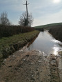
Several beautiful landscapes. Very little tarmac. There may be muddy patches in very wet weather. Best done in a circular direction to avoid muddy paths on the descent.

Details

1538329
Creation:
Last update:
Last review:
  • Walking
    Activity: Walking
  • ↔
    Distance: 3.96 mi
  • ◔
    Average duration: 2h 15 
  • ▲
    Difficulty: Easy

  • ⚐
    Back to start: Yes
  • ↗
    Ascent: + 466 ft
  • ↘
    Descent: - 476 ft

  • ▲
    Highest point: 1,368 ft
  • ▼
    Lowest point: 1,050 ft

Description of the walk

Leave your car in the car park near the cemetery in Montagny.

(S/E) With your back to the cemetery, head towards the village centre and go straight on. At the end, turn right twice to climb up towards the Route de Charolles (D983). When you reach this road, cross it at the pedestrian crossing on the right, turn left and then, after the house, turn right onto a path that climbs and soon joins theGR®76. Continue right along this GR®.

(1) Cross the D977 with care, then continue along the path opposite. Head straight on at the junction at the edge of a small wood and reach a fork near the Cruchaud quarry, which you can make out on your right.

(2) Leave theGR®76on your left and turn right. The village of Cruchaud is clearly visible not far away.

(3) Ignore thefirstdirttrackwhich climbs steeply to the right; continue for 50 m (signpost) until you reach another track branching off to the right. Leave Cruchaud on your left and take this track (sometimes muddy), which descends steadily and comes into view of a large house above the hamlet of Davenay.

(4) Go round this house, turning left then right at a right angle. Ignore the small road leading down towards Davenay and take the path straight ahead to reach another small road.

(5) Turn left onto it, cross another road a few metres further on, and look for a narrow but pleasant path opposite, running perpendicular to the road. Take this path, which leads to a track that is more or less passable by car; take this track on the left.

(6) At the junction by the vineyards, turn right and head down through one of the gaps between the vines to reach the D977 road further down. Follow this road to the right along the parallel path, then cross over and follow the path to the right which runs alongside the vineyards and the road.

(7) Turn left to head down towards Montagny, crossing the vineyards via the paths. When you reach a large house, take the sharp left-hand bend to go past it, then rejoin the village road at the cemetery. Continue straight on to reach the car park (S/E).

Waypoints

  1. S/E : mi 0 - alt. 1,122 ft - Montagny Cemetery
  2. 1 : mi 0.93 - alt. 1,257 ft - Crossing the D977
  3. 2 : mi 1.5 - alt. 1,312 ft - Leaving the °°GR®°°
  4. 3 : mi 1.73 - alt. 1,306 ft - Cruchaud Quarry
  5. 4 : mi 2.51 - alt. 1,122 ft - Davenay
  6. 5 : mi 2.78 - alt. 1,270 ft - Route
  7. 6 : mi 3.15 - alt. 1,240 ft - Turn right
  8. 7 : mi 3.67 - alt. 1,086 ft - Path on the left
  9. S/E : mi 3.96 - alt. 1,122 ft - Montagny Cemetery

Worth a visit

Montagny and its white wines, which are among the finest in France (and indeed the world!).

Always be cautious and plan ahead when you're outdoors. Visorando and the author of this route cannot be held responsible for any accidents occurring on this route.

The GR® and PR® markings are the intellectual property of the Fédération Française de Randonnée Pédestre.

Reviews and comments

4.5 / 5
Based on 5 reviews

Reliability of the description
4.4 / 5
Ease of following the route
4.4 / 5
Route interest
4.6 / 5
Nedar71
Nedar71

Overall rating : 5 / 5

Date of your route : Jun 09, 2025
Reliability of the description : ★★★★★ Very good
Ease of following the route : ★★★★★ Very good
Route interest : ★★★★★ Very good
Very busy route : No


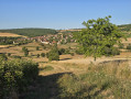
A very pleasant route, enjoyed in beautiful dry weather, ideal for taking in the wide panoramic views and the route with very little tarmac.
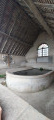
We took the liberty of extending the tour a little by passing through Cruchaud and visiting the wash house at the Fontaine du Cloux. Return to marker 5 via the cross near the Champ d'Orge.

Machine-translated

david71380
david71380

Overall rating : 4.3 / 5

Date of your route : Feb 17, 2025
Reliability of the description : ★★★★☆ Good
Ease of following the route : ★★★★★ Very good
Route interest : ★★★★☆ Good
Very busy route : Yes

Lovely view, a very pleasant walk.

Machine-translated

hd71
hd71

👍

Machine-translated

Lechad
Lechad

It’s true, the last bit of the route isn’t very pleasant.
Personally, I do the circular motion in the opposite direction.
Right from the start, instead of heading towards point 7 as indicated, after the last houses in Montagny, I turn left for a few dozen metres, then right onto the path leading to the road. Cross the two roads (with care), then head up the hill directly opposite. The path is pleasant. It takes us to the statue not far from marker 6.
Then turn left and you’ll soon come to a good path heading off to the left.
We head into the woods, taking a path between two large stones.
The rest is easy: it’s the reverse route to the one on the map.
I have mapped this reverse route on Visorando, but haven’t published it yet.
Happy hiking

Machine-translated

hd71
hd71
• Edited:

Overall rating : 4 / 5

Date of your route : Dec 05, 2024
Reliability of the description : ★★★★☆ Good
Ease of following the route : ★★★★☆ Good
Route interest : ★★★★☆ Good
Very busy route : Yes

It’s a lovely walk, apart from the end where you have to follow the road back to the car park.
And just so you know, it took us less than two hours.

Machine-translated

Nbornel
Nbornel

Overall rating : 4.3 / 5

Date of your route : Aug 05, 2023
Reliability of the description : ★★★★☆ Good
Ease of following the route : ★★★★☆ Good
Route interest : ★★★★★ Very good
Very busy route : No

We absolutely loved this hike with its stunning scenery. It took us barely two hours to complete this well-signposted route, and we didn’t meet a soul. A peaceful walk with some truly beautiful views

Machine-translated

Marijea
Marijea

Overall rating : 4.7 / 5

Date of your route : Mar 04, 2022
Reliability of the description : ★★★★★ Very good
Ease of following the route : ★★★★☆ Good
Route interest : ★★★★★ Very good
Very busy route : No

A short, easy walk with beautiful scenery, ideal for getting back into walking after the winter
I recommend it

Machine-translated

Other walks in the area

For more walks, use our search engine .

The GPS track and description are the property of this route's author. Please do not copy them without permission.