Country:

 City:
City:


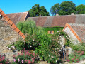
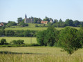
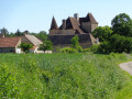
(S/E) Opposite the Town Hall, turn left towards the east and immediately keep right at the Fork in the road to stay on Rue du Centre. Continue straight on at the next two junctions and keep left to turn onto Rue du Grand Puits between two high stone walls.
(1) Soon after, turn left at the cross and then immediately right onto a road running perpendicular to it. Shortly afterwards, turn right onto Rue de l’Abreuvoir; ignore the lane branching off to the right straight away and continue straight on until you reach the Voie Verte.
(2) Turn left onto a path running parallel to the Voie Verte and continue until you reach a junction. Take the road on the right, carry on straight ahead at the next junction and you’ll soon come to a dirt track on the right.
(3) Turn right onto this stony track and carry on straight ahead for about 2 km, passing through farmland and wooded areas, until you reach the forest at the Pont de la Corne.
(4) Cross the stream and follow the path, which immediately turns right into the Bois Communal du Petit Bragny; a little further on, you’ll reach a four-way junction. Turn right onto the road corresponding to theGR®76Aand soon ignore a path on the left. Walk past the pond and continue straight on until you come to a road running at right angles. Turn left and you’ll soon reach the Château du Ponneau.
(5) Continue along the road which bends to the right between the château and the chapel. Soon leave the Route de Messey, which bends to the left, and carry on straight ahead to re-enter the forest. Follow the path as it heads west, crossing several overgrown lanes, until you reach a Fork in the road.
(6) Turn sharply left onto a path that gradually heads south. Carry on straight ahead at the next two junctions and, a little further on, reach a four-way crossroads.
(7) Turn right towards La Guiche (yellow sign), pass a path branching off to the left and reach the edge of the woods. The path continues along the edge of the woods before skirting a pond and reaching a four-way junction near the hamlet of La Petite Praye (Prée on IGN maps).
Carry on straight ahead, even though the path seems rather unclear at first, and you will soon cross the Voie Verte again. A little further on, ignore a path on the left and you will reach the lovely estate of La Grande Praye.
(8) Ignore the lane branching off to the right and carry on straight ahead towards the north-east until you reach, further on, a four-way junction near the vineyards.
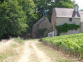
(9) Turn right onto the road, then quickly keep left at the Fork in the road to join a path running alongside the vineyards. Continue along this path without ever entering the vineyard and, a little further up, you’ll reach a four-way junction right next to the large Maison Vigneronne, which you can see from below.
(10) Carry on along the road opposite and, a short distance further on, cross another road to join the Chemin du Grand Perche. Keep right at the next two junctions and follow the Rue du Centre to quickly reach the Town Hall car park (S/E) .




 Visorando Member

 Easy
Easy