


Refine your search for walks in Girancourt
Girancourt walks
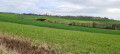
 Girancourt Harol through orchards and past wind turbines
 Visorando Member
 10.83 mi
 +581 ft
 -554 ft
 5h 30
 Moderate
 Departure from Dommartin-aux-Bois (Vosges)
A route along accessible paths offering beautiful views and the option to shorten the route if needed!
The route passes at the foot of a wind turbine and ends on a disused railway line.
The route is marked with various signposts from the Club Vosgien, but as these have only recently been put up, they do not appear on the IGN map.
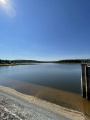
Tour of the Bouzey Reservoir
 Tourist office
 5.18 mi
+115 ft
-105 ft
2h 30
 Easy
Departure from Sanchey (Vosges)
The Bouzey Reservoir, a natural gem situated a stone’s throw from the town of Épinal, is a multifaceted site, perfect for relaxation and ideal for clearing your head. Its lush green surroundings offer a complete change of scenery and it is the perfect place to enjoy a range of sporting and leisure activities. Immerse yourself in idyllic landscapes where you can get active, go for a swim or simply laze on the beach!
Étang de la Comtesse
 7.34 mi
+725 ft
-699 ft
4h 00
Moderate
Departure from Sanchey (Vosges)
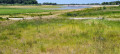
This walk will take you through the Ban d'Uxegney National Forest, starting with the Étang de la Comtesse and its peat bog, where you can discover the little "firefly nymph", frogs, water lilies, marsh marigolds, yellow bladderwort and floating bulrush. Not to mention the sundew, which is an insectivorous plant.
Throughout this walk, you will also discover the Roches d'Olima, its powder magazine and the supply canal for the Bouzey reservoir.
The Source de l’Avière in Renauvoid
3.56 mi
+299 ft
-315 ft
1h 55
Easy
Departure from Renauvoid (Vosges)
A hilly rural and woodland route within the Renauvoid municipal area, passing by fountains, springs and rivers.
Western route from the Épinal Stronghold
 12.80 mi
+318 ft
-607 ft
6h 10
Moderate
Departure from Uzemain (Vosges)
The suggested walk is a circular route and will take you around the forts of the Épinal Stronghold, built by General Séré de Rivières.
This stage starts at Fort du Roulon, situated on the road linking Épinal to Uzemain, and ends at Fort de la Grande Haie in Golbey.
Central area of the Epinal fortified town
 11.04 mi
+879 ft
-899 ft
5h 50
Moderate
Departure from Renauvoid (Vosges)
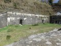
The final section of the Epinal Fortress, passing by the radio station, the arsenal, the Chantraine powder magazine, the barracks, the military hospital, the air station, the Décauville railway line and the powder magazines in the Olima valley.
Around Renauvoid
 7.28 mi
+699 ft
-699 ft
3h 55
Moderate
Departure from Renauvoid (Vosges)
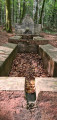
An easy walk combining nature and history, near Épinal, mostly through woodland, on a route signposted by the Club Vosgien. During this walk, you will discover the source of the Avière, then the memorial stone erected in memory of the airmen shot down in July 1944, and further on, the Fontaine de la Couleuvre, built by the military to water their horses.
Méloménil – Relanges
 23.56 mi
+1,460 ft
-1,424 ft
12 hrs
 Very difficult
Departure from Uzemain (Vosges)
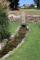
The trail continues through the forests of the Vôge and follows the Saône’s original course from its source.
Circular route around Domèvre-sur-Avière
 4.87 mi
+302 ft
-302 ft
2h 30
Easy
Departure from Domèvre-sur-Avière (Vosges)
An easy walk following the Club Vosgien’s ‘Green Ring’ signposts. The route takes you through deciduous woodland (oak, beech, birch), fields and meadows.
From Épinal to Lac de Bouzey
 15.89 mi
+1,952 ft
-1,936 ft
9h 00
 Difficult
Departure from Épinal (Vosges)
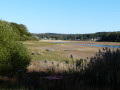
A good day's hike west of Épinal to Lac de Bouzey, without any difficulties, with plenty of picnic spots. Much of the route is marked by the Club Vosgien.
The Croix de Virine circular walk starting from Lamerey
 10.94 mi
+958 ft
-958 ft
5h 50
Moderate
Departure from Madonne-et-Lamerey (Vosges)
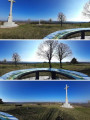
The walk is signposted along almost its entire route, passing by the Croix de Virine and offering a 360° panoramic view.
Route of the Three Soldiers Fountains
 4.76 mi
+627 ft
-623 ft
2h 45
Easy
Departure from Chantraine (Vosges)
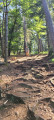
Legend attributes the name of the fountain to an event during the war in the time of Charles the Bold. Lorraine partisans, loyal to Duke René, harassed the Burgundians besieging Epinal and managed to lure a detachment of Burgundians into an ambush not far from the fountain. They killed many of the soldiers in the detachment and left the bodies of three of them there.
West of Chantraine between the forest and the lake
 9.59 mi
+682 ft
-689 ft
5h 00
Moderate
Departure from Chantraine (Vosges)
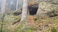
A hike through the beautiful Vosges forest to Lac de Bouzey with some historical remains.
Walk from La Passée to the Roches d'Olima
 3.39 mi
+279 ft
-292 ft
1h 50
Easy
Departure from Chantraine (Vosges)
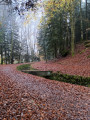
This walk starts from the Passée car park in Chantraine, joins and follows the Bouzey reservoir supply canal and passes at the foot of the Roches d'Olima. The route is mainly under the cover of trees.
Saint-Laurent, Étang du Bult, Ferme du Humbertois and Roches d’Olima
 10.93 mi
+1,125 ft
-1,138 ft
6h 00
Moderate
Departure from Chantraine (Vosges)
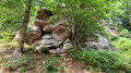
A signposted walk through the forest between Chantraine and Saint-Laurent offering a quick view of Épinal from the Olympe. The walk follows the Bouzey Lake water supply canal twice, passing by the Étang du Bult and the Étang du Riéfaing, as well as the Roches d’Olima after following a small stream.
Route de Circourt
 4.49 mi
+636 ft
-636 ft
2h 35
Easy
Departure from Circourt (Vosges)
A pleasant little walk through woods, fields and paths, with some gentle hills. Starting from Virine, you’ll head down to Circourt, walk around the village and climb back up through the woods to return to Virine, passing a 360° viewpoint! Ideal in summer with plenty of shaded areas, though there are a few fairly steep slopes.
Sources of the Saône and Madon rivers, Saint-Martin cave
 9.53 mi
+774 ft
-751 ft
5h 05
Moderate
Departure from Escles (Vosges)
A small, discreet corner of the Vosges, but one full of beautiful discoveries. Among others, the sources of the Saône and Madon rivers. We recommend that you read the description beforehand to identify the specific points of interest on the route in advance.