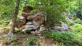
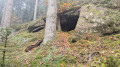
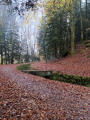
The Source de l’Avière in Renauvoid

A hilly rural and woodland route within the Renauvoid municipal area, passing by fountains, springs and rivers.

Details

35296842
Creation:
Last update:
Last review:
  • Walking
    Activity: Walking
  • ↔
    Distance: 3.56 mi
  • ◔
    Average duration: 1h 55 
  • ▲
    Difficulty: Easy

  • ⚐
    Back to start: Yes
  • ↗
    Ascent: + 299 ft
  • ↘
    Descent: - 315 ft

  • ▲
    Highest point: 1,549 ft
  • ▼
    Lowest point: 1,322 ft
  • ⚐ Country: France
  • ⚐ City: Renauvoid (88390)
  • ⚑
    Start/End: N 48.131675° / E 6.377172°
  • ❏
    IGN map(s): Ref. 3518OT
  • Hour-by-hour weather

Description of the walk

From Épinal, take the D51 towards La Vôge-les-Bains (Bains-les-Bains). Continue to the Avière Forest. Park at the forest access road on the departmental road (see GPS coordinates in ‘Practical information’).

Red Ring markings along the entire route

(S/E) From the starting point, head towards the D51 and cross it to reach the path on the opposite side.
Follow the Red Ring and Red Cross markings and, at the first junction at the forest entrance, carry straight on until you reach the second junction.

(1) Turn left and, some 200 metres further on, you’ll pass close to the Fontaine de la Couleuvre. Continue to the next junction.

(2) Turn left, then right to leave the forest, passing close to a small house.

(3) Turn sharply left to join the D51; cross the road and head to the left of a shed, following the signposted path. This path, which runs alongside fields and woodland, takes you – keeping to your left at all times – to a small tarmac road at a place called Censes des Lois. Leave this hamlet.

(4) Head up the road to the left to reach the Avière Forest House.

(5) Opposite the house, take the signposted path (Red Ring and Red Saltire) and pass a signposted path (Red Saltire) on your right. Further on, you’ll come out onto a stony track.

(6) Follow it to the left until you reach the crossroads.

(7) Turn right onto the path leading to the Source de l’Avière, nestled at the foot of a cirque-shaped valley wooded with a majestic beech forest. Take a few moments to enjoy this magnificent setting, as you’ll then need to climb up to the left, facing the spring, along the winding, signposted path.

Follow the path, passing a track on your right halfway up the slope and, further on, another track on your left. Off the main route, the more adventurous can take a round trip (marked with a Red Triangle) to the memorial stone commemorating the crash of an Allied aircraft during the 1944 bombings. You’ll emerge at the top onto a forest road. Turn left and head back to the starting point (S/E).


Waypoints

  1. S/E : mi 0 - alt. 1,463 ft - Car park
  2. 1 : mi 0.74 - alt. 1,414 ft - Path to the Fontaine de la Couleuvre
  3. 2 : mi 1.2 - alt. 1,542 ft - T-junction
  4. 3 : mi 1.6 - alt. 1,522 ft - Little house
  5. 4 : mi 2.38 - alt. 1,388 ft - Route
  6. 5 : mi 2.58 - alt. 1,444 ft - Avière Forest House
  7. 6 : mi 2.87 - alt. 1,332 ft - Junction – Forest track
  8. 7 : mi 3.05 - alt. 1,378 ft - Towards the source of the - Avière (rivière)
  9. S/E : mi 3.56 - alt. 1,463 ft - Car park

Notes

Coordinates for the start and finish points: 48.131772, 6.377103

Thank you to the Club Vosgien for organising this walk and for the work carried out by its teams throughout the year to mark out and maintain these paths.

Worth a visit

Fontaine de la Couleuvre.

Source de l’Avière.

Commemorative stele marking the crash of an Allied aircraft during the 1944 bombings.

Reviews and comments

4.3 / 5
Based on 3 reviews

Reliability of the description
4.5 / 5
Ease of following the route
4.5 / 5
Route interest
4 / 5
randonneur 70
randonneur 70

Overall rating : 4 / 5

Date of your route : Aug 04, 2025
Reliability of the description : ★★★★☆ Good
Ease of following the route : ★★★★☆ Good
Route interest : ★★★★☆ Good
Very busy route : Yes

a pleasant hike to do with the family; we did it with our 9- and 6-year-old daughters without any problems.
beautiful location, very little road traffic.
i recommend it.

Machine-translated

Pat photos
Pat photos

Overall rating : 4 / 5

Date of your route : May 02, 2024
Reliability of the description : Not used / Not applicable
Ease of following the route : Not used / Not applicable
Route interest : ★★★★☆ Good
Very busy route : Yes

Hello,
I’ve done this route twice because I didn’t see everything the first time round, but I didn’t use the app as my smartphone wasn’t powerful enough.

Machine-translated

mondemeilleur88
mondemeilleur88

Overall rating : 4.7 / 5

Date of your route : Jan 01, 2024
Reliability of the description : ★★★★★ Very good
Ease of following the route : ★★★★★ Very good
Route interest : ★★★★☆ Good
Very busy route : No

A lovely walk for the whole family – easy, with a few points of interest

Machine-translated

Other walks in the area

For more walks, use our search engine .

The GPS track and description are the property of this route's author. Please do not copy them without permission.