Girancourt Harol through orchards and past wind turbines

A route along accessible paths offering beautiful views and the option to shorten the route if needed!
The route passes at the foot of a wind turbine and ends on a disused railway line.
The route is marked with various signposts from the Club Vosgien, but as these have only recently been put up, they do not appear on the IGN map.

Details

n°19702173
Creation:
Last update:
Last review:
  • Walking
    Activity: Walking
  • ↔
    Distance: 10.83 mi
  • ◔
    Average duration: 5h 30 
  • ▲
    Difficulty: Moderate

  • ⚐
    Back to start: Yes
  • ↗
    Ascent: + 581 ft
  • ↘
    Descent: - 554 ft

  • ▲
    Highest point: 1,352 ft
  • ▼
    Lowest point: 1,073 ft

Photos

Description of the walk

The route starts at the old Girancourt railway station, where there is ample parking.
The proximity to the Canal de l’Est means you can set off on other walks from this starting point, particularly towards Lac de Bouzey!

(S/E) Take Rue des Épinettes, leaving the old station and the departmental road behind you. Continue along the old railway line until the first junction.

(1) Turn right to follow the Blue Rings (Sentier de la Gitte) towards the village of Adoncourt and join a road.

(2) Turn right to follow the Blue Rings, then carry on straight ahead, passing a road on your right.

(3) Leave the Blue Rings markings and follow the Yellow Discs along Rue Chemin de Ville. Leave Adoncourt heading towards the wind turbines.

(4) Continue along the path as it extends, leaving the Yellow Discs behind and heading towards the wind turbines by following the Red Triangles.

(5) At the junction at elevation 359, carry on straight ahead to pass at the foot of the wind turbines (shortcut available: see ‘Practical Information’).

(6) Turn left after passing the base of the first wind turbine and join a road.

(7) Follow it to the right and continue downhill to the hamlet of La Rue.

(8) Carry on straight ahead along the same road until you reach a junction with a track.

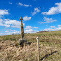
(9) Take the hairpin bend to the left just after the wayside cross, follow the track passing above an orchard and join a road

(10) Turn right onto this road, continue uphill, skirting around Haut du Niaux, and arrive at a road.

(11) Turn right and begin the descent towards the village of Harol.

(12) At the junction before the cemetery, leave the Red Triangle markings and continue down into the village, following the Yellow Circles. Join the D4 and follow it for about a hundred metres.

(13) A little shortcut known to the villagers: after the house with the low wall on the left, take the small gravel path between the houses, then rejoin the tarmac road on the other side and turn left towards the farm, following the Yellow Circles again.
If you’d rather not take the shortcut, follow the Yellow Circles.

(14) Cross the road and take the path opposite, slightly to the left (old railway line), then you’ll reach a road leading to Dommartin-aux-Bois.

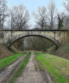
(15) Carry on straight ahead along the old railway line, following the Yellow Circles towards the Pont de Blumont.

(16) Carry on straight ahead along the old railway line until you reach the junction from the outward journey.

(1) Take the route back the way you came to reach the car park at the old Girancourt station (S/E).


Waypoints

  1. S/E : mi 0 - alt. 1,214 ft - Former Girancourt railway station
  2. 1 : mi 0.22 - alt. 1,224 ft - Crossroads at the end of the circular loop
  3. 2 : mi 0.64 - alt. 1,125 ft - Road junction
  4. 3 : mi 0.87 - alt. 1,089 ft - Fork - Gitte (rivière)
  5. 4 : mi 2.15 - alt. 1,309 ft - Path
  6. 5 : mi 2.84 - alt. 1,181 ft - Crossroads
  7. 6 : mi 3.27 - alt. 1,289 ft - First wind turbine
  8. 7 : mi 3.8 - alt. 1,286 ft - Road junction
  9. 8 : mi 4.64 - alt. 1,073 ft - The Street
  10. 9 : mi 5.11 - alt. 1,224 ft - Junction on the path
  11. 10 : mi 5.38 - alt. 1,198 ft - Junction on the road
  12. 11 : mi 6.31 - alt. 1,316 ft - Road junction
  13. 12 : mi 6.78 - alt. 1,325 ft - Crossroads before the cemetery
  14. 13 : mi 7.57 - alt. 1,194 ft - Shortcut
  15. 14 : mi 8.29 - alt. 1,234 ft - Cross the road
  16. 15 : mi 9.14 - alt. 1,240 ft - Cross the road
  17. 16 : mi 9.7 - alt. 1,260 ft - Pont de Blumont
  18. S/E : mi 10.83 - alt. 1,214 ft - Former Girancourt railway station

Notes

(5) You can shorten the route by turning left. Follow a path and then a road to reach (11).

Reviews and comments

4 / 5
Based on 2 reviews

Reliability of the description
4 / 5
Ease of following the route
5 / 5
Route interest
3 / 5
Commandant
Commandant

Overall rating : 4.3 / 5

Date of your route : May 12, 2025
Reliability of the description : ★★★★☆ Good
Ease of following the route : ★★★★★ Very good
Route interest : ★★★★☆ Good
Very busy route : No

A well-signposted route, easy to follow, with clear information boards (apart from one). Although I was a bit taken aback when I came across some quad bikes.

Machine-translated

Christecol
Christecol

Overall rating : 3.5 / 5

Date of your route : Mar 26, 2024
Reliability of the description : Not used / Not applicable
Ease of following the route : ★★★★★ Very good
Route interest : ★★☆☆☆ Disappointing
Very busy route : No

This walk would be more suitable for mountain biking, as there is far too much tarmac.
There are some lovely rolling landscapes to discover, as well as the Blumont Bridge at the end of the route.

Machine-translated

Other walks in the area

For more walks, use our search engine .

The GPS track and description are the property of this route's author. Please do not copy them without permission.