Western route from the Épinal Stronghold

The suggested walk is a circular route and will take you around the forts of the Épinal Stronghold, built by General Séré de Rivières.
This stage starts at Fort du Roulon, situated on the road linking Épinal to Uzemain, and ends at Fort de la Grande Haie in Golbey.

Details

n°233816
Creation:
Last update:
Last review:
  • Walking
    Activity: Walking
  • ↔
    Distance: 12.80 mi
  • ◔
    Average duration: 6h 10 
  • ▲
    Difficulty: Moderate

  • ⚐
    Back to start: No
  • ↗
    Ascent: + 318 ft
  • ↘
    Descent: - 607 ft

  • ▲
    Highest point: 1,467 ft
  • ▼
    Lowest point: 1,119 ft
  • ⚐ Country: France
  • ⚐ City: Uzemain (88220)
  • ⚑
    Start: N 48.118778° / E 6.360123°
  • ⚑
    End: N 48.206234° / E 6.415811°
  • ❏
    IGN map(s): Ref. 3518OT
  • Hour-by-hour weather

Photos

Description of the walk

Start at the junction of the D51 and Rue du Fort.

(S) Follow Rue du Fort to reach the entrance to Fort de Roulonq, which is privately owned and cannot be visited.

(1) Head back down the street, continue along the Chemin de la Veuve and join the departmental road. Turn left towards the forest and follow the path straight on to the Réduit du Thiéha and its old batteries (private property, do not enter).

(2) Continue along the easy path through the forest to Fort du Tiéha. Stay on the path and do not enter this private property.

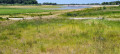
(3) Continue along this old 60-gauge track, which was used by the Décauville railway to supply strategic locations. Cross the D39 and continue straight ahead.

(4) At the junction, turn right, walk for about 150 metres and then turn left. Stay on the old track, which forms the basis of the path.

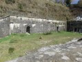
(5) At the tunnel (private, but you can have a look from the outside), which provided shelter for the train in the event of bombing, continue along this flat track. At the junction with Rue de Martin Fontaine (point 422), go straight on and then, a few metres further on, turn left.

(6) At the Croix des Brûlées junction, first turn right then left and continue along the old Line 60 track, which is a stony path. Pass a turn-off on the right and head towards the entrance to Fort de Girancourt (private property).

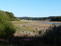
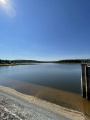
(7) Continue along the track as it descends towards Lac de Bouzey.
When you reach the lake, take in the view of the Chaumousey intermediate depot, which serves to protect the train
(private property), which is visible from the road if you turn round.

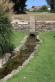
(8) Continue along the footpath which runs alongside the lake on your right.

(9) At the T-junction, turn left onto the path that runs alongside the feed canal on your left. Cross the D460 at the pedestrian crossing and continue along this footpath.

(10) At Rue du Fort, turn left, crossing over the feed canal.

(11) At Fort de Sanchey, go round it on the right, following the footpath, and rejoin the canal.

(12) Cross the canal via the footbridge and turn right. Take the tarmac cycle path, pass through Les Forges and continue until you reach a sharp bend to the right (elevation 357).

(13) Leave the path running alongside the canal by turning left and head towards Les Cots via the street of the same name. Cross the D266, walk a few metres to the left and continue along Rue de la Ménerve to the right. At La Ménère, turn right onto Rue des Forts and head towards Fort d’Uxegney.

(14) Continue along the rebuilt Route 60, pass under the D166 and carry on to Fort de Bois l’Abbé.

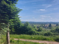
(15) At Fort de Bois l’Abbé, continue along the road for about 200 metres, then turn left onto the path leading into the forest. Follow this path as it bends to the right and joins a road. Follow this road for a few metres to the right, then continue along the next track to the left. At the three-way junction, turn right and head for Fort de la Grande Haie or Golbey.

(16) Continue to the right for a few metres to reach the car park next to the fort (E).

Waypoints

  1. S : mi 0 - alt. 1,440 ft - D51 junction/Rue du Fort
  2. 1 : mi 0.07 - alt. 1,457 ft - Fort du Roul
  3. 2 : mi 1.48 - alt. 1,460 ft - Former Tiéha batteries
  4. 3 : mi 1.84 - alt. 1,457 ft - Fort du Thieba
  5. 4 : mi 2.32 - alt. 1,427 ft - Turn right
  6. 5 : mi 2.67 - alt. 1,388 ft - Tunnel
  7. 6 : mi 4.02 - alt. 1,289 ft - Croix des Brûlées crossroads
  8. 7 : mi 4.54 - alt. 1,352 ft - Girancourt Fort
  9. 8 : mi 5.38 - alt. 1,240 ft - Bouzey Tunnel
  10. 9 : mi 6.48 - alt. 1,224 ft - Bar serving food - Avière (rivière)
  11. 10 : mi 7.34 - alt. 1,243 ft - Turn left
  12. 11 : mi 7.54 - alt. 1,247 ft - Fort de Sanchey
  13. 12 : mi 7.99 - alt. 1,188 ft - Footbridge over the - Canal de l'Est
  14. 13 : mi 9.61 - alt. 1,188 ft - Turn left
  15. 14 : mi 10.98 - alt. 1,214 ft - Fort d'Uxegney
  16. 15 : mi 11.88 - alt. 1,234 ft - Fort de bois l'Abbé
  17. 16 : mi 12.74 - alt. 1,175 ft - Fort de la Grande Haye
  18. E : mi 12.8 - alt. 1,171 ft - Car park at the start

Notes

You can find all the information about the forts by visiting the website on the Place Forte d’Épinal.
Thank you to the “ARFUPE” association for bringing some of our heritage monuments back to life.

Leave a car at the start and follow the route.
Arrange for another vehicle to take you back to Fort de Golbey Grande Haie.

Four stages, each around twenty kilometres long, which sometimes follow the old 60 or Décauville railway line that linked the forts, powder magazines, barracks, hospitals and outbuildings. (120 km)

(9) At the end of the embankment, there are bars serving food.

(11) Fort de Sanchey, managed by an association which is carrying out its restoration.

(14) Fort d’Uxegney can be visited by appointment. The “ARFUPE” association has rebuilt the 60-gauge railway.

Alternative route: (15) You can take the road, which follows the old ‘voie de 60’, to Fort de la Grande Haie
Golbey (easier).

Reviews and comments

5 / 5
Based on 1 review

Reliability of the description
5 / 5
Ease of following the route
5 / 5
Route interest
5 / 5
Jean Louis GROS
Jean Louis GROS

Overall rating : 5 / 5

Date of your route : Jan 26, 2021
Reliability of the description : ★★★★★ Very good
Ease of following the route : ★★★★★ Very good
Route interest : ★★★★★ Very good
Very busy route : No

Hello Bruno

The final leg of the four hikes – brilliant, though it’s a shame about the weather. Let’s do it again in the spring, COVID permitting.
Thank you very much

Machine-translated

martinevosges
martinevosges

Unfortunately, I didn’t manage to do it because of the weather, and, more importantly, I hadn’t realised that this walk wasn’t circular, which is why it was so difficult...............

Machine-translated

Other walks in the area

For more walks, use our search engine .

The GPS track and description are the property of this route's author. Please do not copy them without permission.