Central area of the Epinal fortified town

The final section of the Epinal Fortress, passing by the radio station, the arsenal, the Chantraine powder magazine, the barracks, the military hospital, the air station, the Décauville railway line and the powder magazines in the Olima valley.

Details

n°1026429
Creation:
Last update:
Last review:
  • Walking
    Activity: Walking
  • ↔
    Distance: 11.04 mi
  • ◔
    Average duration: 5h 50 
  • ▲
    Difficulty: Moderate

  • ⚐
    Back to start: Yes
  • ↗
    Ascent: + 879 ft
  • ↘
    Descent: - 899 ft

  • ▲
    Highest point: 1,529 ft
  • ▼
    Lowest point: 1,083 ft
  • ⚐ Country: France
  • ⚐ City: Renauvoid (88390)
  • ⚑
    Start/End: N 48.148657° / E 6.402884°
  • ❏
    IGN map(s): Ref. 3518OT
  • Hour-by-hour weather

Photos

Description of the walk

Park at La Basse Henri on the road from Épinal to Bains-les-Bains. At Les Treize Cantons, turn right and use the small car park 100 metres further down.

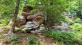
(S/E) Walk back up the road and cross the D51 at Les Treize Cantons; head straight ahead and follow the stony track to point 385. Turn left onto the path running alongside the track, leading to La Fontaine des 3 Soldats.

(1) Return to the path and the track until you cross the road at point 452. Head straight on and take the first track on the right.
Note: at point 461, this is the highest point where the antennas connecting Épinal to Paris were installed; this is the Cense Billot station.

(2) Continue along this track and head down towards Chantraine; just before you leave the forest, take a path on your left. Walk for 300 metres and turn right, joining Rue du Chant de la Terre, then turn left. Walk down Rue Victor Hugo; at the bottom of the street, cross the road and head towards the old Arsenal.

(3) Walk 150 metres and turn right onto a footpath, then join Rue des Forges and turn left, crossing it at the pedestrian crossing (watch out for traffic). Walk down the street to reach the Chantraine Gunpowder Store.

(4) Continue along the path on the right, following the stream (Chemin de l’Ancienne Voie de 60); this runs below the Courcy and Reffye barracks. Carry on until you reach the La Louvroie powder magazine.

(5) Carry on straight ahead until you reach Rue de Grandrupt, turn right, go under the railway bridge, and opposite you’ll reach the barracks in the La Magdeleine district (one of the seven barracks in the area).

(6) Walk alongside the building on your left towards Rue de l’Arsenal, turn left and go under the bridge, walk up Rue Calame and then Rue de Grandrupt, turn right onto Rue Pierre Curie, then turn left towards the swimming pool car park. From there, you’ll have a view of the last building of the Golbey Military Hospital.

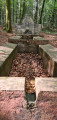
(7) Head left up Rue de La Louvroie towards the water tower, continue straight on along Rue de l’Aérostation to enter the forest. On your left, you’ll see the ruins of the aerostation, with washbasins and the remains of the barracks.

(8) Carry on straight ahead and turn left at the next junction, towards Rue des Forges.
At the restaurant La Chaumière, first turn left then right. Take Rue du Vieux Moulin. Turn right off this street onto a small footpath. Walk downhill past the riding centre and rejoin the road. Turn right and walk back up to the Beau Désir gunpowder store.

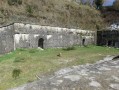
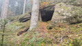
(9) Continue along this gently sloping stony path: this is the old Route 60 linking the forts and powder magazines. Pass through a tunnel and arrive at the Olima powder magazine, which serves as a bat sanctuary.

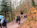
(10) Head to point 436 and descend towards the Olima Farm, following the Red Discs which will take you back to the start via the stream path (S/E).

Waypoints

  1. S/E : mi 0 - alt. 1,447 ft - Henri Base car park
  2. 1 : mi 2.11 - alt. 1,322 ft - Fountain of the Three Soldiers
  3. 2 : mi 2.84 - alt. 1,473 ft - La Cense Billot Radio Station
  4. 3 : mi 3.73 - alt. 1,207 ft - Former Arsenal
  5. 4 : mi 4.14 - alt. 1,135 ft - Chantraine gunpowder shop
  6. 5 : mi 4.68 - alt. 1,122 ft - La Louvroie Gunpowder Store
  7. 6 : mi 5.24 - alt. 1,112 ft - La Magdeleine Barracks
  8. 7 : mi 5.98 - alt. 1,129 ft - Golbey Military Hospital
  9. 8 : mi 6.89 - alt. 1,270 ft - Hot-air balloon ride
  10. 9 : mi 7.84 - alt. 1,194 ft - Beau Désir gunpowder shop
  11. 10 : mi 8.95 - alt. 1,309 ft - Olima Gunpowder Store
  12. S/E : mi 11.04 - alt. 1,447 ft - Henri Base car park

Notes

(8) In front of the hot-air balloon centre, there are tables and benches where you can take a break and have a snack.
If the weather is bad, there are two bars on Rue Général Leclerc in Golbey

Worth a visit

For more information, visit the website
Thank you to the volunteers who are restoring the buildings in the fort.

Reviews and comments

4 / 5
Based on 2 reviews

Reliability of the description
2.5 / 5
Ease of following the route
5 / 5
Route interest
4.5 / 5
POULIN Gérard
POULIN Gérard ★

Hello,
This hike is still on your account and you can edit it by adding waypoints, text, photos, etc.

Machine-translated

bruphcv
bruphcv

Hello, I’m the creator of this walk. Is it possible to add a waypoint to the Visorando route?
I no longer have the original in my possession
Thank you in advance for your reply
Bruno Phlbert

Machine-translated

Marie5746
Marie5746

Overall rating : 4.3 / 5

Date of your route : Aug 01, 2024
Reliability of the description : ★★★☆☆ Average
Ease of following the route : ★★★★★ Very good
Route interest : ★★★★★ Very good
Very busy route : No

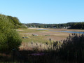
We went on this walk on 23 July 2024. We really enjoyed walking through Chantraine, discovering Chantraine Pond, the path along the old 60-gauge railway line that took us to the outskirts of Épinal, and the return journey through the forest...
The directions were a bit complicated at times, but thanks to the GPX track, there’s no problem following the route.
Many thanks to the Visorandonneur who suggested this lovely walk

Machine-translated

Gilhou
Gilhou

Overall rating : 3.7 / 5

Date of your route : Jun 02, 2019
Reliability of the description : ★★☆☆☆ Disappointing
Ease of following the route : ★★★★★ Very good
Route interest : ★★★★☆ Good

The section through the forest is superb, whereas the section through the town is rather uninteresting.
The route description must be aimed at experienced walkers; thank goodness the route is marked on the map.

Machine-translated

Other walks in the area

For more walks, use our search engine .

The GPS track and description are the property of this route's author. Please do not copy them without permission.