


Refine your search for walks in Gedinne
Gedinne walks


 SAS Monument at La Plaine Grenadier - Coubry Pond
 Visorando Member
 7.10 mi
 +486 ft
 -472 ft
 3h 40
3h 40
 Moderate
 Departure from Gedinne (Province de Namur)
A hilly route, not particularly difficult, mainly through woodland.
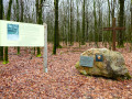
Circular loop towards the Chapelle du Maquis de la Croix Scaille
 11.70 mi
+912 ft
-925 ft
6h 10
Moderate
Departure from Gedinne (Province de Namur)
11.70 mi
+912 ft
-925 ft
6h 10
Moderate
Departure from Gedinne (Province de Namur)
Starting from the centre of Gedinne, the walk first heads through the countryside towards the nature reserve and the ponds of the old Moulin de Boiron before turning off and reaching the Croix Scaille plateau through the woods.The Croix Scaille scrubland was located slightly below the former Jacob Farm. A chapel had been built there. A memorial has now replaced it.
Sart-Custinne, its forests and the Houille valley
 10.59 mi
+1,083 ft
-1,083 ft
5h 50
10.59 mi
+1,083 ft
-1,083 ft
5h 50
 Difficult
Departure from Gedinne (Province de Namur)
Difficult
Departure from Gedinne (Province de Namur)
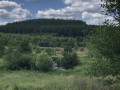
A circular walk starting from Sart-Custinne through the forests and along the streams of Gedinne. A magnificent walk for lovers of (almost) untouched nature.
A difficult hike, not because of its length, gradient or terrain, but because of its route and the lack of visible landmarks in the forest.
Forest, mud and beavers in Willerzie
 14.17 mi
+1,165 ft
-1,165 ft
7h 30
Difficult
Departure from Gedinne (Province de Namur)
14.17 mi
+1,165 ft
-1,165 ft
7h 30
Difficult
Departure from Gedinne (Province de Namur)
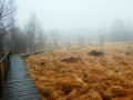
From the centre of Willerzie, the walk heads towards the forest in a south-easterly direction and reaches the former Jacob Farm, then the Millennium Tower at Croix Scaille (the highest point in the province of Namur) via fairly easy forest paths and tracks.After the Croix Scaille and a short stretch on the southern side in France, the next stop is the Fange de l’Abîme and its wooden walkways (caution: very slippery in wet weather).The walk continues through landscapes of clear-cut areas as well as young spruce and larch plantations before reaching an open area where you must follow the route exactly after the 10 km mark, as the path is barely visible there… or even non-existent on the ground.Master Beaver has been present in the Hulle Valley for a very long time, and one cannot help but notice his countless works and the damage they have caused to the forest.
From the Millennium Tower to the Fange de l'Abîme
 4.30 mi
+341 ft
-335 ft
2h 15
4.30 mi
+341 ft
-335 ft
2h 15
 Easy
Departure from Gedinne (Province de Namur)
Easy
Departure from Gedinne (Province de Namur)
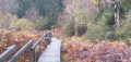
After climbing the 234 steps of the Millennium Tower to enjoy a 360° panorama of the Ardennes forest, set off on a walk towards the Fange de l'Abîme, a state-owned nature reserve, finishing at the Ferme Jacob.
In the footsteps of the resistance fighters between Gedinne and Graide
 11.80 mi
+866 ft
-886 ft
6h 10
Moderate
Departure from Gedinne (Province de Namur)
11.80 mi
+866 ft
-886 ft
6h 10
Moderate
Departure from Gedinne (Province de Namur)
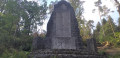
The walk starts in Gedinne and follows a route largely through the vast Ardennes forests of the province of Namur, passing through Haut-Fays. Along the way, you’ll have the chance to visit the Monument du Maquis (a memorial to 17 resistance fighters killed in 1944) and the walk ends at Graide-Station.
Vencimont and the Houille valley
 8.06 mi
+1,033 ft
-1,047 ft
4h 35
Moderate
Departure from Gedinne (Province de Namur)
8.06 mi
+1,033 ft
-1,047 ft
4h 35
Moderate
Departure from Gedinne (Province de Namur)
First, follow the wild Houille valley. After a steep climb, you will discover two typical Ardennes villages and descend through the woods and along the Hiek stream to Vencimont.
Along the streams around Nafraiture
 6.24 mi
+738 ft
-719 ft
3h 30
Moderate
Departure from Vresse-sur-Semois (Province de Namur)
6.24 mi
+738 ft
-719 ft
3h 30
Moderate
Departure from Vresse-sur-Semois (Province de Namur)
Set in beautiful countryside, this forest route along streams follows well-maintained paths and trails.
On either side of the Ruisseau de l'Ours
 7.12 mi
+1,234 ft
-1,217 ft
4h 20
Moderate
Departure from Les Hautes-Rivières (Ardennes)
7.12 mi
+1,234 ft
-1,217 ft
4h 20
Moderate
Departure from Les Hautes-Rivières (Ardennes)
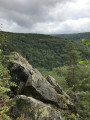
Forest walk starting from Linchamps in the commune of Hautes Rivières. A mountainous start, a stop at La Neuville aux Haies, a forest path running along the edge above the Ravin de l'Ours, a marked descent to rejoin... the Ravin de l'Ours and a peaceful finish.
See suggested alternative in the section: Places to see
The use of a GPS is recommended; do not rely on the old dot-marking system, which remains in place in some areas
Around Linchamps
 12.35 mi
+2,093 ft
-2,113 ft
7h 30
Difficult
Departure from Les Hautes-Rivières (Ardennes)
12.35 mi
+2,093 ft
-2,113 ft
7h 30
Difficult
Departure from Les Hautes-Rivières (Ardennes)
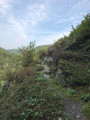
There is a lot of forest and surprising terrain around this long village on the right bank of the Saint-Jean stream.
Orchimont – Nafraiture – Barrière de Mointerne
 7.66 mi
+656 ft
-630 ft
4h 05
Moderate
Departure from Vresse-sur-Semois (Province de Namur)
7.66 mi
+656 ft
-630 ft
4h 05
Moderate
Departure from Vresse-sur-Semois (Province de Namur)
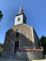
This pleasant route follows the Nafraiture stream upstream to the village of the same name, reaches the Belgian-French border and returns via the other side of the same valley.
Between Nafraiture and Vresse-sur-Semois
 10.03 mi
+1,237 ft
-1,217 ft
5h 40
Moderate
Departure from Vresse-sur-Semois (Province de Namur)
10.03 mi
+1,237 ft
-1,217 ft
5h 40
Moderate
Departure from Vresse-sur-Semois (Province de Namur)
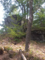
Starting from the old Orchimont local tram station, set off to explore La Roche à Campa along the French border. Then head towards the Flachîs chapel, followed by the Camp des Blaireaux – a reconstruction of a resistance camp – and finish at the Roche des Fées in Vresse-sur-Semois.
From Orchimont to Bellefontaine via the old local road
 9.14 mi
+719 ft
-745 ft
4h 50
Moderate
Departure from Vresse-sur-Semois (Province de Namur)
9.14 mi
+719 ft
-745 ft
4h 50
Moderate
Departure from Vresse-sur-Semois (Province de Namur)
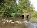
This lovely walk gradually follows the Orchimont stream along the old local road (line 553) and returns via the Bellefontaine stream valley. At the entrance to the village of Bellefontaine, a short detour leads to the Saint-Furcy Fountain and the Grotto of Notre-Dame de Bellefontaine.
The Roche Mouselle Cave
 3.10 mi
+377 ft
-390 ft
1h 45
Easy
Departure from Bièvre (Province de Namur)
3.10 mi
+377 ft
-390 ft
1h 45
Easy
Departure from Bièvre (Province de Namur)
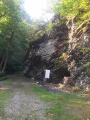
A family walk to discover the Grotte de la Roche Mouselle, pleasant as it is mostly through the woods.
Saint-Furcy walk
 5.34 mi
+584 ft
-577 ft
3h 00
Easy
Departure from Bièvre (Province de Namur)
5.34 mi
+584 ft
-577 ft
3h 00
Easy
Departure from Bièvre (Province de Namur)
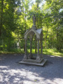
Discover the Saint-Furcy spring with a return trip along the Bellefontaine stream.
The Saint-Furcy Spring and the Roche Mouselle in a snap
10.27 mi
+948 ft
-942 ft
5h 35
Moderate
Departure from Bièvre (Province de Namur)
This walk in the Namur Ardennes is pure bliss, alternating between countryside and forests, streams, paths and trails.The route combines two major points of interest in the region: the Saint Furcy Spring and the Roche Mouselle Cave.
The Jambon viewpoint from the heights of Vresse
 7.42 mi
+866 ft
-866 ft
4h 10
Moderate
Departure from Vresse-sur-Semois (Province de Namur)
7.42 mi
+866 ft
-866 ft
4h 10
Moderate
Departure from Vresse-sur-Semois (Province de Namur)
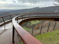
Discover a viewpoint above a bend in the Semois river at Bohan. The route starts from the hamlet of Terne, above Vresse. After passing the viewpoint, the route winds along the top of the Semois hillside to reach the Col de Conrad and then the Flachi Chapel.
Circular Ardennes starting from Vresse-sur-Semois
10.12 mi
+2,077 ft
-2,077 ft
6h 30
Difficult
Departure from Vresse-sur-Semois (Province de Namur)
Ups and downs in terms of terrain, but not at all in terms of relationships, quite the contrary! The Namur Ardennes, on the Semois side, is very hilly!The route will test your calves, so it is best to avoid it in wet weather and to follow it in the suggested direction rather than in the opposite direction.
La Dauphinée, Linchamps Castle, La Roche Margot and La Croix d’Enfer
 7.44 mi
+1,430 ft
-1,411 ft
4h 40
Moderate
Departure from Les Hautes-Rivières (Ardennes)
7.44 mi
+1,430 ft
-1,411 ft
4h 40
Moderate
Departure from Les Hautes-Rivières (Ardennes)
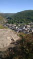
This hike along varied trails takes you to the sites of La Dauphinée and Linchamps Castle, as well as two remarkable viewpoints overlooking the industrious village of Les Hautes-Rivières.
Champ Bernard and the Nantanru Valley
 3.94 mi
+643 ft
-643 ft
2h 20
Moderate
Departure from Thilay (Ardennes)
3.94 mi
+643 ft
-643 ft
2h 20
Moderate
Departure from Thilay (Ardennes)
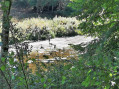
Good physical condition is required for this short route, which has a significant elevation gain in its first section. The descent along the Ruisseau du Nantanru is very pretty and presents no difficulty. The return via the Transsemoisienne, the old "little train" route, allows for a leisurely return along the Semoy.
A route in the "Hauts"
 8.14 mi
+584 ft
-584 ft
4h 15
Moderate
Departure from Thilay (Ardennes)
8.14 mi
+584 ft
-584 ft
4h 15
Moderate
Departure from Thilay (Ardennes)
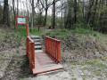
Three stunning spots and a viewpoint over the Semoy Valley are on the itinerary for this forest walk.
From Roc la Tour to Tchar Scaille
 7.63 mi
+863 ft
-866 ft
4h 15
Moderate
Departure from Thilay (Ardennes)
7.63 mi
+863 ft
-866 ft
4h 15
Moderate
Departure from Thilay (Ardennes)
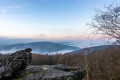
Forest route starting from Roc la Tour to the Six Chênons clearing.
Alternating between marked paths and more secluded trails.
La Roche à Sept Heures
 8.19 mi
+1,194 ft
-1,211 ft
4h 50
Moderate
Departure from Tournavaux (Ardennes)
8.19 mi
+1,194 ft
-1,211 ft
4h 50
Moderate
Departure from Tournavaux (Ardennes)
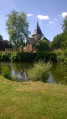
With a fairly challenging first section through the forest and a more leisurely second section along the Meuse and Semoy rivers, this route has two main destinations:
- the Roc la Tour site, a vast quartzite massif,
- and La Roche à Sept Heures, located at the top of rocky spurs overlooking the Meuse.
The viewpoint at this site offers a very picturesque panorama of the meander, considered to be the most spectacular in France, on the convex side of which Monthermé was built.