SAS Monument at La Plaine Grenadier - Coubry Pond

A hilly route, not particularly difficult, mainly through woodland.

Details

15300775
Creation:
Last update:
Last review:
  • Walking
    Activity: Walking
  • ↔
    Distance: 7.10 mi
  • ◔
    Average duration: 3h 40 
  • ▲
    Difficulty: Moderate

  • ⚐
    Back to start: Yes
  • ↗
    Ascent: + 486 ft
  • ↘
    Descent: - 472 ft

  • ▲
    Highest point: 1,362 ft
  • ▼
    Lowest point: 1,102 ft

Description of the walk

Car park in front of the church.

(S/E) Start near the tourist sign under the chestnut trees. Head towards the church and take the first left, Rue Léon Demars, which you follow until you reach the edge of the woods about 1 km further on. The gently uphill path then takes you to a crossroads.

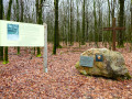
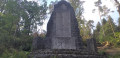
(1) Take the path on the left towards the Plaine Grenadier. Continue to the spot where a huge stone stands, a monument dedicated to Colonel Blondeel’s SAS paratroopers, who were dropped a few hundred metres from here in 1944, and to the resistance fighters of Group C, Section V of Zone 5 of the A.S. who received them.

(2) With your back to the monument, cross the Rienne-Vencimont road and take the path in front of you. Begin a long descent.

(3) At the bottom of the descent, turn left towards the hamlet of Bohée. At Bohée, head right towards the Rienne-Bourseigne-Vieille road, then turn left to follow the road for about a hundred metres.

(4) Turn right onto the stony path. Continue along this path for nearly 800 metres.

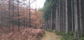
(5) At the fork, turn right. The path runs alongside a fir forest on your left, and when you reach the top of the hill, the conifers give way to deciduous trees.

(6) Take the path on the left, then the track (a bit muddy at the start) for about 750 m.

(7) Continue left until you reach the Rienne-Bourseigne-Neuve road.

(8) On the tarmac, turn right for a few dozen metres, then head towards the path on the left which descends for about 600 m.

(9) At the crossroads, turn right, then go straight on to the next crossroads.

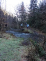
(10) Turn left towards Étang de Coubry. Walk along the edge of the pond and continue straight on towards the Rienne-Willerzie road, which you cross to join the stony path directly in front of you. There are fields on the right and a hedge on the left.

(11) As you enter the woods, turn immediately left. The path is a little muddy and, towards the end, it narrows and becomes a track. You’ll come out onto a stony path and head left towards the village of Rienne.

(12) At the chapel, turn left and continue straight on until you reach the crossroads. There, if you look to your right, you will see Rienne Church, your destination (S/E).

Waypoints

  1. S/E : mi 0 - alt. 1,211 ft - Car park in front of the town hall
  2. 1 : mi 0.95 - alt. 1,342 ft - Path on the left
  3. 2 : mi 1.33 - alt. 1,316 ft - Monument SAS
  4. 3 : mi 2.14 - alt. 1,112 ft - At the bottom of the descent, on the left
  5. 4 : mi 2.85 - alt. 1,138 ft - Turn right onto the stony path.
  6. 5 : mi 3.2 - alt. 1,243 ft - Junction, turn right
  7. 6 : mi 3.49 - alt. 1,263 ft - Path on the left
  8. 7 : mi 3.8 - alt. 1,329 ft - Turn left
  9. 8 : mi 4.05 - alt. 1,316 ft - Road, on the right
  10. 9 : mi 4.47 - alt. 1,243 ft - At the crossroads, turn right.
  11. 10 : mi 4.82 - alt. 1,184 ft - At the crossroads, turn left towards Étang de Coubry.
  12. 11 : mi 5.59 - alt. 1,217 ft - Entrance to the woods, on the left
  13. 12 : mi 6.55 - alt. 1,204 ft - Chapel, on the left
  14. S/E : mi 7.1 - alt. 1,211 ft - Car park in front of the town hall

Notes

Good walking shoes.
Bring drinks and a snack.
At the end of the route, the Auberge des Ardennes.

Worth a visit

After your walk, if you fancy a bite to eat, the Restaurant de Boiron is located 1.5 km from Rienne church. Gedinne also offers several options.
It is best to book, especially in high season.

Moulin de Boiron
0032 61 58 99 59
https://goo.gl/maps/ELGwUN5hjDMrEReF6

Reviews and comments

4 / 5
Based on 1 review

Reliability of the description
4 / 5
Ease of following the route
4 / 5
Route interest
4 / 5
fzutterman
fzutterman

Overall rating : 4 / 5

Date of your route : Dec 18, 2022
Reliability of the description : ★★★★☆ Good
Ease of following the route : ★★★★☆ Good
Route interest : ★★★★☆ Good
Very busy route : No

Overall, a lovely route, especially in the second half, which is wilder and features more unspoilt woodland. It’s likely to be quite muddy in damp weather or after a spell of rain (not a problem yesterday, as it was freezing). The directions are accurate, except perhaps at point 1. Near this point, there are actually two paths leading to the left. You need to take the second one, near which there is a post with signposts. The direction ‘Plaine Grenadier’ is not marked on the post or on the signposts.
.

Machine-translated

Other walks in the area

For more walks, use our search engine .

The GPS track and description are the property of this route's author. Please do not copy them without permission.