Saint-Furcy walk

Discover the Saint-Furcy spring with a return trip along the Bellefontaine stream.

Details

1313124
Creation:
Last update:
Last review:
  • Walking
    Activity: Walking
  • ↔
    Distance: 5.34 mi
  • ◔
    Average duration: 3h 00 
  • ▲
    Difficulty: Easy

  • ⚐
    Back to start: Yes
  • ↗
    Ascent: + 584 ft
  • ↘
    Descent: - 577 ft

  • ▲
    Highest point: 1,237 ft
  • ▼
    Lowest point: 994 ft

Photos

Description of the walk

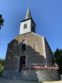
Parking at the church in Petit-Fays.

No signposts

(S/E) With your back to the church entrance, turn left onto Rue Monseigneur Lefort.
Walk carefully along the road. Turn right at the crossroads.

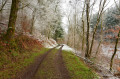
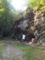
(1) Before the end of town sign, turn left onto the farm track. The track leads into the woods and turns sharply to the left.

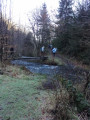
(2) At the fork, turn right. The path is wet, and the stream merges with the path and then separates. The path turns right and crosses a small stream. Stay on the main path and ignore any other paths that branch off. You will pass through a clear-cut area with ferns, broom, foxgloves and young oak trees, then return to the trees.

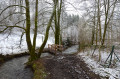
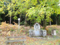
(3) At the crossroads, turn left. At the end, the path turns left and becomes a trail. Cross the stream via a pontoon and you will come out behind the Saint-Furcy fountain. Go up the path opposite the fountain. Continue along the road and take the path on your right to see the replica of the Notre-Dame de Lourdes grotto, built in 1923. Retrace your steps and continue to the right along the road.

Green diamond markings

Turn left at thefirst gravel path on your left.

(4) Keep left at the fork.

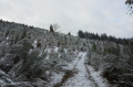
(5) At the next fork, keep left again. Walk through the open area and then into the undergrowth, ignoring the path on your right. You will come to a clear-cut area and, a little further on, the Grand Moinil area with its bench. Continue along the forest path and now pay attention to your left.

Blue Rectangle Markings

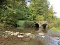
(6) On your left, take the hairpin path marked with a blue rectangle sign to cross the Bellefontaine stream and change banks. Follow the trail to return to a wide path and turn right.

(7) You will come to a stony path; continue straight ahead.

No markings

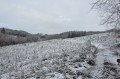
(8) Take the grassy path on your left, an old path overgrown with broom and tall grass. Leave the markings and climb uphill. At the junction on the left, go up the ravines. At the entrance to a meadow on your left, the path turns sharply to the right. Continue straight ahead. Leave the forest, walk along a meadow, past farm buildings and then houses.

(9) Turn left onto the road. Further on, another road joins on your left; continue to the right. Pass the cemetery and return to Rue Monseigneur Lefort. Walk carefully up the street. Continue straight ahead at the crossroads and return to the church (S/E).

Waypoints

  1. S/E : mi 0 - alt. 1,188 ft - With your back to the church
  2. 1 : mi 0.29 - alt. 1,230 ft - Take the path on the left before the end of town sign.
  3. 2 : mi 0.64 - alt. 1,211 ft - Fork to the right
  4. 3 : mi 1.53 - alt. 1,175 ft - Crossroads on the left
  5. 4 : mi 2.2 - alt. 1,168 ft - Fork to the left
  6. 5 : mi 2.49 - alt. 1,106 ft - Fork to the left
  7. 6 : mi 3.5 - alt. 1,020 ft - Path on the left with hairpin bend signposting
  8. 7 : mi 4 - alt. 1,024 ft - Stony path
  9. 8 : mi 4.16 - alt. 994 ft - Abandoned uphill path on the left
  10. 9 : mi 4.61 - alt. 1,194 ft - Road on the left
  11. S/E : mi 5.34 - alt. 1,188 ft - Church

Notes

An added bonus for this hike is that it can be combined with La Grotte de la Roche Mouselle if you want to cover more kilometres.
One difficulty from (8) to (9)
There is a bench at Grand Moinil just before (6).
You can fill your water bottles at the Saint-Furcy fountain.
Please note: this route does not correspond to the eponymous walk marked out by the municipality of Bièvre.

Worth a visit

Saint-Furcy spring

Bellefontaine is known throughout the region for the quality of the water from the Saint-Furcy spring (listed as a heritage site since 1990).
According to tradition, Saint-Furcy, during his visit to Gaul around 650 AD, caused a spring to gush forth, and a woman suffering from eczema dipped her hand in it and was cured. The village was built around the spring and the cross that Saint Furcy himself had planted, and later around the church that replaced it, built by order of Godfrey of Bouillon in honour of the saint (1090).
The carved granite monument above the fountain consists of four columns topped by a statue of the saint.

A little further from the spring, you can discover a beautiful granite monument carved into the rock. This is the Notre-Dame cave, blessed by Monsignor Heylen, Bishop of Namur, on 20 September 1923.

Reviews and comments

4.5 / 5
Based on 6 reviews

Reliability of the description
4.6 / 5
Ease of following the route
4 / 5
Route interest
4.8 / 5
Yoshi123
Yoshi123
• Edited:

Don't worry, we didn't have a pushchair. We'll have one in a few months... This was our first walk via Visorando. We'll read the comments next time when there are more than two of us. I mentioned the pushchair because I had read someone talking about it. I hadn't read your reply on this subject.

Thank you for making this first experience a very positive one. Kind regards.
Edit: Oops, I used a different account to reply...

Machine-translated

lazzerini
lazzerini

Good evening, FDML,

Thank you for your feedback.
It's a shame you didn't read the forum before you left. I had already been asked if the "mountain bike" section was accessible with a pushchair, and I replied that it wasn't on that section, adding an alternative route.
When you're on the walk/hike page, you can't see all the discussions, just the rating.
But in any case, it seems to me that you did well
and, judging by your rating, you enjoyed it. That's what matters.

Thank you.

Machine-translated

FDML
FDML

Overall rating : 4.7 / 5

Date of your route : Jan 08, 2021
Reliability of the description : ★★★★★ Very good
Ease of following the route : ★★★★★ Very good
Route interest : ★★★★☆ Good
Very busy route : No

Walk taken on a Friday morning in winter (08-01). We only encountered two people during this walk.
The roads were snow-covered, but the view was magnificent as soon as we reached the farm track (1).
There was a lot of mud at point 6, and the path was narrow from point 8 onwards and too uneven for a pushchair (all-terrain model with three large wheels) = > this information is for those who would like to do the route with a pushchair.
The route information was very clear, GPS tracking on smartphones was effective, but there was no network coverage for several sections.
Thank you for this walk.

Machine-translated

EdProc
EdProc
• Edited:

Overall rating : 4.3 / 5

Date of your route : Dec 14, 2020
Reliability of the description : ★★★★☆ Good
Ease of following the route : ★★★★☆ Good
Route interest : ★★★★★ Very good
Very busy route : No

We will repeat this route when the weather improves, extending it to discover more of this attractive area!

Machine-translated

Arn_T!
Arn_T!

Hello Carla,
Many thanks for these tips.
I will analyse them and they will help me plan my itinerary.
I will be sure to leave a comment for future reference.

Machine-translated

lazzerini
lazzerini

Hello,
I think that the section after (8) will be very difficult to navigate with a pushchair, even a mountain bike, as the path was overgrown with tall grass and gorse when I walked it to plan the route, and it is unlikely to have improved. It must already be quite difficult for a single person to pass through.

I suggest you turn left at (7) and follow the forest road until you reach a tarmac road, which you take to the right to rejoin the trail at the cemetery. Have the hike on the app so you can see the map and know where you are in relation to the original route. As in Belgium, we have to use OpenStreetMap, which is free.

I always write too much, perhaps... but here is what you asked for: other hikes in the area.

Best regards
Carla

I will only mention the ones I have done, of course:

"La grotte de la roche Mouselle" (The Mouselle Rock Cave), which is shorter, could be done with a mountain bike pushchair, especially if the path has been cleared since the wood was cut between (3) and (4), but unfortunately I cannot confirm this.

"Between Nafraiture and Vresse sur Semois" is just the circular route from (S/E) to (10) and then directly down to (S/E), which should be 11 km rather than the original 16 km, as the section between (14) and (15) would be difficult with a mountain bike pushchair due to the narrowness of the path and its slope.

"Walk to the Rondia meadows" should be fine, but there are sections with tall grass.

"Serenity in the woods around Cornimont" should also be possible. However, be careful if it has rained, as between (5) and (6) there are fords to cross without footbridges, so you will get your feet wet. This was very easy to do when I visited in May 2018, with barely any wet soles, but apparently more difficult for ArinaTomberg in May this year, although this was not the case for Noel Ju, who reported no problems last September.

For other hikes in the region, enter "Bièvre" (last choice in the list of locations) on the visorando.be homepage in "search for a hike" without specifying duration, difficulty or other criteria, and you will get a map showing the various hikes available within a large radius of your desired starting point.

Machine-translated

Arn_T!
Arn_T!

Hello,

I would like to use this route with a mountain bike pushchair. Do you think it is suitable?
If not, do you know of one in this area that is?

Thank you for your replies.

Best regards,

Arnaud.

Machine-translated

servalyd
servalyd

Indeed. I think I'll do the missing part backwards to locate "the crossroads of error"...if you know what I mean.

Machine-translated

Patrick Bouvier
Patrick Bouvier

Overall rating : 5 / 5

Date of your route : Sep 06, 2019
Reliability of the description : ★★★★★ Very good
Ease of following the route : ★★★★★ Very good
Route interest : ★★★★★ Very good

A very beautiful route.
Interesting for the Furcy Fountain, but also for the magnificent Bellefontaine stream valley
and what a lovely walk in the Belgian countryside.

Machine-translated

henri57
henri57 ★

Hello,

Thank you for your feedback.

And that's how we end up in Orchimont, missing the climb up the ravines between 7 and 8.

Wouldn't it be between (8) and (9)?

See you soon

Machine-translated

servalyd
servalyd

Overall rating : 4.3 / 5

Date of your route : Sep 16, 2019
Reliability of the description : ★★★★☆ Good
Ease of following the route : ★★★★☆ Good
Route interest : ★★★★★ Very good

Hello and thank you for this route. I did the route for reconnaissance, imposing difficult conditions on myself: a map that wasn't detailed enough (1:25,000) and photos of the route taken with my mobile phone. And that's how I ended up in Orchimont, missing the climb up the ravines between 7 and 8. I'll go back, partly out of pride and mainly because of the attractive features of this lovely route.

Machine-translated

lazzerini
lazzerini

Hello tonton1959,

I will be sure to add this comment to the practical information. It's true that I didn't really pay attention when choosing the title, as the name is exactly the same as the one used by the municipality because the final destination is, in fact, the same.
All the best with Visorando.

Machine-translated

tonton1959
tonton1959

Hello,
In that case, my apologies, but as I am new to this site and this is only my second walk,
my partner (who has slightly reduced mobility) and I were influenced by the name of the walk...perhaps it would be a good idea to indicate that some routes do not necessarily correspond to those shown on the municipal maps...but now that we know .
That said, thank you for all your efforts, as your site is very enjoyable to visit. I will be sure to tell others about it.
Kind regards.

Machine-translated

lazzerini
lazzerini

Hello Uncle 1959.
I suggest hikes that do not follow the unique markings of the municipalities but rather a mixture or even markings in the opposite direction. These suggestions are often made to avoid too much tarmac, which is often the case with the walks suggested by the municipalities.

Why did you select my route if you are following the markings and not what is suggested?
In that case, obviously, it has nothing to do with it. Neither the route nor the description.
I am therefore surprised by your opinion.

Machine-translated

tonton1959
tonton1959

Overall rating : 3 / 5

Date of your route : Sep 11, 2019
Reliability of the description : Not used / Not applicable
Ease of following the route : ★☆☆☆☆ Very disappointing
Route interest : ★★★★★ Very good

From the church, follow the red diamond markers. The route has nothing to do with the one described.

Machine-translated

Other walks in the area

For more walks, use our search engine .

The GPS track and description are the property of this route's author. Please do not copy them without permission.