


At km 12 (8), don’t get your hopes up too high about shortening the walk by crossing the ford on the Hulle and heading due north along the left bank: the ford is usually impassable without wellington boots. A slight detour is therefore necessary to bypass the magnificent muddy area in the Ruisseau du Moulin valley, whilst turning a blind eye to the huts on the eastern side as you approach.
Shortcuts are possible between (5) and (9) or between (6) and (9).
A shortcut is, of course, also possible by turning right at (9).
Forest, mud and beavers in Willerzie


From the centre of Willerzie, the walk heads towards the forest in a south-easterly direction and reaches the former Jacob Farm, then the Millennium Tower at Croix Scaille (the highest point in the province of Namur) via fairly easy forest paths and tracks.
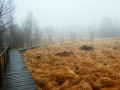
After the Croix Scaille and a short stretch on the southern side in France, the next stop is the Fange de l’Abîme and its wooden walkways (caution: very slippery in wet weather).
The walk continues through landscapes of clear-cut areas as well as young spruce and larch plantations before reaching an open area where you must follow the route exactly after the 10 km mark, as the path is barely visible there… or even non-existent on the ground.
Master Beaver has been present in the Hulle Valley for a very long time, and one cannot help but notice his countless works and the damage they have caused to the forest.
Details
Creation:
Last update:
Last review:
–
–
-
 Activity: Walking
 -
 Distance: 14.17 mi
 -
 Average duration: 7h 30
 -
 Difficulty: Difficult
 -
-
 Back to start: Yes
 -
 Ascent: + 1,165 ft
 -
 Descent: - 1,165 ft
 -
-
 Highest point: 1,680 ft
 -
 Lowest point: 863 ft
-
 Country:
Belgium
Country:
Belgium
-
 Area: Massif des Ardennes
 -
 City:
Gedinne
City:
Gedinne -
 Start/End: N 49.986041° / E 4.848105°
 -
 IGN map(s): Ref. 3008SB
 -


 Hour-by-hour weather
Photos
Waypoints
- S/E : mi 0 - alt. 1,106 ft - Les Tilleuls Community Centre
- 1 : mi 1.45 - alt. 1,296 ft - Le Gros Bois
- 2 : mi 2.79 - alt. 1,611 ft - Former Jacob Farm
- 3 : mi 3.05 - alt. 1,644 ft - Millennium Walk
- 4 : mi 4.61 - alt. 1,440 ft - Fagne or Fange de l’Abîme
- 5 : mi 6.13 - alt. 1,460 ft - Shortcut
- 6 : mi 6.81 - alt. 1,283 ft - Shortcut
- 7 : mi 7.41 - alt. 1,102 ft - Hulle Valley
- 8 : mi 7.49 - alt. 1,083 ft - Ford impassable without getting your feet wet
- 9 : mi 8.47 - alt. 1,093 ft - Ruisseau du Moulin
- 10 : mi 10.05 - alt. 974 ft - Beaver works
- 11 : mi 10.77 - alt. 974 ft - Pont Collin
- 12 : mi 11.56 - alt. 866 ft - End of the Hulle Valley
- S/E : mi 14.17 - alt. 1,106 ft - Les Tilleuls Community Centre
Notes
Other walks in the area
SAS Monument at La Plaine Grenadier - Coubry Pond
 Visorando Member7.10 mi
+486 ft
-472 ft
3h 40
Visorando Member7.10 mi
+486 ft
-472 ft
3h 40
 Moderate
 Departure from Gedinne (Province de Namur)
A hilly route, not particularly difficult, mainly through woodland.
From the Millennium Tower to the Fange de l'Abîme
 4.30 mi
+341 ft
-335 ft
2h 15
4.30 mi
+341 ft
-335 ft
2h 15
 Easy
Departure from Gedinne (Province de Namur)
Easy
Departure from Gedinne (Province de Namur)
After climbing the 234 steps of the Millennium Tower to enjoy a 360° panorama of the Ardennes forest, set off on a walk towards the Fange de l'Abîme, a state-owned nature reserve, finishing at the Ferme Jacob.
Sart-Custinne, its forests and the Houille valley
 10.59 mi
+1,083 ft
-1,083 ft
5h 50
Difficult
Departure from Gedinne (Province de Namur)
10.59 mi
+1,083 ft
-1,083 ft
5h 50
Difficult
Departure from Gedinne (Province de Namur)
A circular walk starting from Sart-Custinne through the forests and along the streams of Gedinne. A magnificent walk for lovers of (almost) untouched nature.
A difficult hike, not because of its length, gradient or terrain, but because of its route and the lack of visible landmarks in the forest.
Circular loop towards the Chapelle du Maquis de la Croix Scaille
 11.70 mi
+912 ft
-925 ft
6h 10
Moderate
Departure from Gedinne (Province de Namur)
11.70 mi
+912 ft
-925 ft
6h 10
Moderate
Departure from Gedinne (Province de Namur)
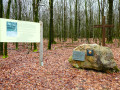
Starting from the centre of Gedinne, the walk first heads through the countryside towards the nature reserve and the ponds of the old Moulin de Boiron before turning off and reaching the Croix Scaille plateau through the woods.The Croix Scaille scrubland was located slightly below the former Jacob Farm. A chapel had been built there. A memorial has now replaced it.
Vencimont and the Houille valley
 8.06 mi
+1,033 ft
-1,047 ft
4h 35
Moderate
Departure from Gedinne (Province de Namur)
8.06 mi
+1,033 ft
-1,047 ft
4h 35
Moderate
Departure from Gedinne (Province de Namur)
First, follow the wild Houille valley. After a steep climb, you will discover two typical Ardennes villages and descend through the woods and along the Hiek stream to Vencimont.
On either side of the Ruisseau de l'Ours
 7.12 mi
+1,234 ft
-1,217 ft
4h 20
Moderate
Departure from Les Hautes-Rivières (Ardennes)
7.12 mi
+1,234 ft
-1,217 ft
4h 20
Moderate
Departure from Les Hautes-Rivières (Ardennes)
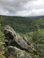
Forest walk starting from Linchamps in the commune of Hautes Rivières. A mountainous start, a stop at La Neuville aux Haies, a forest path running along the edge above the Ravin de l'Ours, a marked descent to rejoin... the Ravin de l'Ours and a peaceful finish.
See suggested alternative in the section: Places to see
The use of a GPS is recommended; do not rely on the old dot-marking system, which remains in place in some areas
Around Linchamps
 12.35 mi
+2,093 ft
-2,113 ft
7h 30
Difficult
Departure from Les Hautes-Rivières (Ardennes)
12.35 mi
+2,093 ft
-2,113 ft
7h 30
Difficult
Departure from Les Hautes-Rivières (Ardennes)
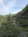
There is a lot of forest and surprising terrain around this long village on the right bank of the Saint-Jean stream.
In the footsteps of the resistance fighters between Gedinne and Graide
 11.80 mi
+866 ft
-886 ft
6h 10
Moderate
Departure from Gedinne (Province de Namur)
11.80 mi
+866 ft
-886 ft
6h 10
Moderate
Departure from Gedinne (Province de Namur)
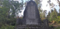
The walk starts in Gedinne and follows a route largely through the vast Ardennes forests of the province of Namur, passing through Haut-Fays. Along the way, you’ll have the chance to visit the Monument du Maquis (a memorial to 17 resistance fighters killed in 1944) and the walk ends at Graide-Station.
For more walks, use our search engine .
The GPS track and description are the property of this route's author. Please do not copy them without permission.

