From the Millennium Tower to the Fange de l'Abîme

After climbing the 234 steps of the Millennium Tower to enjoy a 360° panorama of the Ardennes forest, set off on a walk towards the Fange de l'Abîme, a state-owned nature reserve, finishing at the Ferme Jacob.

Details

4361350
Creation:
Last update:
Last review:
  • Walking
    Activity: Walking
  • ↔
    Distance: 4.30 mi
  • ◔
    Average duration: 2h 15 
  • ▲
    Difficulty: Easy

  • ⚐
    Back to start: Yes
  • ↗
    Ascent: + 341 ft
  • ↘
    Descent: - 335 ft

  • ▲
    Highest point: 1,680 ft
  • ▼
    Lowest point: 1,345 ft

Photos

Description of the walk

Car park at the Tour du Millénaire, Croix-Scaille, part of Gedinne.

(S/E) After climbing to the top of the tower, head towards the road. Turn left, then left again onto the path behind the hedge and walk to the junction at the edge of the pine forest.

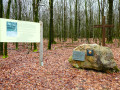
(1) Turn right until you reach the wide path and turn right again. At the grassy path on your left, marked by a large post and a tyre, turn left. Walk for 500 m along the path, which bends to the right, becomes a track and winds through the bushes until you reach a wide path.

Marking: Yellow Rectangle 41

(2) Head left and walk for 600 m, ignoring the cross-cutting paths, until you reach a multi-way junction. Turn left and cross the French border just before reaching the wide forest track. Continue to the right until you reach a path on your right.

(3) Turn right and, further on, when you reach the paths and tracks on your right, keep to the left. Follow the track, which is joined by a stream, before coming out onto a wide forest track. Continue to the right for about ten metres until you reach another track on your right.

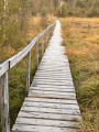
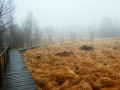
(4) Take the path on the right, cross the ditch and, just after that, at the fork, take thesecond path on the right. Once back in Belgium, ignore thefirst gate in the fence. Walk to thesecond gate, at a place called La Fange de l'Abîme, open it (make sure you close it behind you) and head left along the boardwalks of the state-owned nature reserve until you reach the T-junction.

(5) Turn left. Go through a gate (make sure you close it behind you). Go downhill and cross over the stream. At the end of the boardwalk, turn left. Take the path cluttered with roots and go downhill to the wide forest track. Continue to the right for 300 m until you reach a path on your right.

Unmarked

Turn right. Head uphill and follow the well-marked main path for 1 km, ignoring any cross-paths you come across.

(6) Take the grassy path on your right, about 200 m before the road. This path becomes a track and, depending on the time of year, you may or may not have to battle your way through the ferns. Once back on the wide forest track you took on the way out, turn left.

(2) At the bend, continue straight ahead. At the road, turn right and walk to the junction. Turn left towards Ferme Jacob, then turn right towards the buildings.

(7) At the information board for Ferme Jacob, head slightly to the right towards the oratory. Pass to the left of it.

Cross-country skiing trail markers

Take the path on the right and, at the two trees in the middle of the path, turn right. Walk straight on to the road, then turn left to return to the car park (S/E).

Waypoints

  1. S/E : mi 0 - alt. 1,644 ft - Millennium Tour car park
  2. 1 : mi 0.14 - alt. 1,647 ft - Junction at the edge of the pine forest
  3. 2 : mi 0.66 - alt. 1,578 ft - Junction with a wide path
  4. 3 : mi 1.35 - alt. 1,617 ft - Path on the right with a sign
  5. 4 : mi 1.95 - alt. 1,476 ft - Path, ditch then multiple crossroads
  6. 5 : mi 2.26 - alt. 1,417 ft - T-junction on a boardwalk
  7. 6 : mi 3.21 - alt. 1,552 ft - Grassy path on the right
  8. 7 : mi 4.04 - alt. 1,614 ft - Information board at Ferme Jacob
  9. S/E : mi 4.3 - alt. 1,644 ft - Millennium Tower car park

Notes

Good walking boots are recommended as the ground is wet and muddy in places.

There are many roads on the Croix Scaille plateau, with very few opportunities for long off-road walks
From October to December, please be aware of hunting dates

Worth a visit

During

Tour du Millénaire: erected on the Croix-Scaille plateau, a spectacular 60-metre-high hourglass-shaped viewpoint, marking the highest point in the province of Namur and thefifth highest in Belgium (503 m).
Inspired by history (four towers once stood on this summit at various times), this structure offers free access to a fabulous landscape stretching over 30 km in all directions, aided by an orientation table.
Staircases provide access to three viewing platforms situated at 15, 30 and 45 metres respectively. The site is open all year round except during the hunting season in this area, in the event of bad weather, or if the access road is reserved for cross-country skiing.

Fange de l'Abîme: A State Nature Reserve, situated on the Croix-Scaille plateau, at the junction of the Semois and Meuse valleys, a short distance from the French border. Covering just over 8 hectares, it is one of the last remaining examples of sphagnum peat bogs and peaty meadows. It is situated not far from the highest point in the Western Ardennes, at a place called ‘Croix-Scaille’ (505 m).

Croix-Scaille: on a map of the region drawn up in 1614, during the reign of Archduke Albert and Archduchess Isabella, the name ‘Croix d’Escaille’ appeared for the first time, at the junction of two forest paths. It is a place where a man from the Château Regnault estate was once killed; his parents had a slate cross erected there, which has since been broken and is no longer visible. In Walloon, ‘escaille’ or ‘scaille’ means slate, that Ardennes rock which splits so perfectly and is used for roofing. It is therefore a slate cross that gave rise to the name ‘Croix Scaille’. Today, the famous Escaille cross overlooks the entrance to Ferme Jacob. Found damaged in a copse and then stored in the farm’s bakery, it is said to have been returned to the façade in 1937 during the building’s restoration.

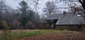
Ferme Jacob: In the 17th century, this farm was first known as Cense des Hez (coppice); it subsequently bore the names of successive farmers and ultimately retained the name of the Jacob family, who occupied it from the early 19th century. The Jacob Farm was for a long time the central point for the affouage (the right to collect firewood from a communal forest) for the inhabitants of the villages that now make up Gedinne. This house, nestled in a forest that is both dense and marshy, was also long a legendary and ideal hideout for political refugees from the neighbouring state, those wanted for banditry, and wayfarers in search of the absolute. Today, the Jacob Farm, now owned by the Municipality of Gedinne, is a rural lodge.

Reviews and comments

4.1 / 5
Based on 5 reviews

Reliability of the description
4.6 / 5
Ease of following the route
4.2 / 5
Route interest
3.4 / 5
fzutterman
fzutterman

Overall rating : 4 / 5

Date of your route : Apr 20, 2026
Reliability of the description : ★★★★★ Very good
Ease of following the route : ★★★★★ Very good
Route interest : ★★☆☆☆ Disappointing
Very busy route : No

Unfortunately, the devastated forest (as mentioned in the last comment from 2024) is still in a sorry state (a veritable battlefield stretching over dozens of square kilometres). No new planting in sight, all the debris is still there. The small fen (Fange de l'Abîme) is fortunately very beautiful; that’s why we came. The forests around Croix Scaille were a favourite hiking spot for us in the 1980s and 1990s, but they’ve lost all their appeal. And it’s the same devastation on the French side...

Machine-translated

Jean-Michel Joissains

Overall rating : 3.7 / 5

Date of your route : Apr 20, 2026
Reliability of the description : ★★★★☆ Good
Ease of following the route : ★★★★☆ Good
Route interest : ★★★☆☆ Average
Very busy route : No

A lovely walk to explore the highest point of the Ardennes, though it’s a bit of a shame about the damage caused by the bark beetle ☹️. Make sure you wear wellies for certain sections. Enjoy the walk 😉

Machine-translated

Rand’InLove
Rand’InLove

Some sections are tricky between points 1 and 2 and a few metres from point 6; you have to work out where the path is and be careful as it’s very marshy, but these spots are undoubtedly the best parts of the hike – just you and nature!
The walk along the boardwalks in the Fange de L’Abîme nature reserve is always a pleasure; afterwards, you walk through what was once a forest. It is distressing to see all this deforestation caused by the bark beetle epidemic; the equivalent of 10 years’ worth of felling has just taken place. It is also a place where you will realise the extent of the damage caused by the greatest forest pest. The Millennium Tower is unfortunately closed for a few months whilst repairs to the platforms are underway, but you can make use of the picnic area and the chalet, which is open in season.

Please note: wear waterproof shoes, and this hike is only accessible on foot

Hike and leave the forest as you found it

Rand’InLove

Machine-translated

naejiram
naejiram

The site has been utterly devastated! The endangered forest has, alas—a thousand times alas—suffered the ravages of global warming, and the mire of the abyss loses all its charm in the face of this scene of desolation. It is sad, and it will take a few years to restore it, I hope. Let’s meet up in five years’ time to see the changes and the rewilding that I so dearly hope for! The trail will likely be restored and reopened before long!
I was familiar with the site, and this upheaval has shocked me.

Machine-translated

lazzerini
lazzerini

Hello naejiram,
I’m sorry to hear that.
Didn’t even the mire of the abyss manage to charm you?

Machine-translated

naejiram
naejiram

Overall rating : 4 / 5

Date of your route : Aug 16, 2024
Reliability of the description : ★★★★★ Very good
Ease of following the route : ★★★★☆ Good
Route interest : ★★★☆☆ Average
Very busy route : No

The Millennium Tower is closed until further notice due to damage (a beam on the first floor is out of action). The start of the walk between points 1 and 2 follows a barely marked path, and you find yourself in the middle of the undergrowth with no way of avoiding the numerous puddles! The landscape has been altered by the clear-cutting of the bark beetle-infested forest, which takes all the charm out of the walk. What a shame!

Machine-translated

Cristina
Cristina

Overall rating : 5 / 5

Date of your route : Sep 30, 2023
Reliability of the description : ★★★★★ Very good
Ease of following the route : ★★★★★ Very good
Route interest : ★★★★★ Very good
Very busy route : Yes

A lovely walk 🫶

Machine-translated

Rethel
Rethel

Overall rating : 3.7 / 5

Date of your route : Jul 24, 2023
Reliability of the description : ★★★★☆ Good
Ease of following the route : ★★★☆☆ Average
Route interest : ★★★★☆ Good
Very busy route : No

Apart from a stretch through the dewy grass, it was a very pleasant walk.
Note that there is a second grassy section, but it is possible to avoid it.

Thanks to the Visorando app for tracking the route.

Machine-translated

Other walks in the area

For more walks, use our search engine .

The GPS track and description are the property of this route's author. Please do not copy them without permission.