Refine your search for walks in Étais-la-Sauvin
Étais-la-Sauvin walks


 Chemin de Bel-Air
 Visorando Member
 6.28 mi
 +144 ft
 -144 ft
 3h 00
3h 00
 Easy
Easy
 Departure from Étais-la-Sauvin (Yonne)
Marked walk No. 26.
A lovely route between the Yonne and Nièvre departments, taking in farmland and wooded areas.
This route has been surveyed and marked out by members of the local walking club.
It can be tackled on horseback or by mountain bike, but in the opposite direction.
Chemin des Plots
 4.05 mi
+121 ft
-125 ft
2h 00
Easy
Departure from Étais-la-Sauvin (Yonne)
4.05 mi
+121 ft
-125 ft
2h 00
Easy
Departure from Étais-la-Sauvin (Yonne)
Marked walk No. 27.
A short, family-friendly walking or mountain-biking route that is enjoyable and accessible all year round.
This route has been surveyed and marked out by members of the local association A Travers Champs. It is fully signposted with yellow signs, black lettering and yellow arrows on a red background.
The Montagne des Alouettes as seen from Etais-la-Sauvin
 8.33 mi
+492 ft
-499 ft
4h 15
8.33 mi
+492 ft
-499 ft
4h 15
 Moderate
Departure from Étais-la-Sauvin (Yonne)
Moderate
Departure from Étais-la-Sauvin (Yonne)
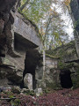
A very pleasant walk in all seasons across the plain and through the woods, climbing to the region’s highest point (363 m). Along the ancient Roman road, discover the old underground limestone quarries, which were used to build the region’s houses and bridges. Magnificent panoramic views stretch out on either side of this road, which once linked Auxerre to Nevers, with Entrains-sur-Nohain as its main junction.
Chemin du Puits
 4.62 mi
+102 ft
-102 ft
2h 15
Easy
Departure from Étais-la-Sauvin (Yonne)
4.62 mi
+102 ft
-102 ft
2h 15
Easy
Departure from Étais-la-Sauvin (Yonne)
Marked trail No. 29.
A pleasant walk or mountain bike ride in all weathers.
This route has been surveyed and marked out by members of the local association À Travers Champs. It is fully signposted with yellow signs, black lettering and yellow arrows on a red background.
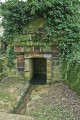
Source de l’Oisy, near Fondelin
7.02 mi
+433 ft
-453 ft
3h 35
Easy
Departure from Billy-sur-Oisy (Nièvre)
A lovely, relaxing walk along pleasant paths. Along the route, you’ll find a pretty well-and-washhouse and the La Motte washhouse, fed by the River Oisy. A shaded stretch through part of the Trucy Forest.
Billy, between woodland and the banks of the Oisy
 5.23 mi
+312 ft
-285 ft
2h 40
Easy
Departure from Billy-sur-Oisy (Nièvre)
5.23 mi
+312 ft
-285 ft
2h 40
Easy
Departure from Billy-sur-Oisy (Nièvre)
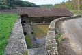
A lovely walk around Billy combining woodland and the banks of the Oisy, as well as the chance to discover a charming wash house.
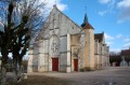
Around the village of Sougères-en-Puisaye
 4.64 mi
+305 ft
-295 ft
2h 25
Easy
Departure from Sougères-en-Puisaye (Yonne)
4.64 mi
+305 ft
-295 ft
2h 25
Easy
Departure from Sougères-en-Puisaye (Yonne)
Explore the hamlets on the outskirts of the village of Sougères-en-Puisaye.
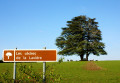
From the Church to Le Sully via the Cèdres de la Lavière
 8.21 mi
+404 ft
-417 ft
4h 05
Moderate
Departure from Sougères-en-Puisaye (Yonne)
8.21 mi
+404 ft
-417 ft
4h 05
Moderate
Departure from Sougères-en-Puisaye (Yonne)
Marked trail No. 10.
Discover the local heritage: ponds and old drinking troughs, crosses and calvaries, the Sully lime tree, and the cedars of La Lavière. Beautiful views of varied, rolling countryside punctuate this route, the length of which can be adapted to suit.
Although classified as a walking route, this route is also one of the most beautiful routes for mountain biking, hybrid cycling and horse riding.
The Druyes Viaduct and the Panama Valley
10.00 mi
+341 ft
-358 ft
4h 55
Moderate
Departure from Sougères-en-Puisaye (Yonne)
Marked route No. 11.
This route takes you to the small village of Druyes-les-Belles-Fontaines, passing through wooded areas and farmland. The return journey follows an old railway line. Between Les Roches and Pesselière, you can admire the cedars of La Lavière, and in Pesselières, the Sully tree as well as the ruins of the old castle.
The leisure trail along the old tracks
8.08 mi
+371 ft
-390 ft
4h 00
Moderate
Departure from Sougères-en-Puisaye (Yonne)
Route closed by municipal order dated 9 July 2026.
Marked walk No. 12.A route themed around recreational sport, following a section of an old railway line and a section of an ancient Roman road, with some wonderful heritage sites to discover.
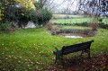
Les Quatre Arpents
 4.03 mi
+295 ft
-121 ft
2h 05
Easy
Departure from Sainpuits (Yonne)
4.03 mi
+295 ft
-121 ft
2h 05
Easy
Departure from Sainpuits (Yonne)
A pleasant route in all weathers, with plenty of springs at the end of the route. This route partly follows the path once taken by the ox-herders to drive the oxen from the Morvan to Paris.
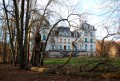
Walk in Sainpuits in the Forterre valleys towards the Roman road
 11.38 mi
+479 ft
-476 ft
5h 40
Moderate
Departure from Sainpuits (Yonne)
11.38 mi
+479 ft
-476 ft
5h 40
Moderate
Departure from Sainpuits (Yonne)
Marked trail No. 5.
At the crossroads of Puisaye, Forterre and the banks of the Nohain, this village invites you to discover its heritage and landscapes.
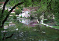
The tour of the fortified castle...without taking your eyes off it
 4.11 mi
+249 ft
-243 ft
2h 05
Easy
Departure from Druyes-les-Belles-Fontaines (Yonne)
4.11 mi
+249 ft
-243 ft
2h 05
Easy
Departure from Druyes-les-Belles-Fontaines (Yonne)
Medieval castle, viaduct, springs, washhouses and heritage, something to enjoy with the family !
If that's not enough, a little bungee jump to get the adrenaline pumping ?
Druyes-les-Belles-Fontaines is classified in the villages "Cities of character of Bourgogne-Franche-Comté".
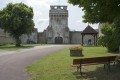
Blin Farm – Druyes Valley
 6.50 mi
+554 ft
-551 ft
3h 30
Moderate
Departure from Druyes-les-Belles-Fontaines (Yonne)
6.50 mi
+554 ft
-551 ft
3h 30
Moderate
Departure from Druyes-les-Belles-Fontaines (Yonne)
Marked hike N°51.
From the old medieval castle, discover a village built between an old, partly dried-up marsh and a cliff. Druyes Valley offers a green setting that contrasts with the chalky rocks that support the ruined building.
Les sources - The springs
 6.29 mi
+367 ft
-374 ft
3h 15
Easy
Departure from Lainsecq (Yonne)
6.29 mi
+367 ft
-374 ft
3h 15
Easy
Departure from Lainsecq (Yonne)
Marked hike N°8.
You will see no less than 8 fountains and 6 wash-houses on this rather easy hike, ideal for family walks. A few picnics spots are available here and there, to take a break and enjoy a relaxing moment (Fountain of the Moon, of the Pisserotte .....) Even though there are some hills along the way, it is a very pleasant walk with a lot of historical heritage spots to be discovered.
Also good for mountain biking.
 Entrains - Ouanne via the Roman road
15.69 mi
+1,234 ft
-1,033 ft
2 hrs
Moderate
Departure from Entrains-sur-Nohain (Nièvre)
Route along part of the Roman road linking Bourges to Auxerre, starting from Entrains-sur-Nohain (formerly Intaranum in Gallo-Roman times) in the Nièvre department to Ouanne (Odoana) in the Yonne department.From the vast expanses of woods and forests and the large plains of cultivated land, passing through two of the highest points in this region (367m and 368m), discover new spaces, views, fauna and flora on these limestone plateaus and hills.
Fougilet wash house and leisure trail
4.21 mi
+226 ft
-249 ft
2h 10
Easy
Departure from Sougères-en-Puisaye (Yonne)
Route closed by municipal order of 9 July 2021.
A short family walk featuring a few pieces of play equipment along the leisure trail. A really enjoyable outing for everyone.
From Thury to Lainsecq via the Montagne des Alouettes
 9.19 mi
+699 ft
-617 ft
4h 50
Moderate
Departure from Thury (Yonne) (Yonne)
9.19 mi
+699 ft
-617 ft
4h 50
Moderate
Departure from Thury (Yonne) (Yonne)
Pass by the Moulery wash house and the Roman road with panoramic views of Puisaye, Forterre, Frétoy Forest and Druyes Castle.
Between the Fossés Noirs and the Pierre Noire
 4.30 mi
+262 ft
-194 ft
2h 10
Easy
Departure from Thury (Yonne) (Yonne)
4.30 mi
+262 ft
-194 ft
2h 10
Easy
Departure from Thury (Yonne) (Yonne)
Starting from St Julien church, follow the paths to reach the Moulin de Hausse Côte.
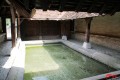
The wash houses
 13.88 mi
+974 ft
-945 ft
7h 15
Moderate
Departure from Thury (Yonne) (Yonne)
13.88 mi
+974 ft
-945 ft
7h 15
Moderate
Departure from Thury (Yonne) (Yonne)
Marked route No. 9.From wash house to wash house, passing close to old underground limestone quarries and ancient Neolithic and Palaeolithic sites, this route circles the commune. At each crossroads, you can head into the village centre. There are beautiful views along much of the route.Please note: this route is reserved for walkers. For mountain bikers, hybrid cyclists or horse riders, this route is designed for you.
The wash houses and thatched roofs of Thury by mountain bike
13.72 mi
+1,004 ft
-991 ft
2.5 hrs
Moderate
Departure from Thury (Yonne) (Yonne)
A mountain bike route for hiking enthusiasts, featuring natural and built heritage. A real treat! But do stay safe!
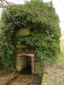
Springs, fountains and wash houses
 9.43 mi
+568 ft
-587 ft
4h 50
Moderate
Departure from Sainte-Colombe-sur-Loing (Yonne)
9.43 mi
+568 ft
-587 ft
4h 50
Moderate
Departure from Sainte-Colombe-sur-Loing (Yonne)
Marked trail No. 7.A hike focusing on springs and wash houses. All these springs feed the Paris Basin via the water table and the Seine via the Loing. Superbly well-marked route (No. 7) with no damage to the natural environment (no more paint on trees, monuments or houses). This route can be done on horseback or by mountain bike (in the opposite direction if possible).
On the heights of La Pisserote
 6.65 mi
+502 ft
-492 ft
3h 30
Moderate
Departure from Sainte-Colombe-sur-Loing (Yonne)
6.65 mi
+502 ft
-492 ft
3h 30
Moderate
Departure from Sainte-Colombe-sur-Loing (Yonne)
Suitable for walking, mountain biking or horse riding on the border between the Puisaye and Forterre regions. Beautiful heritage sites and interesting views.
On the Forterre side, the Moulin Buteau and the Source de la Pisserote
 4.20 mi
+210 ft
-190 ft
2h 05
Easy
Departure from Sainte-Colombe-sur-Loing (Yonne)
4.20 mi
+210 ft
-190 ft
2h 05
Easy
Departure from Sainte-Colombe-sur-Loing (Yonne)
A historical and cultural route on the border between Puisaye and Forterre, with some beautiful views.