Les Quatre Arpents

A pleasant route in all weathers, with plenty of springs at the end of the route. This route partly follows the path once taken by the ox-herders to drive the oxen from the Morvan to Paris.

Details

46729
Creation:
Last update:
Last review:
  • Walking
    Activity: Walking
  • ↔
    Distance: 4.03 mi
  • ◔
    Average duration: 2h 05 
  • ▲
    Difficulty: Easy

  • ⚐
    Back to start: No
  • ↗
    Ascent: + 295 ft
  • ↘
    Descent: - 121 ft

  • ▲
    Highest point: 1,073 ft
  • ▼
    Lowest point: 781 ft
  • ⚐ Country: France
  • ⚐
    Area: Puisaye
  • ⚐ City: Sainpuits (89520)
  • ⚑
    Start: N 47.518607° / E 3.257319°
  • ⚑
    End: N 47.555444° / E 3.274657°
  • ❏
    IGN map(s): Ref. 2521SB, 2522SB, 2621SB, 2622SB
  • Hour-by-hour weather

Photos

Description of the walk

Starting point: Place de l’Église (car park in front of the town hall or at the car-sharing area).
(S) Take the Route de Perreuse (Rue du Tilleul) for about 500 metres. Pass the housing estate on your left.

(1) Turn right onto the small dirt track (Chemin des Bœufs Gras), which will later take you round the Grande Breuille and the Petite Breuille. After crossing a small street, you’ll reach a junction with the main road (D7).

(2) Cross this road and take the dirt track. Go straight on at the first junction. You’ll reach the junction with a tarmac road.

(3) Turn left and continue along this tarmac road, which is quite narrow. You’ll come to a few houses and farm buildings. At the junction, turn left and head downhill to the next junction.

(4) Turn right. Turn right again and head down the road.

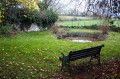
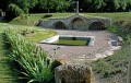
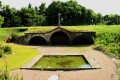
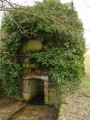
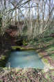
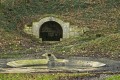
(5) Before the house on your right, take – for a round trip – a small path on the left leading to the fountain and the washhouse at La Guirtelle d’en Bas. Retrace your steps and turn left.

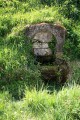
(6) Shortly after passing the Fontaine au Sucre on your right, turn left onto the dirt track. At the end of the track, take the tarmac road on the right which leads back up to the village of Lainsecq.
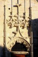
Turn left onto Rue du Village, then right onto Rue Traversière, and then right again to reach the foot of the church.
Take the footpath between the restaurant and the church, then turn left to cross the road and reach the Place du Champ de Foire.

Waypoints

  1. S : mi 0 - alt. 784 ft - Place de l’Église - Eglise Sainte-Marie-Madeleine de Sainpuits
  2. 1 : mi 0.23 - alt. 781 ft - On the right, the path known as the “Chemin des Boeufs Gras”
  3. 2 : mi 1.35 - alt. 883 ft - Crossing the D7
  4. 3 : mi 1.81 - alt. 912 ft - Junction with the tarmac road
  5. 4 : mi 2.98 - alt. 1,033 ft - Head towards the Guirtelle d’en Bas
  6. 5 : mi 3.13 - alt. 981 ft - Head towards the spring and the Guirtelle d’en Bas wash house
  7. 6 : mi 3.53 - alt. 948 ft - Leave the road and head onto the track
  8. E : mi 4.03 - alt. 951 ft - Place du Champ de Foire

Notes

There are plenty of springs, but the water is not safe to drink. In summer, don’t forget your hat – the sun is strong!
You’ll come across plenty of signposts along this route; ignore them for this hike, but they’ll be there to guide you next time.
This route can be tackled on a mountain bike or hybrid bike.

Worth a visit

From the finish point, there are some lovely routes to explore (the Saint-Martin fountains, the Pisserotte spring and washhouse, etc.) – maps and descriptions are available on this website.
The Chemin des Bœufs Gras is a very old track which was once used to drive cattle from the Morvan to the capital.

Reviews and comments

4.6 / 5
Based on 3 reviews

Reliability of the description
4.7 / 5
Ease of following the route
4.7 / 5
Route interest
4.3 / 5
POULIN Gérard
POULIN Gérard ★

Hello Boispille,
You’ve got a bit lost – but why? Was it the route description, the route marked on the IGN map, or simply a momentary lapse of concentration?

Machine-translated

Boispille
Boispille

Overall rating : 4 / 5

Date of your route : Sep 17, 2019
Reliability of the description : ★★★★☆ Good
Ease of following the route : ★★★★☆ Good
Route interest : ★★★★☆ Good

I got a bit lost... I didn’t finish the right route...

Machine-translated

pitiflo
pitiflo

Overall rating : 4.7 / 5

Date of your route : Jul 01, 2018
Reliability of the description : ★★★★★ Very good
Ease of following the route : ★★★★★ Very good
Route interest : ★★★★☆ Good

A perfect description:
a walk set off at the crack of dawn in the company of roe deer and hares!
Some sections can be a bit tricky due to the vegetation, but with good walking boots it’s no problem. The route alternates between shaded paths and a few sections that are quite exposed to the sun (but as I set off early, it wasn’t an issue).
As for the app’s guidance, it gives you a clear reminder if you stray from the route :-)

Machine-translated

chogui
chogui

Thank you.
I’d also forgotten to mention how pleased I was
to see that many hedges have been replanted in this area.
A huge thank you to everyone involved!!!!!!!

Machine-translated

POULIN Gérard
POULIN Gérard ★

Hello Chogui,
Thank you for your feedback on the walk. This walk is, in essence, a route linking two villages. You were right to point out that it’s possible to return to the starting point via this route. When you say ‘across the fields’, it’s actually a path that has only very recently been opened up.
I can see you’re a keen hiker in this area, and I’d like to thank you very much for that – and especially for sharing your very constructive feedback with us.
Perhaps we’ll bump into each other on a path one day,

Machine-translated

chogui
chogui

Overall rating : 5 / 5

Date of your route : Jun 10, 2017
Reliability of the description : ★★★★★ Very good
Ease of following the route : ★★★★★ Very good
Route interest : ★★★★★ Very good

A lovely walk with beautiful scenery.
Don’t forget your cap in hot weather!!!!!
To avoid retracing your steps, take the paths opposite Lainsecq cemetery that go via Vaurimbert
Bois Brulé and Champ Martin, then turn right across the fields towards Les Champs Du Moulin.

Machine-translated

Other walks in the area

For more walks, use our search engine .

The GPS track and description are the property of this route's author. Please do not copy them without permission.