


Refine your search for walks in Dommary-Baroncourt
Dommary-Baroncourt walks
 Amel Pond
 Visorando Member
 4.86 mi
 +46 ft
 -46 ft
 2h 15
2h 15
 Easy
Easy
 Departure from Senon (Meuse)
The Étang d’Amel, owned by the Conservatoire d’espaces naturels de Lorraine, was designated, along with the adjoining land, as a Regional Nature Reserve in 2006 by the Lorraine Regional Council.
The Étang d’Amel nature route, which runs through the villages of Senon and Amel-sur-l’Étang, features information boards and two observation points. This allows you to watch the birds without disturbing them.
Route des Fontaines
 2.49 mi
+92 ft
-72 ft
1h 15
Easy
Departure from Mercy-le-Bas (Meurthe-et-Moselle)
2.49 mi
+92 ft
-72 ft
1h 15
Easy
Departure from Mercy-le-Bas (Meurthe-et-Moselle)
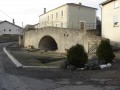
A beautiful walking route amongst the old stone buildings, tunnel fountains and the countryside.
Although described as a walking route, this route can also be tackled by mountain bike (in which case, adjust the starting point due to road signage; see description).
 Between Fontaines and Charpont
 5.88 mi
+322 ft
-318 ft
1.5 hrs
5.88 mi
+322 ft
-318 ft
1.5 hrs
 Moderate
Departure from Mercy-le-Bas (Meurthe-et-Moselle)
Moderate
Departure from Mercy-le-Bas (Meurthe-et-Moselle)
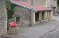
A route for fitness enthusiasts and walkers, for fans of beautiful photos, and lovers of peace and nature.
Mercéenne Valley
 5.68 mi
+243 ft
-269 ft
2h 50
Easy
Departure from Mercy-le-Bas (Meurthe-et-Moselle)
5.68 mi
+243 ft
-269 ft
2h 50
Easy
Departure from Mercy-le-Bas (Meurthe-et-Moselle)
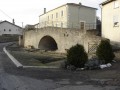
Set in a very pretty rural setting with lush green valleys and a traditional village.
The Yellow Witch’s Walk
2.73 mi
+259 ft
-259 ft
1h 30
Moderate
Departure from Fillières (Meurthe-et-Moselle)
Famous for its Witches’ Festival, Fillières also offers lovely countryside and woodland walking trails. This walk through the woods will let you discover the charms of the Crusnes through the seasons.
The path is currently impassable due to fallen trees. Forestry work is not yet complete.
The Blue Witch’s Walk
3.77 mi
+240 ft
-230 ft
1h 55
Easy
Departure from Fillières (Meurthe-et-Moselle)
Famous for its Witches’ Festival, Fillières also offers lovely walking trails. This one combines a walk through the forest with country lanes. It runs alongside the River Crusnes and offers you peaceful spots to recharge your batteries in the heart of nature.
 From Conflans-Jarny (station) to the Metz conurbation (Lorry-lès-Metz)
17.20 mi
+1,099 ft
-915 ft
2 hrs
Moderate
Departure from Jarny (Meurthe-et-Moselle)
The second part of the stage from Conflans-Jarny station is a route along small country roads back to Metz. The grounds of Moncel Castle near Jarny are an ideal spot for a break. From the Montvaux Valley, which we pass through, it is easy to reach the southern part of the Metz conurbation.
Walk in the Azannais
6.05 mi
+509 ft
-505 ft
3h 15
Easy
Departure from Azannes-et-Soumazannes (Meuse)
A very pleasant walk with sweeping views.
Walk through the Lorraine Regional Park
 14.79 mi
+427 ft
-446 ft
7h 10
Moderate
Departure from Jarny (Meurthe-et-Moselle)
14.79 mi
+427 ft
-446 ft
7h 10
Moderate
Departure from Jarny (Meurthe-et-Moselle)
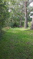
A walk in Jarnisy, in the land of the iron mines. You’ll walk through fields, woods and alongside marshes, and discover the eco-village of Ville-sur-Yron. You’ll be able to admire the village architecture, traditional Lorraine-style dwellings, the building materials used, and the history reflected in the landscape and the symbolic sites still visible today: the church, the mill, the wash house and the labourers’ cottage.
Verdun battlefields
5.63 mi
+449 ft
-463 ft
3h 00
Easy
Departure from Fleury-devant-Douaumont (Meuse)
Connect, in 9 km, the memorial, the destroyed village of Fleury, the ossuary, the Zigzag Trench and Fort Douaumont.
Around Douaumont
7.61 mi
+840 ft
-866 ft
4h 15
Moderate
Departure from Fleury-devant-Douaumont (Meuse)
A route steeped in the history of the Great War.This route offers a chance to explore the woods replanted following the 1914–1918 war between France and Germany.There are several historical remains to explore, such as bunkers, shelters and buildings including the Douaumont Ossuary and Fort Douaumont.
From the Verdun Memorial to Bezonvaux via Fort Douaumont
 Association / Club / Walk leader
 10.83 mi
+840 ft
-833 ft
5h 45
Moderate
Departure from Fleury-devant-Douaumont (Meuse)
10.83 mi
+840 ft
-833 ft
5h 45
Moderate
Departure from Fleury-devant-Douaumont (Meuse)
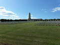
This walk takes you past many ruined structures, a destroyed village, monuments, memorial stones and recently restored trenches. It passes by Fort Douaumont and the Douaumont Cemetery. Look carefully at the ground – you’ll still find plenty of shell fragments and sometimes even whole shells.
Along the Chiers between Lexy and Cons-la-Grandville
 6.30 mi
+433 ft
-456 ft
3h 15
Moderate
Departure from Lexy (Meurthe-et-Moselle)
6.30 mi
+433 ft
-456 ft
3h 15
Moderate
Departure from Lexy (Meurthe-et-Moselle)
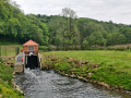
A walk along the Chiers, on a mainly tarmac-surfaced and easily accessible route. This walk takes you close to former industrial and production sites that are now disused. In the tranquillity of the forest, imagine the hum of activity from days gone by still echoing amongst the trees and the remnants of the past.
The Crête des Éparges
 4.99 mi
+574 ft
-571 ft
2h 50
Moderate
Departure from Les Éparges (Meuse)
4.99 mi
+574 ft
-571 ft
2h 50
Moderate
Departure from Les Éparges (Meuse)
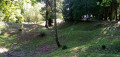
A memorial hike on a site where very deadly battles took place between February and April 1915, considered by some historians to be a prelude to the Battle of Verdun (nearby), which was triggered a year later. Several monuments and numerous remains mark the route, including impressive craters left by huge explosions.
Lachaussée Pond and its satellite lakes
 8.99 mi
+30 ft
-30 ft
4h 10
Moderate
Departure from Lachaussée (Meuse)
8.99 mi
+30 ft
-30 ft
4h 10
Moderate
Departure from Lachaussée (Meuse)
Listed as a Regional Nature Reserve, the Lachaussée pond has remained in its natural state. Many birds have made their home there or stop off during their migration. It is a haven of peace for flora and fauna.Please note: it is forbidden to stray from the existing paths, particularly around the ponds, otherwise you may be liable for a hefty fine.
Mining heritage in Lasauvage and Fond-de-Gras
 13.12 mi
+1,142 ft
-1,135 ft
7h 00
13.12 mi
+1,142 ft
-1,135 ft
7h 00
 Difficult
Departure from Differdange (Luxembourg (Country))
Difficult
Departure from Differdange (Luxembourg (Country))
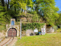
Lasauvage and Fond-de-Gras are must-see sites for understanding the mining history of this cross-border region.The railway line between Fond-de-Gras and Pétange was built in the 19th century to facilitate the transport of iron ore from the hills to the steelworks and foundries located on the plain.The narrow-gauge network, which can be seen in both Lasauvage and Fond-de-Gras, was used to transport the ore from the underground mine galleries to the transfer points.Fond-de-Gras, formerly known as the Lamadelaine industrial station, has now become a living museum of the region’s mining and industrial past and houses magnificent relics from days gone by. It is also the home of the ‘Train 1900’ and ‘Minièresbunn’ (underground) tourist trains, which operate mainly at weekends and on public holidays from May to September.
The Mines in Differdange
 10.53 mi
+1,004 ft
-1,020 ft
5h 45
Moderate
Departure from Differdange (Luxembourg (Country))
10.53 mi
+1,004 ft
-1,020 ft
5h 45
Moderate
Departure from Differdange (Luxembourg (Country))
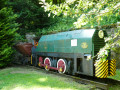
The mines, the mines of yesterday, the iron mines... this is the main theme of this hike.Fond-de-Gras is the most informative site on this subject: it was the station where narrow-gauge trains converged to unload iron ore into standard-gauge wagons bound for the steelworks and blast furnaces of Pétange, Differdange and others in Belgium and Germany.
Terres Rouges between Esch-sur-Alzette and Kayl
 11.33 mi
+1,079 ft
-1,106 ft
6h 10
Moderate
Departure from Esch-sur-Alzette (Luxembourg (Country))
11.33 mi
+1,079 ft
-1,106 ft
6h 10
Moderate
Departure from Esch-sur-Alzette (Luxembourg (Country))
This magnificent walk takes you on a journey of discovery through the former mining sites operated by the A.R.B.E.D between Esch-sur-Alzette, Schifflange and Kayl. It is offered by the CFL (Luxembourg's railway company) as part of its Hike & Rail range of hiking trails from station to station and has been slightly modified by us at the start and finish.
Gorze Abbey and the Rocher de la Pucelle
 5.82 mi
+919 ft
-896 ft
3h 30
Moderate
Departure from Gorze (Moselle)
5.82 mi
+919 ft
-896 ft
3h 30
Moderate
Departure from Gorze (Moselle)
A walk offering views of Gorze from various angles, including Gorzia, the statue of the Virgin of Saint-Blin, the cemetery, the Rocher de la Pucelle, Saint-Clément Chapel, the Altar of the Lepers, and Saint-Étienne Collegiate Church.
From the 1st century onwards, the springs of Gorze were harnessed by the Romans to supply Divodorum (now Metz) with water via an underground conduit and an aqueduct (one of the longest in Europe). Most of Gorze’s springs still supply the town.
Nature and heritage around Gorze
 4.87 mi
+676 ft
-686 ft
2h 50
Moderate
Departure from Gorze (Moselle)
4.87 mi
+676 ft
-686 ft
2h 50
Moderate
Departure from Gorze (Moselle)
Between nature and heritage, cross the Graoully Forest, descend into the "Fond de la Gueule", discover the mysterious Saint-Clément Chapel and its altar, small cliffs, the Rocher de la Pucelle, and end your walk at the Benedictine abbey of Gorze and its abbey palace.