


Refine your search for walks in Courgenay
Courgenay walks


 Around Courgenay
 Visorando Member
 5.32 mi
 +308 ft
 -322 ft
 2h 45
2h 45
 Easy
Easy
 Departure from Courgenay (Yonne)
Listening to the Cistercian Abbey of Vauluisant, discover the monks’ irrigation system, the old flour mill, the Saint-Thomas gate, the old farms of Vauluisant, La Singerie and the Vauluisant State Forest.
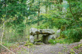
The Lancy Dolmen
 4.11 mi
+135 ft
-131 ft
2h 00
Easy
Departure from Saint-Maurice-aux-Riches-Hommes (Yonne)
4.11 mi
+135 ft
-131 ft
2h 00
Easy
Departure from Saint-Maurice-aux-Riches-Hommes (Yonne)
A discovery route around the Lancy Dolmen, situated in the Vauluisant State Forest.
The coat-of-arms-adorned boundary stones of the Vauluisant Forest
 3.77 mi
+266 ft
-285 ft
2h 00
Easy
Departure from Saint-Maurice-aux-Riches-Hommes (Yonne)
3.77 mi
+266 ft
-285 ft
2h 00
Easy
Departure from Saint-Maurice-aux-Riches-Hommes (Yonne)
In this forest, the boundary markers bear the coats of arms of three lords: Cardinal Louis de Bourbon-Vendôme, the Briçonnet-Raguier couple and the de Belleville brothers. These boundary markers must have been set in the ground around 1550, following disputes over the respective boundaries of their estates.
The Bezeaux Spring and Les Hauts de Flacy
6.28 mi
+397 ft
-397 ft
3h 15
 Moderate
Departure from Flacy (Yonne)
Moderate
Departure from Flacy (Yonne)
After admiring the church dedicated to Saint-Loup and the wash house dating from 1877, head towards the Hauts de Flacy via the Source Bézeaux and the Flacy forest.
Discovering the Postolle
2.25 mi
+217 ft
-217 ft
1h 15
Easy
Departure from La Postolle (Yonne)
Discover the village of La Postolle: the Church of Saint Joseph and Saint Fiacre, the Bollée windmill built in 1898, and its remarkable trees.
Around Les Clérimois
 10.03 mi
+705 ft
-709 ft
5h 15
Moderate
Departure from Les Clérimois (Yonne)
10.03 mi
+705 ft
-709 ft
5h 15
Moderate
Departure from Les Clérimois (Yonne)
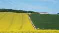
A long walk through the countryside around Les Clérimois, with a stop in each hamlet and at the Saint-Hubert Chapel.
The Vanne Hills circular route
 5.65 mi
+479 ft
-476 ft
3h 00
Easy
Departure from Chigy (Yonne)
5.65 mi
+479 ft
-476 ft
3h 00
Easy
Departure from Chigy (Yonne)
From Chigy (Les Vallées de la Vanne) to Pont-sur-Vanne, this trail passes through natural sites included in the European Natura 2000 network, which recognises the richness of their flora and fauna.
The dry grasslands on chalk offer significant and unique floral diversity. The view over the Vanne valley is breathtaking.
Information boards along the route explain the site’s natural riches.
The Champ-Fêtu Forest
 7.56 mi
+538 ft
-525 ft
3h 55
Moderate
Departure from Vareilles (Yonne) (Yonne)
7.56 mi
+538 ft
-525 ft
3h 55
Moderate
Departure from Vareilles (Yonne) (Yonne)
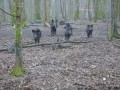
From Vareilles, discover the beautiful Champs-Fêtu forest, reforested at the end of the 18th century. You will walk along the wild boar park and arrive at the old Champ-Fêtu farm and its 35-metre giant sequoia.
Discovering Vareilles
 3.85 mi
+138 ft
-138 ft
1h 55
Easy
Departure from Vareilles (Yonne) (Yonne)
3.85 mi
+138 ft
-138 ft
1h 55
Easy
Departure from Vareilles (Yonne) (Yonne)
All around this route, you will find signs with QR codes telling you about the history of the places you encounter.
 Pont-sur-Vanne, Les Clérimois, Chigy, starting from Vareilles
13.58 mi
+440 ft
-466 ft
2.5 hrs
Moderate
Departure from Vareilles (Yonne) (Yonne)
A lovely cycle ride that takes in some interesting paths at the start of the Champagne Crayeuse (Natura 2000 site) and along the River Vanne.A ride between the Pays d’Othe and the Champagne Crayeuse. A beautiful viewpoint halfway along the route, overlooking the Vanne Valley as far as the eye can see.
Vaudeurs and the hilltop hamlets from Vareilles
 15.42 mi
+715 ft
-715 ft
2.5 hrs
15.42 mi
+715 ft
-715 ft
2.5 hrs
 Difficult
Departure from Vareilles (Yonne) (Yonne)
Difficult
Departure from Vareilles (Yonne) (Yonne)
A walk through the Vareilles Valley to Vaudeurs along a quiet little road, then back via the hilltop hamlets surrounding this pretty valley. A few disused wells along the route, a Bollée windmill and a medieval tower, the Salazar Tower.
Between Vareilles and Pont-sur-Vanne via Chigy
7.76 mi
+49 ft
-49 ft
1.5 hrs
Easy
Departure from Vareilles (Yonne) (Yonne)
A short, flat, easy walk or cycle (suitable for all types of bikes).Along the way, you’ll discover, amongst other things: the Ferme des Prés (a listed dovecote), the Ru de Vareilles, the village of Pont-sur-Vanne, the old railway line from Sens to Troyes, the Vanne (a Category 1 river), the Paris water pumping station in Chigy, the Lavoir à Moutons, the narrow streets of Chigy, the Fontaine Saint-Léger, and the church in Vareilles.
The Bérulle Iron Trail
 3.46 mi
+469 ft
-443 ft
2h 00
Easy
Departure from Bérulle (Aube)
3.46 mi
+469 ft
-443 ft
2h 00
Easy
Departure from Bérulle (Aube)
A walk through the Forêt d'Othe to discover iron mining in the Middle Ages. A route marked with information panels.
Chapelle Sainte-Reine route
6.89 mi
+522 ft
-509 ft
3h 35
Moderate
Departure from Bérulle (Aube)
Walk in the Forest of Othe on the border of the Yonne department.
The village of Bérulle itself is already very pretty.
But the forest paths are charming and peaceful, very pleasant!
Montagne Julien Trail
 Tourist office
 5.89 mi
+620 ft
-597 ft
3h 15
Easy
Departure from Villiers-Louis (Yonne)
5.89 mi
+620 ft
-597 ft
3h 15
Easy
Departure from Villiers-Louis (Yonne)
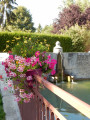
This circular walk, which presents no major difficulties, offers varied and picturesque scenery (open views and woodland) along minor roads, tracks and forest paths.
The Villiers-Louis Bell Tower Circular Walk
 4.33 mi
+518 ft
-522 ft
2h 25
Easy
Departure from Villiers-Louis (Yonne)
4.33 mi
+518 ft
-522 ft
2h 25
Easy
Departure from Villiers-Louis (Yonne)
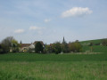
This easy circular walk follows clear paths that skirt the village of Villiers-Louis, allowing you to explore its church and the surrounding countryside.
The Vaumort Menhir Route
4.50 mi
+427 ft
-430 ft
2h 25
Easy
Departure from Vaumort (Yonne)
A walk around Vaumort, taking in its church, the Vallimaurais goat farm and the ‘Pierre aux Sorciers’ menhir, before heading up towards the forest and the Vaumartin valley.
Around the Orvin
9.07 mi
+82 ft
-82 ft
4h 15
Moderate
Departure from Fontaine-Fourches (Seine-et-Marne)
A gentle, almost flat circular route through the plain bathed by the Orvin, a small river which flows into the Seine. The farm tracks you’ll follow wind through this vast plain, taking you to the banks of the Seine at Athis and then along the Orvin.