The Vaumort Menhir Route

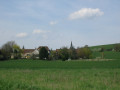
A walk around Vaumort, taking in its church, the Vallimaurais goat farm and the ‘Pierre aux Sorciers’ menhir, before heading up towards the forest and the Vaumartin valley.

Details

n°283249
Creation:
Last update:
Last review:
  • Walking
    Activity: Walking
  • ↔
    Distance: 4.50 mi
  • ◔
    Average duration: 2h 25 
  • ▲
    Difficulty: Easy

  • ⚐
    Back to start: Yes
  • ↗
    Ascent: + 427 ft
  • ↘
    Descent: - 430 ft

  • ▲
    Highest point: 650 ft
  • ▼
    Lowest point: 331 ft

Description of the walk

(S/E) Start at Place de l’Église Saint-Jean-Baptiste, head along the grassy path which joins the road after 850m.

(1) Turn sharply left and follow Route de la Collate downhill for 360 metres.
Take the first path on the right towards the D905. Cross it and follow the grassy path opposite, which joins the Route des Vauliards.

(2) Turn left and continue to the crossroads 110 metres ahead.

(3) Turn right onto the Route de Villeuneuve and continue left onto the Route de Dixmont.

(4) After 330 metres, continue along Rue de la Lampe, passing the goat farm and the old wash house.

(5) At the junction, turn right onto Rue de la Lampe and follow the road past the ‘Menhir la Pierre aux Sorciers’.

(6) Turn right onto the path, Rue du Terrier, which climbs the hill for 1.750km.

(7) Turn sharply left. Follow the path through the woods for 160 metres. Walk down along the edge of the forest for 1 km and continue for a further 300 metres. Join the small road and follow it to the right for 300 metres.

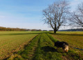
(8) Turn left onto the grassy path until you reach the stony track. Turn right and head down the track.

(6) Carry on straight ahead along Rue du Terrier. Cross the D905 and head up Chemin de l’Église opposite.
Turn left and you’ll reach the car park (S/E).

Waypoints

  1. S/E : mi 0 - alt. 486 ft - Saint-Jean-Baptiste Church Square
  2. 1 : mi 0.52 - alt. 381 ft - Route de la Collate
  3. 2 : mi 0.88 - alt. 331 ft - Route des Vauliards
  4. 3 : mi 0.96 - alt. 331 ft - Route de Villeuneuve
  5. 4 : mi 1.18 - alt. 358 ft - Rue de la Lampe
  6. 5 : mi 1.35 - alt. 341 ft - Turn right towards the menhir
  7. 6 : mi 1.52 - alt. 348 ft - Rue du Terrier
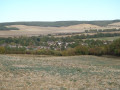
  8. 7 : mi 2.59 - alt. 636 ft - Vaumartin Valley
  9. 8 : mi 3.58 - alt. 410 ft - Grassy path on the left
  10. S/E : mi 4.5 - alt. 489 ft - Saint-Jean-Baptiste Church Square

Worth a visit

(S/E) 13th-century Church of Saint John the Baptist

(4) Producer of goat’s cheese and free-range poultry – visits to the goat farm available by appointment
EARL du Vallimaurais, 13bis Rue Lampe
Tel: 03-86-88-34-15

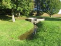
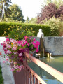
(5) At the junction, on the left, note the old wash house.
Then, 40 metres further on to the left, stands a menhir known as ‘la Pierre aux Sorciers’ on private property.

Reviews and comments

5 / 5
Based on 1 review

Reliability of the description
5 / 5
Ease of following the route
5 / 5
Route interest
5 / 5
Sometimes
Sometimes

Overall rating : 5 / 5

Date of your route : May 04, 2025
Reliability of the description : ★★★★★ Very good
Ease of following the route : ★★★★★ Very good
Route interest : ★★★★★ Very good
Very busy route : No

A really lovely walk, with some beautiful views along the route.

Machine-translated

Other walks in the area

For more walks, use our search engine .

The GPS track and description are the property of this route's author. Please do not copy them without permission.