Around the Orvin

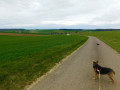
A gentle, almost flat circular route through the plain bathed by the Orvin, a small river which flows into the Seine. The farm tracks you’ll follow wind through this vast plain, taking you to the banks of the Seine at Athis and then along the Orvin.

Details

n°53180332
Creation:
Last update:
Last review:
  • Walking
    Activity: Walking
  • ↔
    Distance: 9.07 mi
  • ◔
    Average duration: 4h 15 
  • ▲
    Difficulty: Moderate

  • ⚐
    Back to start: Yes
  • ↗
    Ascent: + 82 ft
  • ↘
    Descent: - 82 ft

  • ▲
    Highest point: 282 ft
  • ▼
    Lowest point: 194 ft

Description of the walk

Park at Fontaine-Fourches, on Rue de Nonat before the junction with Rue Saint-Martin

(S/E) Take Rue Saint-Martin for a few metres to the left and head down Route de Cercy to the right. Turn left immediately (Rue aux Ouches), which continues as a track.

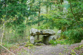
(1) At the end, take the path on the right and, when you reach the woods, turn left. Pass the Bas-de-Fourches washhouse and continue until you reach a road (Rue du 19 mars 1962).

(2) Turn right, then, after an industrial building, turn left. Cross a track on the left, then arrive at a three-way junction.

(3) Turn slightly to the right. The path winds its way through the fields.

(4) Pass under the high-voltage power line. Further on, ignore a path on the right, cross a stream, and come out onto the D411.

(5) Cross carefully and continue straight on into Villiers-sur-Seine. At thefourth junction (a green space with a bench), turn right onto Rue de la Place des Fêtes and head towards the church.

(6) Turn right, then take thefirst street on the left (Rue du Four d’Athis). The road crosses the Orvin and enters Athis. You can just make out the Seine through the fairly dense trees. Before the next junction, a few steps hidden amongst the vegetation lead down to the riverbank: a few steps further on, more steps are blocked by a gate.

(7) Turn right immediately, cross back over the D411 (take great care) and carry on straight ahead. The path joins the Vieil Orvin, then crosses the Orvin and ends at the Ru de Fontenoy.

(8) Turn right and follow the stream. The path veers to the left, crosses the stream and reaches thefirst houses of Cercy.

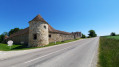
(9) Do not enter the hamlet but, before the farm, turn right. The path leads to a bridge over the Orvin (wash house). Cross the road without going over the bridge and continue straight on along the woodland. The path winds pleasantly.

(10) Cross a small road (D120) and carry on straight ahead. Ignore a path on the right.

(11) Do not follow thePR® route shown on the map, but turn right just before the Moulin de la Folie, which you may have spotted a little earlier. The path continues but is not maintained, and it is not possible to cross the property as shown on the IGN map. Join the tarmac road at the entrance to the mill. Turn left at the junction and follow the tarmac road for about 200 m.

(12) Take the path on the right, which further on turns sharply left. Immediately afterwards, turn right along the edge of the woodland, then right again to enter it. At the bottom of the steep slope leading to Fontaine-Fourches, there is another wash house. Climb the steep slope.

(13) Head towards the church on the right and go round the back of it. Join Rue Saint-Martin and follow it straight on to reach the car park 600 metres further on.

Waypoints

  1. S/E : mi 0 - alt. 276 ft - Fontaine-Fourches. Rue de Nonat
  2. 1 : mi 0.33 - alt. 249 ft - End of street x footpath
  3. 2 : mi 0.71 - alt. 226 ft - End of the path
  4. 3 : mi 1.42 - alt. 210 ft - Three-Way Junction
  5. 4 : mi 1.81 - alt. 203 ft - Under the high-voltage power line
  6. 5 : mi 3.08 - alt. 197 ft - D411
  7. 6 : mi 3.57 - alt. 194 ft - Église Saint-Agnan (Villiers-sur-Seine)
  8. 7 : mi 4.24 - alt. 197 ft - Athis - Seine [la]
  9. 8 : mi 5.57 - alt. 200 ft - Ru de Fontenoy
  10. 9 : mi 6.12 - alt. 207 ft - Entrance to Cercy
  11. 10 : mi 7.21 - alt. 223 ft - Crossing the D120
  12. 11 : mi 7.69 - alt. 223 ft - Moulin de la Folie
  13. 12 : mi 8.08 - alt. 230 ft - Crossroads
  14. 13 : mi 8.54 - alt. 276 ft - Church of Fontaine-Fourches
  15. S/E : mi 9.07 - alt. 276 ft - Fontaine-Fourches. Rue de Nonat

Notes

This walk was originally mapped out by Codérando 77 but has been modified to avoid a poorly signposted and uninteresting section.

(1) ThisPR® route appears on the IGN map, but with a route error at Moulin de la Folie (see description).
Yellow markings (which, of course, are absent on the farm tracks in the middle of the fields).

Please note: between (13) and (S/E), the yellow markings suggest turning off Rue Saint-Martin to the right onto Rue de Maupertuis, but the path is not maintained (nettles); the route round the school is obvious but poorly signposted.

Always be cautious and plan ahead when you're outdoors. Visorando and the author of this route cannot be held responsible for any accidents occurring on this route.

The GR® and PR® markings are the intellectual property of the Fédération Française de Randonnée Pédestre.

Reviews and comments

4.2 / 5
Based on 2 reviews

Reliability of the description
4.5 / 5
Ease of following the route
5 / 5
Route interest
3 / 5
User 24836069

Overall rating : 4 / 5

Date of your route : Sep 14, 2026
Reliability of the description : ★★★★☆ Good
Ease of following the route : ★★★★★ Very good
Route interest : ★★★☆☆ Average
Very busy route : No

It’s a lovely walk.
Less busy.
It’s a bit uncertain at the start. Border of private property.
The rest of the route is through open countryside.
There’s a short stretch through the town of Villiers-sur-Seine halfway along the route.
Most of the route runs through the countryside.

Machine-translated

ealet
ealet

Overall rating : 4.3 / 5

Date of your route : Jun 26, 2025
Reliability of the description : ★★★★★ Very good
Ease of following the route : ★★★★★ Very good
Route interest : ★★★☆☆ Average
Very busy route : No

An easy walk, but lacking in variety; the path winds through fields and gets a bit monotonous towards the end; avoid doing it in hot weather as you’re out in the open almost the whole time; you’ll see plenty of well-preserved wash houses,
thanks to the author for sharing this

Machine-translated

Other walks in the area

For more walks, use our search engine .

The GPS track and description are the property of this route's author. Please do not copy them without permission.