The Villiers-Louis Bell Tower Circular Walk

This easy circular walk follows clear paths that skirt the village of Villiers-Louis, allowing you to explore its church and the surrounding countryside.

Details

n°11042353
Creation:
Last update:
Last review:
  • Walking
    Activity: Walking
  • ↔
    Distance: 4.33 mi
  • ◔
    Average duration: 2h 25 
  • ▲
    Difficulty: Easy

  • ⚐
    Back to start: Yes
  • ↗
    Ascent: + 518 ft
  • ↘
    Descent: - 522 ft

  • ▲
    Highest point: 663 ft
  • ▼
    Lowest point: 364 ft

Photos

Description of the walk

Red markings
Start from the car park at Place de la Mairie.

(S/E) Walk round the village hall and head up the street called Place de la Mairie, which soon turns into a track.

(1) At the crossroads, follow the path on the left to the Dames Douces goat farm.

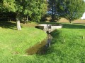
(2) Turn left onto the path that descends in a straight line, leaving a street on your left. At the end of the path, turn right before the D40 and follow the path that runs alongside the road. You’ll see the Vanne aqueduct in the distance.

(3) At the first path you come to, turn left and cross the road with care. Opposite, follow the path down into the valley for several tens of metres, then at the junction, turn left towards the village, following the Ravin de la Vallée. You’ll come to a crossroads (with a view of the 1636 dovecote in the distance).

(4) Turn right and head up the path towards the church.

(5) Turn right onto the road, walk past the cemetery, go round it and head up the path that runs past a pine copse.

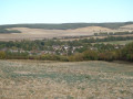
(6) Turn right onto the path that climbs up to the crossroads. Then turn left onto the path running alongside an orchard; continue along this path, which curves to the right and overlooks the village to the left (you will see the water tower and the first houses of the hamlet of Haut-de-Villiers in the distance).

(7) Turn sharply left and go round the wooded ravine (Fossé de Vaublus), then head downhill for several hundred metres to the sports ground. Immediately afterwards, turn right onto Rue de l’Étang and follow it to the D40, which runs through the village. At the end of Rue de l’Étang, turn right onto Grande Rue and leave the village via the road until you reach the ‘Miel Julien Henry’ sign, at the entrance to the first track on the left. Take this track and follow it straight on for about 400 metres. Pass the honey farm, then continue along the track to the next junction. Cross Rue Colatte, and continue straight ahead along the track to the four-way crossroads.

(1) Turn left here, heading back in the opposite direction along the path you took on the way there, to reach the car park at Place de la Mairie (S/E).

Waypoints

  1. S/E : mi 0 - alt. 420 ft - Car park at the Town Hall square
  2. 1 : mi 0.37 - alt. 551 ft - Communal junction (out and return)
  3. 2 : mi 0.56 - alt. 545 ft - Turn left at the junction
  4. 3 : mi 1.02 - alt. 387 ft - Crossing the D 40
  5. 4 : mi 1.38 - alt. 390 ft - Crossroads. View of the dovecote
  6. 5 : mi 1.65 - alt. 443 ft - Junction. Towards the cemetery
  7. 6 : mi 1.91 - alt. 502 ft - Turn right at the junction
  8. 7 : mi 2.61 - alt. 663 ft - Hairpin bend
  9. S/E : mi 4.33 - alt. 420 ft - Car park at the Place de la Mairie

Notes

The route offers very little shelter, so you should bring a hat and water during hot weather.

For your safety, please avoid using this route during the traditional hunting season from 1 October to 28 February.

The sections through woods and forests must be followed on country lanes; entering any woodland (even communal woodland) is prohibited. Please take care.

Worth a visit

Reviews and comments

4.3 / 5
Based on 2 reviews

Reliability of the description
4.5 / 5
Ease of following the route
5 / 5
Route interest
3.5 / 5
Rico Ayr
Rico Ayr

Overall rating : 4.7 / 5

Date of your route : Oct 19, 2026
Reliability of the description : ★★★★★ Very good
Ease of following the route : ★★★★★ Very good
Route interest : ★★★★☆ Good
Very busy route : Yes

A lovely walk we went on in the autumn – the perfect time of year for it.

Machine-translated

CR_10
CR_10

Overall rating : 4 / 5

Date of your route : Apr 29, 2024
Reliability of the description : ★★★★☆ Good
Ease of following the route : ★★★★★ Very good
Route interest : ★★★☆☆ Average
Very busy route : No

A well-described route that is easy to follow. Stage 7, starting from the descent along the ravine, follows a grassy path.
It’s a bit of a shame that the route takes you back almost to the centre of the village, but there doesn’t seem to be any other option.
An enjoyable walk overall.

Machine-translated

Other walks in the area

For more walks, use our search engine .

The GPS track and description are the property of this route's author. Please do not copy them without permission.