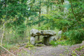
The coat-of-arms-adorned boundary stones of the Vauluisant Forest

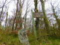
In this forest, the boundary markers bear the coats of arms of three lords: Cardinal Louis de Bourbon-Vendôme, the Briçonnet-Raguier couple and the de Belleville brothers. These boundary markers must have been set in the ground around 1550, following disputes over the respective boundaries of their estates.

Details

25904733
Creation:
Last update:
Last review:
  • Walking
    Activity: Walking
  • ↔
    Distance: 3.77 mi
  • ◔
    Average duration: 2h 00 
  • ▲
    Difficulty: Easy

  • ⚐
    Back to start: Yes
  • ↗
    Ascent: + 266 ft
  • ↘
    Descent: - 285 ft

  • ▲
    Highest point: 712 ft
  • ▼
    Lowest point: 482 ft

Photos

Description of the walk

Starting point: the Henri Pickford Monument. Parking available nearby.

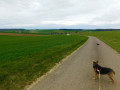
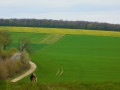
(S/E) Facing the monument, walk a few metres to the left, then turn sharply left onto the straight path between the fields. At the road, turn right towards Courgenay.

(1) Just before the edge of the woods, turn right onto the path.

(2) Look out for the boundary stone bearing a coat of arms on both sides. Carry on straight ahead, then turn right, following the edge of the woodland.

(3) Cross the D110 and take the path below which initially runs alongside it before veering away to reach the edge of the woodland. Continue along the path, which then turns right and continues along the edge of the woodland.

(4) When you reach the southern corner, enter the woodland on your left, cross the hollow and look out for thesecond coat-of-arms marker on your right, about 100 m away. Then turn right and take the narrow path. Carry on straight ahead.

(5) A few metres before you leave the woodland, on your right, you’ll find a large flat stone. Leave the woodland and turn right onto the village path. Go round the edge of the woodland and continue to the right to rejoin the D110.

(3) Follow it, turning left towards Chaume: take care. Enter the village and carry on until you reach the junction with the main street (Rue du Tilleul).

(6) Turn right, walk past a magnificent lime tree and head towards the Pickford Monument (S/E).

Waypoints

  1. S/E : mi 0 - alt. 528 ft - Pickford Monument
  2. 1 : mi 0.39 - alt. 554 ft - Edge of the woods
  3. 2 : mi 0.69 - alt. 617 ft - Coat-of-arms marker
  4. 3 : mi 1.33 - alt. 620 ft - D110 road
  5. 4 : mi 1.96 - alt. 689 ft - Coat-of-arms marker
  6. 5 : mi 2.26 - alt. 696 ft - Flat stone
  7. 6 : mi 3.57 - alt. 482 ft - Rue du Tilleul
  8. S/E : mi 3.77 - alt. 528 ft - Pickford Monument

Worth a visit

H. Pickford, aged 19, a rear gunner on a bomber, was shot down by German fighters during the night of 3 to 4 May 1944.

Reviews and comments

4.7 / 5
Based on 2 reviews

Reliability of the description
5 / 5
Ease of following the route
4.5 / 5
Route interest
4.5 / 5
Gingin
Gingin

Overall rating : 4.7 / 5

Date of your route : Aug 18, 2025
Reliability of the description : ★★★★★ Very good
Ease of following the route : ★★★★☆ Good
Route interest : ★★★★★ Very good
Very busy route : No

A very easy hike that is accessible to beginners like me who are new to this activity. The hike is scheduled to take two hours. It took me an hour and ten minutes at a brisk pace.
There was a small mistake in the signposting between points 4 and 5. Nothing too serious, but the GPS indicated that we had strayed from the route for 10 minutes.
A hike not to be missed 😉

Machine-translated

boucles d'or
boucles d'or

Overall rating : 4.5 / 5

Date of your route : Apr 14, 2023
Reliability of the description : Not used / Not applicable
Ease of following the route : ★★★★★ Very good
Route interest : ★★★★☆ Good
Very busy route : No

A leisurely, slightly undulating walk. I combined it with the ‘Le Dolmen de Lancy’ route;
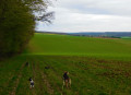
The sort of routes my dogs and I love – wide open spaces with very few people about

Machine-translated

Other walks in the area

For more walks, use our search engine .

The GPS track and description are the property of this route's author. Please do not copy them without permission.