Around Les Clérimois

A long walk through the countryside around Les Clérimois, with a stop in each hamlet and at the Saint-Hubert Chapel.

Details

n°276563
Creation:
Last update:
Last review:
  • Walking
    Activity: Walking
  • ↔
    Distance: 10.03 mi
  • ◔
    Average duration: 5h 15 
  • ▲
    Difficulty: Moderate

  • ⚐
    Back to start: Yes
  • ↗
    Ascent: + 705 ft
  • ↘
    Descent: - 709 ft

  • ▲
    Highest point: 778 ft
  • ▼
    Lowest point: 394 ft

Photos

Description of the walk

The route starts in the centre of the village of Les Clérimois. You can park in the centre of the village, opposite the school, or along the even-numbered side of the Grande Rue.

(S/E) Follow the Grande-Rue towards Fontaine la Gaillarde. Proceed to the first junction.

(1) Carry on straight ahead until you reach the village boundary; the path on the left will be the return route. At the three-way junction, take the road on the right. Pass through the hamlet of La Bardoue, carry on straight ahead along the tarmac road and cross the motorway bridge.

(2) After the motorway bridge, take the road on the right which runs alongside the A5 for about 2 km.

(3) At the junction with Route de Voisines in the oak forest, turn right, cross the motorway bridge and you will see the Chapel of Saint-Léonard.

(4) Cross the motorway bridge again and turn right to continue alongside the motorway for 450 metres.
The path curves to the left as it passes the Colombier farm. Carry on straight ahead.

(5) Walk past the goniometer and carry on to La Goujauderie farm.

(6) Opposite the farm, follow the sloping path on the right which runs closer to the motorway and leads to a junction.

(7) Turn right and go under the motorway via the underpass used by farm machinery. Continue along the left-hand side of the motorway for 470 metres.

(8) Turn right onto the path that leads downhill and go under the power line. Cut across a path and continue to the junction with the Route de Foissy (D46).

(9) Take the road on the right for 300 metres, then take the first path on the left. Walk alongside the Bois de Narveau for 1,200 metres, then cross through it. On leaving the woods, turn left and join a tarmac road.

(10) Follow this tarmac road to the right and head up to the hamlet of Les Caves. At the exit, 600 metres on the left, leave the road and take the second junction onto a sloping track.

(11) After 450m, at the next junction, take the grassy, sloping path on the right which leads back up towards the village. After 300m, turn left, then after 270m turn right.

(12) Turn right onto Chemin des Vignes and then left onto Chemin de la Grosse Montagne to reach the junction you passed on the way out.

(1) Turn right onto the Grande Rue and continue to the car park in the village (S/E)

Waypoints

  1. S/E : mi 0 - alt. 771 ft - Village centre
  2. 1 : mi 0.16 - alt. 768 ft - Meeting point for the outward and return journeys
  3. 2 : mi 1.42 - alt. 696 ft - Bridge over the motorway
  4. 3 : mi 3.06 - alt. 755 ft - Junction at the A5 bridge
  5. 4 : mi 3.17 - alt. 758 ft - Saint-Léonard Chapel
  6. 5 : mi 3.93 - alt. 768 ft - The goniometer
  7. 6 : mi 4.44 - alt. 692 ft - La Goujauderie Farm
  8. 7 : mi 5.03 - alt. 633 ft - Turn right towards the motorway
  9. 8 : mi 5.51 - alt. 617 ft - Path leading downhill to the right
  10. 9 : mi 6.52 - alt. 397 ft - Turn right onto the D46
  11. 10 : mi 7.84 - alt. 436 ft - Exit from the Bois de Narveau
  12. 11 : mi 8.97 - alt. 525 ft - Old well
  13. 12 : mi 9.76 - alt. 764 ft - Chemin des Vignes
  14. S/E : mi 10.03 - alt. 771 ft - Village centre

Notes

Parking is available in the village centre, opposite the school; otherwise, along the even-numbered side of the main street.

Worth a visit

On the Grande Rue, there is a well approximately 100 metres deep.

In La Bardoue
The houses here belong to Fontaine-la-Gaillarde. There is a former tile works with its brick kiln on the shaded path to the right.
The construction of the motorway brought to light some low furnaces, used for iron production and dating from the early Christian era. One example is on display at the museum in Sens.

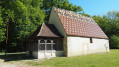
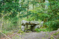
(4) The Chapel of Saint-Léonard is a former village church that has fallen into disrepair due to the ravages of time and human neglect.
The first mention of the chapel dates from 1637.

On the road to La Goujauderie, the Colombier farm;
(5) An old goniometer on the right. Everyone in Clérimois called it the ‘radar’. Built in the 1950s and occupied by the military for a few years, it was sold at auction and converted into a residential property.

Along the motorway, a superb view over the Vanne Valley and the Pays d’Othe.

(10) On emerging from the Narveau woods, a very beautiful view of Les Caves and Les Clérimois.

(11) In the middle of the fields, a concrete slab covers the well that supplied the village with water until 1966. As the flow was no longer sufficient, it fell into disuse following the commissioning of the new water network and the new water tower.

Reviews and comments

4.2 / 5
Based on 2 reviews

Reliability of the description
4.5 / 5
Ease of following the route
4.5 / 5
Route interest
3.5 / 5
dwarfclimb
dwarfclimb

Overall rating : 4.3 / 5

Date of your route : Apr 26, 2026
Reliability of the description : ★★★★★ Very good
Ease of following the route : ★★★★★ Very good
Route interest : ★★★☆☆ Average
Very busy route : No

A lovely, quiet circular route offering varied scenery with a few challenging climbs. The presence of tarmac roads and the section running alongside the motorway detracts somewhat from the experience.
For those looking for points of interest, the old well is a little further on from Point 11 (Altitude 175 m, 48.22469°N, 3.44470°E); it is a concrete slab in the middle of the fields with a pile of stones on top – a ‘cairn’?
The short detour to St Léonard’s Chapel is not to be missed. Locked. Visits by appointment.
The “Goniometer” (former radar station), converted into a private residence, is situated 500 m before Point 5 on the map, on the right (personal observation: the house has a certain “brutalist” charm).
No designated picnic area, which is quite normal as we’re in the middle of nowhere.
Best done on a clear day for the views.

Machine-translated

Loi
Loi

Overall rating : 4 / 5

Date of your route : Jan 20, 2025
Reliability of the description : ★★★★☆ Good
Ease of following the route : ★★★★☆ Good
Route interest : ★★★★☆ Good
Very busy route : No

Machine-translated

Other walks in the area

For more walks, use our search engine .

The GPS track and description are the property of this route's author. Please do not copy them without permission.