Montagne Julien Trail

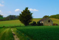
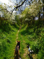
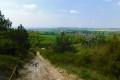
This circular walk, which presents no major difficulties, offers varied and picturesque scenery (open views and woodland) along minor roads, tracks and forest paths.

Details

11042326
Creation:
Last update:
Last review:
  • Walking
    Activity: Walking
  • ↔
    Distance: 5.89 mi
  • ◔
    Average duration: 3h 15 
  • ▲
    Difficulty: Easy

  • ⚐
    Back to start: Yes
  • ↗
    Ascent: + 620 ft
  • ↘
    Descent: - 597 ft

  • ▲
    Highest point: 741 ft
  • ▼
    Lowest point: 410 ft

Photos

Description of the walk

The route starts from the car park at the Place de la Mairie.

Blue signposting

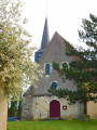
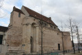
(S/E) Turn into Rue du Ruisseau. At the top of the short hill, you can take a detour along Rue de la Tour to discover, about 60 metres away, a 17th-century dovecote, now converted into a lodge. Go round Saint-Martin’s Church, built in the 15th and 16th centuries, on the left, and follow the tarmac road. Walk past the cemetery, turn right and continue along the road to its end (beautiful view of the village).

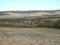
(1) A few dozen metres before the wayside cross, take the path on the left, then carry on straight ahead (view to the right over the Vanne valley and the villages of Theil-sur-Vanne and Pont-sur-Vanne).

(2) At the T-junction, turn right for about a hundred metres, then turn left and head down the path to the edge of a wood, then carry on to the end of the path. Opposite, enter the wood and follow the path which climbs and winds through the woodland until it meets a forest track.

(3) Turn left and carry on for a long way, keeping straight on – the path becomes winding towards the end – until you reach the D 225 (Route des Clérimois).

(4) On the road, head left for about fifty metres, then take the first path on the right. After the left-hand bend, carry on alongside the woodland.

(5) At the first junction, turn right and walk past the hunting lodge. After the small woodland, walk alongside the fields. At the crossroads, ignore the path on the right leading to the Grande Chatière farm and continue straight on for about a hundred metres.

(6) Turn left and enter the woodland via a path, which you should follow until you reach the edge of the woodland. In the distance, you can make out the village of Fontaine-la-Gaillarde. Continue along the path with a small copse on your left and a field on your right.

(7) Once you’ve left the woods, at the second T-junction, turn left and follow the path uphill to the hamlet of Haut de Villiers.

(8) When you reach the D225, turn left onto the road and follow it until you leave the hamlet.

(9) After house number 56, turn right onto Chemin de Vaublus and, at the first junction, take the first path leading down to the right, running alongside the Vaublus ravine on the left. At the end of the woodland, continue to the next crossroads.

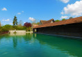
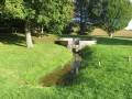
(10) Turn left and walk past the sports ground. Carry on straight ahead along Chemin de la Montagne Blanche, which continues as a sunken lane until you reach the wash house. Turn right into Rue de l’Église and, immediately after the wash house, take the grassy path on the left alongside the wash house until you reach Rue du Ruisseau. At the crossroads, turn right back towards the car park at the town hall square (S/E).


Waypoints

  1. S/E : mi 0 - alt. 417 ft - Car park at the Place de la Mairie
  2. 1 : mi 0.52 - alt. 558 ft - Junction after the wayside cross
  3. 2 : mi 0.76 - alt. 568 ft - First T-junction
  4. 3 : mi 1.22 - alt. 581 ft - Junction at the edge of the woodland
  5. 4 : mi 2.31 - alt. 741 ft - Junction with the D225
  6. 5 : mi 2.55 - alt. 702 ft - Junction before the hunting lodge
  7. 6 : mi 2.84 - alt. 692 ft - Junction before the woodland
  8. 7 : mi 3.64 - alt. 466 ft - Second T-junction
  9. 8 : mi 4.46 - alt. 682 ft - The hamlet of Haut de Villiers
  10. 9 : mi 4.76 - alt. 702 ft - Junction at the exit from the hamlet
  11. 10 : mi 5.43 - alt. 492 ft - Junction before the City-Stade
  12. S/E : mi 5.89 - alt. 417 ft - Car park at the Place de la Mairie

Notes

For your safety, please avoid using this route during the traditional hunting season from 1 October to 28 February.

Sections through woods and forests must be followed on rural tracks; entering any woodland (even communal woodland) is prohibited. Please take care.

Worth a visit

At (4), you can shorten the circular route by taking the D225 as far as the first houses in the hamlet of Haut de Villiers, then turning left at (9) and rejoining the route to head back down to Villiers-Louis.

(8) Next to kilometre marker no. 7, the wayside shrine was built on the spot where Saint Louis is said to have rested in 1239, whilst leading the procession carrying Christ’s crown of thorns from Villeneuve-l’Archevêque to Sens.

(10) The washhouse was inaugurated on 5 July 1864.

Reviews and comments

4.6 / 5
Based on 3 reviews

Reliability of the description
4.7 / 5
Ease of following the route
4.7 / 5
Route interest
4.3 / 5
Lilyane Dav
Lilyane Dav

Overall rating : 4.7 / 5

Date of your route : Jul 25, 2025
Reliability of the description : ★★★★★ Very good
Ease of following the route : ★★★★★ Very good
Route interest : ★★★★☆ Good
Very busy route : No

We enjoyed this tour. Congratulations to those who organised it. We didn't encounter any difficulties

Machine-translated

Philippe89320
Philippe89320

Overall rating : 4 / 5

Date of your route : Dec 14, 2024
Reliability of the description : ★★★★☆ Good
Ease of following the route : ★★★★☆ Good
Route interest : ★★★★☆ Good
Very busy route : No

A lovely walk, with a good bit of it through the woods. Make sure you take a high-visibility jacket.

Machine-translated

OT Sens
OT Sens ★

Thank you for sharing your thoughts on this walk! We’re delighted that you enjoyed the natural scenery and heritage sites along the way!
See you soon on the trails of the Sénonais!
The team at the tourist office

Machine-translated

Daniele.melain@orange.fr

Overall rating : 5 / 5

Date of your route : Aug 23, 2021
Reliability of the description : ★★★★★ Very good
Ease of following the route : ★★★★★ Very good
Route interest : ★★★★★ Very good
Very busy route : No

A very well-signposted route. A very pleasant walk through woods and across vast fields, with beautiful panoramic views.
The village of Villiers-Louis has several points of interest: a dovecote, the church’s pretty bell tower and a wash house..

Machine-translated

Other walks in the area

For more walks, use our search engine .

The GPS track and description are the property of this route's author. Please do not copy them without permission.