Country:
 City:
City:


Set off from the village town hall; parking is available nearby at the kerb.
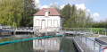
(S/E) With your back to the Town Hall, turn right and take Rue de l’Église. Go round the church on your right, then turn left onto Chemin des Vaches and head for the Saint-Léger Fountain.
(1) After taking in the view, carry on to the end of the tarmac road.
(2) Turn onto the grassy path to the left, then, at the corner of the first field, turn right. You’ll reach a stream after the 90° left-hand bend.
(3) Cross the bridge over the stream and carry on straight ahead. At the edge of the woods, turn left, enter Pont-sur-Vanne and keep left until you reach the church.
(4) Carry on to the right, then left, along Grand’Rue. Cross the bridge over the Vanne and walk a few metres to the left along Chemin de la Petite Gravelle to see the flood gauges.
(5) Return to the road, continue left along the Grand’Rue and the D660, then turn right at the three-way junction onto the Route des Clerimois. At the three-way junction, keep right and you’ll soon reach the Arcades aqueduct in Pont-sur-Vanne (supplying water to Paris).
(6) Carry on along the road, then turn off onto the first path climbing to the right. Follow a chalky path (Natura 2000 site) to reach the ridge, then a fork at the end of the clearing. Beautiful panoramic views of the Vanne valley to the right and the ‘Queue de Chimay’ to the left.
(7) First turn right then left, and continue along a grassy track until you reach a road, near a wind turbine and a water tower.
(8) Follow it to the left, keeping the wind turbines on your left, and at the junction, keep to the right. Enter Les Clérimois; at the end of the D225, turn right and carry on straight ahead to the Minimalist Church of Les Clérimois (explanation on a sign), at number 18.
(9) Carry on to the right along Chemin des Clerimois aux Caves, and follow this road to the next junction.
(10) Ignore the tarmac and follow the grassy path that runs alongside the D660, then cross it carefully to take the next path on the left. Carry on straight ahead and you’ll soon reach the banks of the Vanne.
(11) A good spot to take a break and enjoy the river. Head right over the footbridge, go deeper into the woods, then you’ll soon emerge onto a meadow; continue along the Vanne until you reach a bridge over it.
(12) Turn left across the bridge and carry on straight ahead until you reach the junction with the D175. Follow it to the left and you’ll reach Rue du Maroy, at the corner of No. 5.
(13) Take this street, then carry on straight ahead along the grassy path until you rejoin the route you took on the way there.
(2) At the junction, turn left back onto the road, carry on straight ahead at the next junction, then turn right to reach Vareilles Town Hall (S/E).
 Visorando Member
 Difficult
 Easy
Easy  Tourist office