


Refine your search for walks in Charnier de signes
Charnier de signes walks


 On the trail of Manon des Sources - Le Mémorial de Signes
 Visorando Member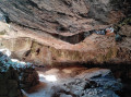
 9.55 mi
 +797 ft
 -810 ft
 5h 05
5h 05
 Moderate
 Departure from Signes (Var)
On this walk you'll discover some of the locations used to film Manon des Sources and Jean de Florette (1986): the Grotte de Mounoï cave, the dried-up stream and the Villa Renard - the hunchback's house.
This route will also let you discover the Vallon des Martyrs, with its monument commemorating resistance fighters executed by the SS in 1944. All along the walk you'll experience incredible Provence landscapes and the Sainte-Baume.
Les Coins de Manon and the Signes Mass Grave Memorial
 6.17 mi
+814 ft
-837 ft
3h 35
6.17 mi
+814 ft
-837 ft
3h 35
 Difficult
Departure from Cuges-les-Pins (Bouches-du-Rhône)
Difficult
Departure from Cuges-les-Pins (Bouches-du-Rhône)
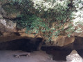
We visit several locations where scenes from the films “Jean de Florette” and “Manon des Sources” were filmed. We set off from the car park at the large hairpin bend on the climb to Riboux, 3 km above Ok Corral, the theme park, located 3 km from Cuges-Les-Pins.
Walks near Charnier de signes
A night in Sainte Baume
17.29 mi
+3,780 ft
-3,563 ft
2 days
Moderate
Departure from Cuges-les-Pins (Bouches-du-Rhône)
A beautiful two-day hike starting from Cuges, climbing to the ridges of Sainte Baume where the panoramic views across the whole of Provence and the Alps are magnificent. Descent via the Col du Saint-Pilon and the Grotto of Mary Magdalene, steeped in history and spirituality. Overnight stay at the Hostellerie de la Sainte Baume. The following day, the descent takes you past the Huveaune springs, La Taurelle farm, then the picturesque Source des Nayes and Saint-Zacharie.
At both ends of the route, the walk is accessible via the free public transport network of the Pays d’Aubagne et de l’Étoile.
From Cuges to the Hostellerie via the Col du Saint Pilon
8.71 mi
+3,222 ft
-1,660 ft
6h 50
Difficult
Departure from Cuges-les-Pins (Bouches-du-Rhône)
This walk connects Cuges-les-Pins to the Hostellerie (Plan d’Aups), passing through the Sainte-Baume ridges, the Col du Saint-Pilon and the Grotto of Mary Magdalene. On the ridges, the 360-degree panoramic views are magnificent. The Grotto of Mary Magdalene is steeped in history and spirituality, as it is said that the saint spent the last 30 years of her life there.
This walk is the first stage of a two-day trip, fully accessible via the free bus network of the Pays d’Aubagne et de l’Étoile. The walk starts from Cuges-les-Pins (free bus route 11). At the end of the first day’s walk, the Hostellerie de la Sainte Baume offers affordable accommodation. The following day, the walk continues from the Hostellerie to Saint-Zacharie (free bus routes 8 and 9).
The Jas de Sylvain
8.78 mi
+1,647 ft
-1,765 ft
5h 30
Moderate
Departure from Cuges-les-Pins (Bouches-du-Rhône)
A lovely walk above Cuges-Les-Pins. The Jas de Sylvain is a restored former sheepfold which offers free overnight accommodation for a few walkers in basic comfort. Beautiful panoramic views over the Cuges plain. The walk is accessible at the start and finish via the free Pays d’Aubagne et de l’Étoile bus route No. 11.
From the Hostellerie to Saint-Zacharie via La Taurelle
8.56 mi
+591 ft
-1,919 ft
4h 25
Moderate
Departure from Plan-d'Aups-Sainte-Baume (Var)
This lovely walk starts at the Hostellerie de la Sainte-Baume and heads to Saint-Zacharie. It passes through the fabulous site of the Huveaune springs, where the water forms waterfalls from one pool to the next. It’s all completely natural. It’s one of the region’s most beautiful spots, especially when there’s water. The trail then passes through the pretty Taurelle valley before descending towards the Source des Nayes and Saint-Zacharie.
From Carnoux to Cassis via La Croix
5.34 mi
+361 ft
-1,056 ft
2h 45
 Easy
Departure from Carnoux-en-Provence (Bouches-du-Rhône)
Easy
Departure from Carnoux-en-Provence (Bouches-du-Rhône)
A very lovely walk linking Carnoux to Cassis through the hills. Panoramic views of Cassis and Sainte Baume. Botanical trail. The walk is fully accessible by bus.
From Cassis to La Ciotat via the ridge trail
6.48 mi
+1,703 ft
-1,706 ft
4h 30
Moderate
Departure from Cassis (Bouches-du-Rhône)
The walk connects two charming towns via the ridge path on top of the Falaises Soubeyranes. Magnificent views along much of the route.
GPS strongly recommended.
The coastline between Six-Fours and Sanary
 6.27 mi
+453 ft
-374 ft
3h 15
Moderate
Departure from Six-Fours-les-Plages (Var)
6.27 mi
+453 ft
-374 ft
3h 15
Moderate
Departure from Six-Fours-les-Plages (Var)
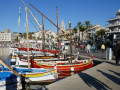
This easy route will take you to Bonnegrâce Beach and the wild coastline of Sanary, as well as offering a glimpse into the history of this cradle of underwater exploration.
From Peypin to La Destrousse via the Col du Marseillais
6.20 mi
+1,365 ft
-1,680 ft
4h 00
Moderate
Departure from Peypin (Bouches-du-Rhône)
This lovely walk, winding from valley to valley, takes you from Peypin to the Col du Marseillais. Stunning views of Sainte-Victoire, as well as of Roquevaire and the Huveaune valley from the pass. Then the descent back down to the village of La Destrousse.
- The walk is accessible at the start and finish via the free bus network of the Pays d’Aubagne et de l’Etoile (line 17).
From La Penne-sur-Huveaune to Carnoux via La Candolle
8.75 mi
+1,785 ft
-1,276 ft
5h 35
Moderate
Departure from La Penne-sur-Huveaune (Bouches-du-Rhône)
This beautiful walk connects the village of La Penne-sur-Huveaune with Carnoux-en-Provence via the hills. Magnificent panoramic views of the Ruissatel, the Garlaban, the Huveaune valley, the Escourtines valley and Marseille. A lovely stretch through the Candolle cliff. Botanical trail.
From La Penne-sur-Huveaune to Le Charrel via La Candolle
5.32 mi
+1,099 ft
-1,040 ft
3h 25
Easy
Departure from La Penne-sur-Huveaune (Bouches-du-Rhône)
A lovely walk starting from La Penne-sur-Huveaune that takes you through pine forests to the summit of La Candolle. An easy path winds its way along the cliff face, offering magnificent views of Sainte-Baume, the Huveaune valley, Garlaban and the Bay of Marseille. The descent takes you back down to La Pérussonne and Le Charrel. The free bus on Line 6, which connects with the free tram, takes you back to the starting point, and the tram takes you back to the city centre.
You are in the Calanques National Park, which is subject to specific regulations. Failure to comply with these regulations may result in a fine of up to €1,500.