


 Country:

 City:
City:


The starting point is the Hostellerie de la Sainte Baume. Car parks nearby.
(S) With your back to the Hostellerie entrance, take the path opposite, cross the departmental road (D80) and the car park heading north. On your right is the pilgrim’s shop. Take a path slightly to the right that leads towards the forest and northwards.
When you reach a track, take it to the right. You’ll cross a track with a water tank on the left, marked PAS 6. Go straight on along the small path opposite. A mix of stones, moss and trees. Very beautiful. Ignore a path branching off to the left; continue to the right. The path crosses a track; take the small path opposite. You’ll arrive at a small platform.
(1) Keep to the right, then immediately turn left onto the path that descends alongside the platform. Enter the Vallon de la Castelette. Be careful, as the descent can be slippery in places. You’ll reach a junction on the flat path.
(2) Ignore the path to the left leading to the Castelette cave. Instead, take the one that descends to the right. You’ll reach the Huveaune springs (which may be dry on the day of your visit); look out for a wide path that descends below a step on the left.
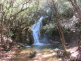
(3) Take this path: you’ll see posts protecting the springs with wire. Cross the wooden bridge on the right and look out for the source of the Huveaune just above the bridge on the right. The waterfalls stretch along the left-hand side for several hundred metres. Further on, at the crossroads, turn left onto the path that slopes down slightly. Then turn right to emerge into a large pine-tree-lined clearing, an ideal spot for a picnic. Continue to the left and follow the red/white and red/yellow markings at a cross-country track.
(4) Take this track to the left (heading west). Pass an uphill track on your right and go through a gate.
(5) Cross a bridge over the Huveaune and take the track on your right. Ignore a path branching off to the right; continue along the track until you reach a junction with another track.
(6) Ignore the Red/Yellow and Red/White signposted path branching off to the right and follow the Yellow markings to the left. Cross the Taurelle plain and reach a pass.
(7) Then descend to a gate.
(8) Go through it and, following the yellow and blue markings, follow the D480 to the right for about 200 m. Look out for a path starting on the right.
(9) Take this path. Do not take the track branching off to the right. At a sharp bend, ignore a path climbing up to the right and continue to a junction where you’ll cross a wide track.
(10) Turn left onto this track (signposted: Saint Zacharie, 1h35). A little further on, on the right, you’ll see Notre-Dame d’Orgnon perched on its rocky outcrop. Pass through a gate, behind which lies the D480 (Angèle Bridge).
(11) Just after the barrier, head down a small path on the right and join the Ruisseau de Peyruis. Follow it towards the source of Les Nayes. A lovely path runs alongside the stream bed, occasionally crossing the road, until you reach the Oratory of Saint-Lazare. You are now in Orgnon. Head down to the right, heading west, for a few dozen metres, then turn right onto the path that runs alongside the D480. Pass a water tank, then a kilometre marker indicating that Saint-Zacharie is 2 km away.
You’ll reach a junction with a DFCI fire track and a barrier on the left. Continue straight ahead along the tarmac road for about 150 metres.
(12) Take a path on the left. Here you’ll find the remains of a Roman road. At the next crossroads, turn left onto a lovely path through the forest. Pass through a clearing before reaching the Source des Nayes: a very beautiful, well-maintained spot.
(13) At its westernmost point, a sign points towards the Tourist Office. Follow it and cross a bridge on the right to join the tarmac road called Chemin des Nayes (toilets on the left). At the junction, carry straight on to stay on the Chemin des Nayes. At the next junction, turn right, join the Chemin du Plan d’Aups and turn left. Leave Avenue Jean Moulin on your right and carry on straight ahead. You’ll arrive at Place du 4 Septembre (end of the yellow signposting).
(14) Follow the D560 (Rue Jean Jaurès) to the right until you reach the Bar des Sports. The finish is at the bus stop: Saint Zacharie Centre Ville (E).

 Visorando Member
 Extremely difficult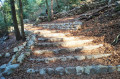
 Easy
Easy 
 Difficult
