Country:
 City:
City:


The starting point is the church at La Penne-sur-Huveaune. There is a car park at the Post Office and on the D8N. The best option is to come by the free bus. From Aubagne station, take the T tram to the swimming pool, then take line 6 towards La Penne-sur-Huveaune, getting off at the “Place de l’Église” stop.
(S) Head due south, keeping the church on your right and the post office on your left. Walk past the cemetery and join Chemin Raymond Retor after house number 6.
Yellow markings
(1) Take this path, then follow Rue Jacqueline Pourrière to the left until you reach a side street opposite No. 35. Turn left and you’ll find yourself beneath an aqueduct.
(2) Pass under the aqueduct and continue uphill through the forest along the track marked ‘No Entry’. At the small car park, ignore the road branching off to the left and go through the barrier opposite. Continue along the track marked CQ122, which is closed to all traffic. You’ll reach a three-way junction.
(3) Turn left onto the track that climbs and, at the next junction, keep right onto the path that climbs, ignoring a track that descends to the left. Ignore a path branching off to the left, pass under the power line and arrive at a Fork in the road. Follow the track climbing to the left and arrive at a right-hand bend.
(4) Follow the path that heads uphill to the left. The sign reads “Sommet de la Candolle 40 mins”. At the next junction, turn left and then keep left at the fork. Take the steps, then turn left at the next junction to reach the ridge and a Fork in the road.
Red and yellow markings
(5) Head left onto the path that climbs. At the Fork in the road, turn left, ignore a path leading uphill to the right, then follow the path along the cliff face. The section may be a little dizzying, but the path is wide. Take care.
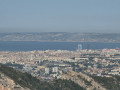
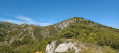
Enjoy the beautiful panoramic view over Penne-sur-Huveaune, Marseille, Allauch, Aubagne, Le Garlaban, Le Ruissatel and La Sainte-Baume.
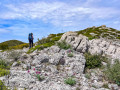
Climb a short, easy section between the rocks; further on, do not take the path branching off to the left but stay on the marked trail. Reach the summit of La Candolle and a track.
End of signposting
(6) Continue straight on, heading due south. A little further on, pass a track on the left and find the start of a path on the right a few metres before a junction.
Yellow and red-and-yellow markings
Ignore this path and head for the junction.
(7) Take the track on the left. Follow this whilst enjoying the view of Cap Canaille, pass under a power line and arrive at a wide track that descends to the left.
(8) Carry on straight ahead, ignoring another track on the same side, until you reach a four-way junction.
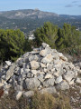
(9) Turn right onto the path leading downwards, walk past the underground cistern on the left, then, a little further on, you’ll come to a path coming from the left. Ignore this and head for the one marked by a cairn a few metres further on.
(10) Follow this narrow path southwards and you’ll come across the markings again a little further on. After a steep but not difficult descent, you’ll reach a track.
(11) Turn left onto it to follow the bottom of a canyon and reach a tarmac road.
(12) Turn left, go under the railway bridge and follow the quiet road. Pass under the railway line again, ignore a track branching off to the left and carry on straight ahead. Ignore the track marked CQ112 branching off to the right and follow the road uphill. As soon as it starts to descend, look for a signposted path on the right with a sign on a post reading ‘2h05 Carnoux-en-Provence via Languillard’.
(13) Follow this path, go under the railway line, turn left and then cross a path. Continue straight on, climbing, then turn left. At the next fork, take the path that climbs to the right and join a track.
(14) Cross it and take the path that climbs opposite, joining the same track a little further up. Follow this to the right and, shortly afterwards, take the signposted path that branches off to the left. Follow this lovely path through a pine forest until you reach a fork.
Yellow markings
(15) Ignore the path on the left, marked in yellow and red and yellow, which leads down to Aubagne, but take the one opposite that goes uphill. Turn left at the next junction just ahead and follow the botanical trail until you reach a track.
(16) Walk up it for a few metres, then take the path branching off to the left and heading uphill. Pass under a power line, then leave the path that descends to the right. You’ll reach the orientation table with benches where you can sit and admire the view.
(17) After enjoying the view, continue along the track to the right (westwards) and you’ll soon reach a multi-way junction.
Pale blue markings
Ignore the track on the right marked with yellow signposting and continue to the left. At the fork in the road with a car park on the left, go straight on and, at the next fork, keep left. Pass a track branching off to the left towards the cemetery and continue straight on until you reach a three-way junction.
(18) Turn left, pass a track branching off to the right and then a path to the left immediately afterwards, and arrive at a gate.
(19) Go through the gate, take the tarmac road (Avenue Jean Bart) on the right, then come to a concrete road with two gates leading down to the left. Take this road and, at the junction, turn right (Avenue Maurice Ravel). At the next junction, turn right onto Avenue Hector Berlioz and continue onto Avenue Claude Debussy.
(20) Head straight ahead, continue to the left then turn right onto Rue des Genêts, then turn left onto Rue des Lauriers Roses, and continue to the right onto Rue de la République.
(21) Turn left just after No. 4 and before the Résidence de l’Esplanade. At the end of the street, note the magnificent cedar tree at the hotel-restaurant and turn right. Walk past the Town Hall and turn left onto Boulevard du Maréchal Alphonse Juin; after about a hundred metres, you’ll reach the roundabout and the “Notre-Dame d’Afrique” bus stop (E).

 Visorando Member
 Easy
Easy 
 Association / Club / Walk leader