Country:
 City:
City:


The start of the walk is in La Penne-sur-Huveaune, at the bus stop on Line 6 called “Place de l’Église”.
(S) Cross the road to head towards the church. Head due south along Boulevard Jean-Jacques Rousseau, walk past the cemetery, then turn right towards the crèche.
(1) Turn left onto Chemin Raymond Retor, pass under the aqueduct, heading towards Chemin des Arcades. Further on, you’ll come to a small tarmac car park.
(2) Ignore the tarmac road on the left and take the dirt track on the right behind the barrier. Do not take the first path on the right, but continue along the track. Another path joins from the right; carry on straight ahead and do the same at the next path, which branches off to the left and heads uphill. When you reach a wide track, turn left onto it. Shortly after a sharp bend to the left, a path branches off to the right.
(3) Turn onto this path and head uphill, following the yellow markings. About a hundred metres further on, ignore the path branching off to the left marked with a Yellow Cross. Continue until you reach a bend to the left followed by a bend to the right.
(4) At the bend, take the path marked with yellow signs which branches off to the left, above the track. Follow the sign for “Sommet de la Candolle 40 min”. At the first junction, turn left, following the yellow markings, and at the next junction turn left again. Just after this, at a Fork in the road, take a moment to admire the view to the right, then return to the Fork in the road and continue along the route to the right, heading south.
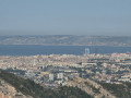
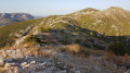
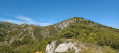
At a fork in the road, turn left towards the east, following the yellow markings. View of the Garlaban. The path winds its way uphill towards La Candolle then levels out: superb views of the Huveaune Valley, the Bay of Marseille, the Garlaban and Sainte-Baume.
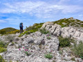
Do not take the path coming in from the right; carry on straight ahead. The path runs along the edge of a cliff: take care with children. Further on, it turns right into a rocky crevice. About a hundred metres further on, ignore the unmarked path on the left and carry on straight ahead to reach the summit.
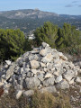
(5) La Candolle: there is a small stone structure, like the outline of a tiny hut.
Stunning panoramic views. Setting off from the tiny hut, head due south to rejoin a track a few dozen metres away. Follow it: opposite, you’ll see Cap Canaille and the Mediterranean. You’ll reach a wide track.
(6) Turn left onto it, following dual markings: yellow and red/yellow. Ignore the first track heading due north, marked ‘Danger’, and carry on straight ahead. Then ignore a second track coming from the left (Le Télégraphe) and continue straight ahead again. You’ll reach a multi-way junction where a tarmac track comes in from the right and a dirt track descends to the right, almost directly opposite. Do not take either of these; continue straight ahead on the track to the left until you reach a gate.
(7) Go round it on the right, heading due north, and follow a fence. Carry on straight ahead until you reach the next barrier.
(8) Go through it and enter Aubagne. At the junction, carry on straight ahead along the Chemin de la Pérussonne. Do not take the Chemin du Camp Lambert on the right, nor the Allée La Provençale, also on the right a few dozen metres further on; keep to the left, following the yellow markings. You’ll reach a road.
(9) Follow it to the right. Pass the bus stop for line 6, “École de La Pérussonne”, and continue to the Route de Marseille (D8n). Turn right towards Aubagne and head for the tram stop opposite the swimming pool (E).


 Visorando Member
 Association / Club / Walk leader
 Moderate