Country:
 City:
City:


The walk is accessible via bus route 68 between Cassis and Aubagne.
There is also a large car park a little further up the street, behind the café “Chez Mary”.
The starting point is at the “Notre Dame d’Afrique” bus stop, next to Carnoux Church.
(S) Walk up Avenue Alphonse Juin heading south-west, pass the café “Chez Mary” and turn left onto Avenue du Mont Fleuri.
Start of the yellow markings
(1) When the road bends to the left, there are two paths opposite (both marked in yellow); take the one on the right. (Skateboard park on the right. Picnic table.)
When you reach the track, turn left and then, straight away, turn right uphill. Let a track join from the right. At the three-way junction, on the right and slightly higher up, there are two paths leading to the cross: one easy, the other difficult. Take the easy one on the right. A lovely path through the forest.
Pass a path leading down to the right. (Several benches to sit on. Botanical trail.)
At the crossroads, follow the yellow markings to the left as the path winds uphill.
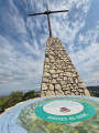
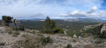
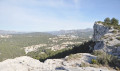
(2) At the summit, there is a cross and an orientation board. Beautiful panoramic views of Sainte Baume and Garlaban. In the foreground, the village of Carnoux. Three benches. Continue eastwards, heading downhill. Turn left onto the track. Pass an educational trail branching off to the left.
(3) A little further on, at the large mast laden with antennas, there is a view of the Pic de Bertagne.
End of the yellow markings
(4) At the next Fork in the road, turn right and head downhill. The path leads to a cluster of villas.
(5) Just before this, two tracks branch off to the right. Take the one furthest to the right. Immediately afterwards, ignore a track branching off to the right. Continue straight on. Cross a track straight ahead, then a footpath. Ignore a footpath branching off to the right. Further on, at the concrete bollards, turn left onto the track, heading due east.
Yellow markings
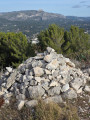
(6) Turn right onto the track. After a large cairn, pass a footpath on the right. After a pair of yellow water tanks, pass another footpath on the right. View of Cap Canaille (Cassis).
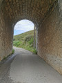
(7) At the Cassis recycling centre, leave the track and take a tarmac road leading down to the left. When you reach a roundabout, take the second exit on the right. Follow the railway line south-eastwards. Pass under the railway bridge and turn left.
(8) At Cassis railway station, continue south-east.
(9) At the roundabout, take the first exit on the right (D1) for 1.2 km.
(10) At the next roundabout, take the second exit towards Cassis centre and La Ciotat (D559).
(11) 200 m further on, turn right (towards Cassis centre) down Avenue Auguste Favier.
At the junction, leave Avenue Jules Ferry on your right and continue along Avenue Joseph Liautaud opposite. At the next junction, turn left towards Toulon. Pass the Parking des Mimosas on your right. Pass the Augustin Isnard stop and continue straight on towards the Cassis Gendarmerie Station. The “Gendarmerie” stop (E) is the terminus of bus route 68, which provides a return service to Carnoux and Aubagne.
The Parking des Mimosas car park and the casino car park are also nearby.


 Visorando Member
 Association / Club / Walk leader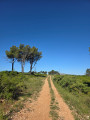
 Moderate